

7-WAVES
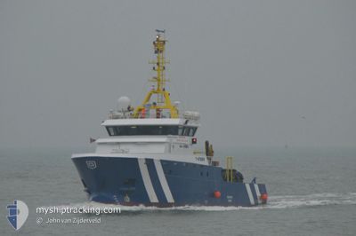
Tug

Current Trip
TOWING 3NM CABLE
| Time Travelled | 21 h, 35 mins |
|---|---|
| Remaining Time | --- |
| Distance Travelled | 224.74 nm |
| Remaining Distance | --- |
| AVG Speed | 10.8 Noeuds |
| MAX Speed | 11.4 Noeuds |
| AVG Wind | 13.5 knots |
| MAX Wind | 17 knots |
| MIN Temp | 17.2°C / 62.96°F |
| MAX Temp | 20.4°C / 68.72°F |
| Tirant d eau | 3 m |
| Position reçue | 2025-02-04 22:12 |
Current Position
| Longitude | --- |
|---|---|
| Latitude | --- |
| Etat | Under way using engine |
| Vitesse | 7.3 Noeuds |
| Parcours | 183.6° |
| Zone | South Atlantic Ocean |
| Station | T-AIS |
| Position reçue | 2025-02-04 22:12 |
Information
The current position of 7-WAVES is in South Atlantic Ocean with coordinates -26.33751° / 14.07260° as reported on 2025-02-04 22:12 by AIS to our vessel tracker app. The vessel's current speed is 7.3 Noeuds
The vessel 7-WAVES (MMSI: 353922000) is a Tug It's sailing under the flag of [PA] Panama.
In this page you can find informations about the vessels current position, last detected port calls, and current voyage information. If the vessels is not in coverage by AIS you will find the latest position.
The current position of 7-WAVES is detected by our AIS receivers and we are not responsible for the reliability of the data. The last position was recorded while the vessel was in Coverage by the Ais receivers of our vessel tracking app.
The current draught of 7-WAVES as reported by AIS is 3 meters
Weather
| Temperature | 20°C / 68°F |
|---|---|
| Wind Speed | 16 knots |
| Direction | 166° SSE |
| Pressure | 1010.2 hPa |
| Humidity | 84.6 % |
| Cloud Coverage | 6 % |


Featured Company
Last Port Calls
| Port | Arrival | Departure | Time In Port |
|---|---|---|---|
| 2025-03-25 10:41 | 2025-03-26 18:33 | 1 d | |
| 2025-02-03 08:56 | 2025-02-03 22:28 | 13 h |
Most Visited Ports (Last year)
| Port | Arrivals | |
|---|---|---|
| 3 | ||
| 2 | ||
| 2 | ||
| 1 | ||
| 1 |
Last Trips
| Origin | Departure | Destination | Arrival | Distance | |
|---|---|---|---|---|---|
| 2025-02-03 22:28 | 2025-03-25 10:41 | 5879.90 nm | |||
| 2024-11-27 18:51 | 2025-02-03 08:56 | 3895.85 nm |
Events
| Heure | Evenement | Détails | Position/ Destination | Info |
|---|---|---|---|---|
| 2025-03-26 16:33 | PORT DE DEPART |
|
-22.93122 / 14.49710
TOWING 3NM CABLE
|
Vitesse: 5.4 kn Parcours: 6° |
| 2025-03-26 16:21 | Démarrage |
-22.95071 / 14.48995
[NA] WALVIS BAY
|
Vitesse: 4.6 kn Parcours: 64° |
|
| 2025-03-25 08:57 | Arret |
-22.95499 / 14.48577
[NA] WALVIS BAY
|
Vitesse: 0.2 kn Parcours: 153° |
|
| 2025-03-25 08:41 | Port d'arrivée |
|
-22.94051 / 14.49629
[NA] WALVIS BAY
|
Vitesse: 10.5 kn Parcours: 183° |
| 2025-03-25 08:33 | Démarrage | 1.36 nm, North of WALVIS BAY |
-22.91748 / 14.49460
TOWING 3NM CABLE
|
Vitesse: 7.5 kn Parcours: 146° |
| 2025-03-25 06:45 | Arret | 1.7 nm, North of WALVIS BAY |
-22.91167 / 14.49464
TOWING 3NM CABLE
|
Vitesse: 0.1 kn Parcours: 174° |
| 2025-03-20 05:04 | Démarrage | 1.29 nm, North West of LUDERITZ |
-26.62290 / 15.13914
TOWING 3NM CABLE
|
Vitesse: 5.2 kn Parcours: 337° |
| 2025-03-20 04:56 | Arret | 1.15 nm, North West of LUDERITZ |
-26.62527 / 15.14033
TOWING 3NM CABLE
|
Vitesse: 0.3 kn Parcours: 87° |