
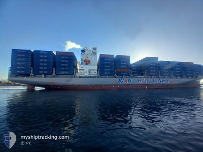
WAN HAI 355
Cargo
Current Trip
| Time Travelled | 20 h, 29 mins |
|---|---|
| Remaining Time | --- |
| Distance Travelled | 206.28 nm |
| Remaining Distance | --- |
| AVG Speed | 16.2 Noeuds |
| MAX Speed | 20.6 Noeuds |
| AVG Wind | 5.3 knots |
| MAX Wind | 9.4 knots |
| MIN Temp | 26.3°C / 79.34°F |
| MAX Temp | 30°C / 86°F |
| Tirant d eau | 7.9 m |
| Position reçue | 15 h, 37 m depuis |
Current Position
| Longitude | 119.99898° |
|---|---|
| Latitude | 14.64647° |
| Etat | Under way using engine |
| Vitesse | 20 Noeuds |
| Parcours | 320.2° |
| Zone | South China Sea |
| Station | T-AIS |
| Position reçue | 15 h, 37 m depuis |
Info
Information
The current position of WAN HAI 355 is in South China Sea with coordinates 14.64647° / 119.99898° as reported on 2024-06-16 13:49 by AIS to our vessel tracker app. The vessel's current speed is 20 Noeuds and is heading at the port of NANSHA. The estimated time of arrival as calculated by MyShipTracking vessel tracking app is 2024-06-17 23:00 LT
The vessel WAN HAI 355 (IMO: 9930375, MMSI: 563171800) is a Cargo It's sailing under the flag of [SG] Singapore.
In this page you can find informations about the vessels current position, last detected port calls, and current voyage information. If the vessels is not in coverage by AIS you will find the latest position.
The current position of WAN HAI 355 is detected by our AIS receivers and we are not responsible for the reliability of the data. The last position was recorded while the vessel was in Coverage by the Ais receivers of our vessel tracking app.
The current draught of WAN HAI 355 as reported by AIS is 7.9 meters
Weather
| Temperature | 29.7°C / 85.46°F |
|---|---|
| Wind Speed | 12 knots |
| Direction | 195° SSW |
| Pressure | 1008.8 hPa |
| Humidity | 78 % |
| Cloud Coverage | 100 % |
Featured Company
Last Port Calls
| Port | Arrival | Departure | Time In Port |
|---|---|---|---|
| 2024-06-13 23:38 | 2024-06-16 08:57 | 2 d | |
| 2024-06-07 15:17 | 2024-06-08 01:48 | 10 h | |
| 2024-06-06 02:40 | 2024-06-07 08:27 | 1 d | |
| 2024-06-04 02:29 | 2024-06-05 01:26 | 22 h | |
| 2024-05-31 02:39 | 2024-06-02 18:24 | 2 d | |
| 2024-05-24 23:35 | 2024-05-25 12:04 | 12 h | |
| 2024-05-23 11:24 | 2024-05-24 12:20 | 1 d | |
| 2024-05-21 18:14 | 2024-05-22 01:29 | 7 h | |
| 2024-05-20 17:30 | 2024-05-21 05:14 | 11 h | |
| 2024-05-16 13:42 | 2024-05-19 09:25 | 2 d |
Last Trips
| Origin | Departure | Destination | Arrival | Distance | |
|---|---|---|---|---|---|
| 2024-06-08 09:48 | 2024-06-14 07:38 | 710.82 nm | |||
| 2024-06-07 16:27 | 2024-06-07 23:17 | 83.57 nm | |||
| 2024-06-05 09:26 | 2024-06-06 10:40 | 371.06 nm | |||
| 2024-06-03 02:24 | 2024-06-04 10:29 | 558.60 nm | |||
| 2024-05-25 20:04 | 2024-05-31 10:39 | 770.58 nm | |||
| 2024-05-24 20:20 | 2024-05-25 07:35 | 97.30 nm | |||
| 2024-05-22 09:29 | 2024-05-23 19:24 | 369.58 nm | |||
| 2024-05-21 13:14 | 2024-05-22 02:14 | 10.34 nm | |||
| 2024-05-19 17:25 | 2024-05-21 01:30 | 549.59 nm | |||
| 2024-05-13 11:48 | 2024-05-16 21:42 | 697.22 nm |
Events
| Heure | Evenement | Détails | Position/ Destination | Info |
|---|---|---|---|---|
| 2024-06-16 13:50 | Etat Changé | Default Under way using engine |
14.64647 / 119.99898
CNNSS
|
Vitesse: 20 kn Parcours: 320.2° |
| 2024-06-16 13:49 | Hors de la zone couverte |
14.64647 / 119.99898
South China Sea
CNNSS
|
Vitesse: 20 kn Parcours: 320.2° |
|
| 2024-06-16 13:46 | Etat Changé | Under way using engine Default |
14.63709 / 120.00700
CNNSS
|
Vitesse: 19.8 kn Parcours: 323° |
| 2024-06-16 13:36 | Etat Changé | Default Under way using engine |
14.58906 / 120.04318
CNNSS
|
Vitesse: 19.4 kn Parcours: 326.7° |
| 2024-06-16 13:32 | Etat Changé | Under way using engine Default |
14.57414 / 120.05313
CNNSS
|
Vitesse: 19.6 kn Parcours: 328° |
| 2024-06-16 13:26 | Dans la zone couverte |
14.57414 / 120.05313
South China Sea
CNNSS
|
Vitesse: 19.4 kn Parcours: 326.7° |
|
| 2024-06-16 10:10 | Etat Changé | Default Under way using engine |
14.53845 / 120.77059
CNNSS
|
Vitesse: 11.9 kn Parcours: 241° |
| 2024-06-16 10:05 | Hors de la zone couverte |
14.54721 / 120.78459
South China Sea
CNNSS
|
Vitesse: 11.9 kn Parcours: 241° |
|
| 2024-06-16 10:04 | Etat Changé | Under way using engine Default |
14.54825 / 120.78651
CNNSS
|
Vitesse: 12.1 kn Parcours: 257° |
| 2024-06-16 09:57 | Etat Changé | Default Under way using engine |
14.55488 / 120.80836
CNNSS
|
Vitesse: 12.2 kn Parcours: 256.4° |