
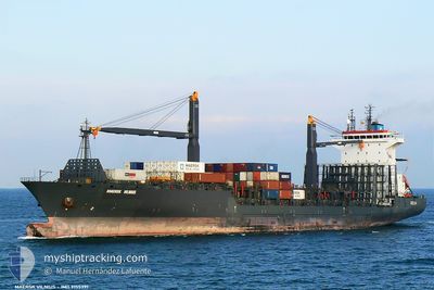
HANSA BREITENBURG
Container Ship
Current Trip
| Time Travelled | 18 h, 29 mins |
|---|---|
| Remaining Time | 18 h, 40 mins |
| Distance Travelled | 257.82 nm |
| Remaining Distance | 330.48 nm |
| AVG Speed | 17.1 Knoten |
| MAX Speed | 18.1 Knoten |
| AVG Wind | 6.3 knots |
| MAX Wind | 8 knots |
| MIN Temp | 29.1°C / 84.38°F |
| MAX Temp | 30.6°C / 87.08°F |
| Tiefgang | 8.2 m |
| Position erhalten | 4 d alt |
Current Position
| Länge | 104.35855° |
|---|---|
| Breite | 1.31993° |
| Zustand | Under way using engine |
| Geschwindigkeit | 17.2 Knoten |
| Kurs | 48.7° |
| Gebiet | South China Sea |
| Station | T-AIS |
| Position erhalten | 4 d alt |
Info
Information
Die aktuelle Position von HANSA BREITENBURG befindet sich in South China Sea mit den Koordinaten 1.31993° / 104.35855°, wie von AIS am 2024-05-16 00:43 an unsere Schiffsverfolgungs-App. Die aktuelle Geschwindigkeit des Schiffes betragt 17.2 Knoten und fahrt in den Hafen von TANJUNG PELEPAS. Die geschatzte Ankunftszeit, berechnet von der MyShipTracking-App zur Schiffsverfolgung, ist 2024-05-21 11:27 LT
Das Schiff HANSA BREITENBURG (IMO: 9155391, MMSI: 636090756) ist Container Ship das wurde im Jahr 2003 ( 21 Jahre alt ) gebaut. Es segelt unter der Flagge [LR] Liberia.
Auf dieser Seite finden Sie Informationen zur aktuellen Position des Schiffes, zu den zuletzt erkannten Hafenanlaufen und zu aktuellen Reiseinformationen. Wenn die Schiffe nicht von AIS abgedeckt werden, finden Sie die neueste Position.
Die aktuelle Position von HANSA BREITENBURG wird von unseren AIS-Empfangern erkannt und wir sind nicht fur die Zuverlassigkeit der Daten verantwortlich. Die letzte Position wurde von den Ais-Empfangern unserer Schiffsverfolgungs-App aufgezeichnet, wahrend sich das Schiff in Deckung befand.
Der aktuelle Entwurf von HANSA BREITENBURG, wie von AIS gemeldet, betragt 8.2 meter
Weather
| Temperature | 29.8°C / 85.64°F |
|---|---|
| Wind Speed | 11 knots |
| Direction | 179° S |
| Pressure | 1004.7 hPa |
| Humidity | 76 % |
| Cloud Coverage | 100 % |
Featured Company
Last Port Calls
| Port | Arrival | Departure | Time In Port |
|---|---|---|---|
| 2024-05-19 21:18 | |||
| 2024-05-15 04:48 | 2024-05-16 03:53 | 23 h | |
| 2024-05-07 13:10 | 2024-05-08 15:16 | 1 d | |
| 2024-05-04 10:03 | 2024-05-05 15:20 | 1 d | |
| 2024-04-30 06:28 | 2024-05-01 01:43 | 19 h | |
| 2024-04-27 08:28 | 2024-04-28 11:56 | 1 d | |
| 2024-04-23 08:04 | 2024-04-24 03:37 | 19 h | |
| 2024-04-20 07:40 | 2024-04-21 10:51 | 1 d | |
| 2024-04-17 08:28 | 2024-04-18 09:58 | 1 d | |
| 2024-04-15 07:53 |
Most Visited Ports (Last year)
| Port | Arrivals | |
|---|---|---|
| 52 | ||
| 41 | ||
| 38 |
Last Trips
| Origin | Departure | Destination | Arrival | Distance | |
|---|---|---|---|---|---|
| 2024-05-08 15:16 | 2024-05-15 04:48 | 1283.66 nm | |||
| 2024-05-05 15:20 | 2024-05-07 13:10 | 633.52 nm | |||
| 2024-05-01 01:43 | 2024-05-04 10:03 | 647.87 nm | |||
| 2024-04-28 11:56 | 2024-04-30 06:28 | 635.08 nm | |||
| 2024-04-24 03:37 | 2024-04-27 08:28 | 645.27 nm | |||
| 2024-04-21 10:51 | 2024-04-23 08:04 | 630.91 nm | |||
| 2024-04-18 09:58 | 2024-04-20 07:40 | 641.58 nm | |||
| 2024-04-15 07:53 | 2024-04-17 08:28 | 639.52 nm | |||
| 2024-04-07 16:14 | 2024-04-09 09:01 | 632.97 nm | |||
| 2024-03-31 13:33 | 2024-04-02 11:29 | 631.40 nm |
Events
| Zeit | Ereignis | Details | Position / Ziel | Information |
|---|---|---|---|---|
| 2024-05-19 14:32 | START Bewegung | 1.86 nm, West of KRONG PREAH SIHANOUK |
10.65500 / 103.47833
MYTPP
|
Geschwindigkeit: 8 kn Kurs: -1° |
| 2024-05-19 14:18 | ABFAHRTSHAFEN |
|
10.65500 / 103.47833
MYTPP
|
Geschwindigkeit: Kurs: -1° |
| 2024-05-18 10:39 | START Bewegung | 3.82 nm, West of KRONG PREAH SIHANOUK |
10.66667 / 103.44666
MYTPP
|
Geschwindigkeit: 4 kn Kurs: -1° |
| 2024-05-16 00:49 | geänderter Status | Default Under way using engine |
1.33689 / 104.37838
MYTPP
|
Geschwindigkeit: 17.2 kn Kurs: 48.7° |
| 2024-05-16 00:43 | Ändere Seegebiet | Malaysian part of the South China Sea Malaysian part of the Singapore Strait |
1.31993 / 104.35855
South China Sea
MYTPP
|
Geschwindigkeit: 17.2 kn Kurs: 48.7° |
| 2024-05-16 00:43 | außerhalb Abdeckung |
1.31993 / 104.35855
South China Sea
MYTPP
|
Geschwindigkeit: 17.2 kn Kurs: 48.7° |
|
| 2024-05-15 23:55 | Ändere Seegebiet | Malaysian part of the Singapore Strait Indonesian part of the Singapore Strait |
1.25978 / 104.14952
Singapore Strait
MYTPP
|
Geschwindigkeit: 16.1 kn Kurs: 81.8° |
| 2024-05-15 21:04 | Auf See entdeckt | Indonesian part of the Singapore Strait |
1.13362 / 103.52956
Singapore Strait
MYTPP
|
Geschwindigkeit: 9.7 kn Kurs: 182° |
| 2024-05-15 20:29 | geänderter Tiefgang | 8.2 9.1 |
1.23022 / 103.53339
MYTPP
|
Geschwindigkeit: 8 kn Kurs: 189.8° |
| 2024-05-15 20:29 | geänderte voraussichtliche Ankunftszeit | 2024/05/17 14:30 2024/05/14 21:00 |
1.23022 / 103.53339
MYTPP
|
Geschwindigkeit: 8 kn Kurs: 189.8° |