
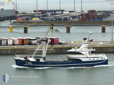
Z.483 JASMINE
Fishing
Current Trip
...
| Time Travelled | 1 day |
|---|---|
| Remaining Time | --- |
| Distance Travelled | 114.66 nm |
| Remaining Distance | --- |
| AVG Speed | 5 Knots |
| MAX Speed | 10.2 Knots |
| AVG Wind | 7.8 knots |
| MAX Wind | 15 knots |
| MIN Temp | 11.2°C / 52.16°F |
| MAX Temp | 12.9°C / 55.22°F |
| Dybgang | 5.4 m |
| Position Modtaget | 4 h, 13 m siden |
Current Position
| Longitude | --- |
|---|---|
| Latitude | --- |
| Status | Engaged in Fishing |
| Fart | 6.3 Knots |
| Kurs | 253° |
| Område | English Channel |
| Station | T-AIS |
| Position Modtaget | 4 h, 13 m siden |
Info
Information
The current position of Z.483 JASMINE is in English Channel with coordinates 50.55034° / -0.40878° as reported on 2024-11-15 08:57 by AIS to our vessel tracker app. The vessel's current speed is 6.3 Knots
The vessel Z.483 JASMINE (IMO: 9896787, MMSI: 205077000) is a Fishing It's sailing under the flag of [BE] Belgium.
In this page you can find informations about the vessels current position, last detected port calls, and current voyage information. If the vessels is not in coverage by AIS you will find the latest position.
The current position of Z.483 JASMINE is detected by our AIS receivers and we are not responsible for the reliability of the data. The last position was recorded while the vessel was in Coverage by the Ais receivers of our vessel tracking app.
The current draught of Z.483 JASMINE as reported by AIS is 5.4 meters
Weather
| Temperature | 11.4°C / 52.52°F |
|---|---|
| Wind Speed | 3 knots |
| Direction | 45° NE |
| Pressure | 1028.4 hPa |
| Humidity | 66.7 % |
| Cloud Coverage | 100 % |
Featured Company
Last Port Calls
| Port | Arrival | Departure | Time In Port |
|---|---|---|---|
| 2024-11-13 15:30 | 2024-11-14 11:56 | 20 h | |
| 2024-11-06 19:46 | 2024-11-07 15:48 | 20 h | |
| 2024-10-29 12:42 | 2024-10-29 19:46 | 7 h | |
| 2024-10-20 13:28 | |||
| 2024-10-09 04:17 | 2024-10-09 13:25 | 9 h | |
| 2024-10-02 09:46 | 2024-10-03 05:05 | 19 h | |
| 2024-09-25 04:57 | 2024-09-25 14:00 | 9 h | |
| 2024-09-17 17:15 | 2024-09-18 05:20 | 12 h | |
| 2024-09-11 09:18 | 2024-09-11 19:31 | 10 h | |
| 2024-09-03 12:52 |
Most Visited Ports (Last year)
| Port | Arrivals | |
|---|---|---|
| 12 | ||
| 11 | ||
| 8 | ||
| 7 | ||
| 5 | ||
| 1 |
Last Trips
| Origin | Departure | Destination | Arrival | Distance | |
|---|---|---|---|---|---|
| 2024-11-07 16:48 | 2024-11-13 16:30 | 223.23 nm | |||
| 2024-10-29 20:46 | 2024-11-06 20:46 | 826.20 nm | |||
| 2024-10-09 14:25 | 2024-10-20 15:28 | 554.64 nm | |||
| 2024-10-03 06:05 | 2024-10-09 05:17 | 32.16 nm | |||
| 2024-09-25 15:00 | 2024-10-02 10:46 | 114.43 nm | |||
| 2024-09-18 06:20 | 2024-09-25 05:57 | 157.41 nm | |||
| 2024-09-11 20:31 | 2024-09-17 18:15 | 110.58 nm | |||
| 2024-09-03 14:52 | 2024-09-11 10:18 | 533.25 nm |
Events
| Tid | Hændelsen | Detaljer | Position / Dest | Info |
|---|---|---|---|---|
| 2024-11-15 08:57 | Udenfor Dækning |
50.55034 / -.40878
English Channel
|
Fart: 6.3 kn Kurs: 253° |
|
| 2024-11-15 08:44 | START Sejllads | 16.36 nm, South East of LITTLEHAMPTON |
50.55608 / -.37533
...
|
Fart: 6 kn Kurs: 257° |
| 2024-11-15 08:36 | STOP Sejllads | 16.4 nm, South East of LITTLEHAMPTON |
50.55606 / -.37224
...
|
Fart: 0.3 kn Kurs: 255° |
| 2024-11-15 06:37 | Status er ændret | Engaged in Fishing Under way using engine |
50.58504 / -.36540
...
|
Fart: 4.8 kn Kurs: 89° |
| 2024-11-15 05:44 | START Sejllads | 13.74 nm, South of LITTLEHAMPTON |
50.58228 / -.47145
...
|
Fart: 4.9 kn Kurs: 87° |
| 2024-11-15 05:42 | STOP Sejllads | 13.65 nm, South of LITTLEHAMPTON |
50.58318 / -.47640
...
|
Fart: 0.2 kn Kurs: 251° |
| 2024-11-14 17:25 | Ændre havområde | United Kingdom part of the English Channel French part of the English Channel |
50.24622 / .00488
English Channel
|
Fart: 8.8 kn Kurs: 0° |
| 2024-11-14 11:59 | Status er ændret | Under way using engine Moored |
49.48869 / .07977
...
|
Fart: 9.9 kn Kurs: 293° |
| 2024-11-14 11:56 | Afsejlet fra sidste havn |
|
49.48648 / .08748
...
|
Fart: 10.2 kn Kurs: 291° |
| 2024-11-14 11:49 | START Sejllads |
49.48299 / .11375
[FR] LE HAVRE
|
Fart: 3.3 kn Kurs: 269° |