
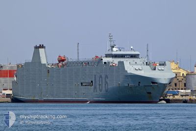
YSABEL
Military ops
Current Trip
YSABEL is out of coverage. Learn how you can join the community and extend the coverage to your area by clicking here!
.
Unknown Port
ETA*
---
| Time Travelled | 4 days |
|---|---|
| Remaining Time | --- |
| Distance Travelled | 910.75 nm |
| Remaining Distance | --- |
| AVG Speed | 10.2 Knots |
| MAX Speed | 18.1 Knots |
| AVG Wind | 9.3 knots |
| MAX Wind | 14.8 knots |
| MIN Temp | 6.5°C / 43.7°F |
| MAX Temp | 13.8°C / 56.84°F |
| Dybgang | 0 m |
| Position Modtaget | 6 h, 53 m siden |
Current Position
| Longitude | --- |
|---|---|
| Latitude | --- |
| Status | Under way using engine |
| Fart | |
| Kurs | 268° |
| Område | North Sea |
| Station | T-AIS |
| Position Modtaget | 6 h, 53 m siden |
Info
info
Information
The current position of YSABEL is in North Sea with coordinates 53.33474° / 7.17298° as reported on 2026-03-06 10:36 by AIS to our vessel tracker app. The vessel's current speed is 0 Knots
The vessel YSABEL (MMSI: 225993642) is a Military ops It's sailing under the flag of [ES] Spain.
In this page you can find informations about the vessels current position, last detected port calls, and current voyage information. If the vessels is not in coverage by AIS you will find the latest position.
The current position of YSABEL is detected by our AIS receivers and we are not responsible for the reliability of the data. The last position was recorded while the vessel was in Coverage by the Ais receivers of our vessel tracking app.
Weather
| Temperature | 13°C / 55.4°F |
|---|---|
| Wind Speed | 5 knots |
| Direction | 169° S |
| Pressure | 1021.3 hPa |
| Humidity | 60.8 % |
| Cloud Coverage | 99 % |
Featured Company
Limited time offer - Install a base station receiver to your area and list your company on MyShipTracking Free forever!
Events
| Tid | Hændelsen | Detaljer | Position / Dest | Info |
|---|---|---|---|---|
| 2026-03-06 10:36 | Udenfor Dækning |
53.33474 / 7.17298
North Sea
|
Fart: Kurs: 186.8° |
|
| 2026-03-06 10:00 | STOP Sejllads | --- |
53.33451 / 7.17130
.
|
Fart: 0.1 kn Kurs: 279° |
| 2026-03-06 09:10 | Ændre havområde | German part of the North Sea Dutch part of the North Sea |
53.32297 / 7.02193
North Sea
|
Fart: 11.6 kn Kurs: 92.1° |
| 2026-03-06 08:10 | Ændre havområde | Dutch part of the North Sea German part of the North Sea |
53.51112 / 6.78130
North Sea
|
Fart: 16.9 kn Kurs: 124.1° |
| 2026-03-06 07:47 | Ændre havområde | German part of the North Sea Dutch part of the North Sea |
53.57775 / 6.62703
North Sea
|
Fart: 16.9 kn Kurs: 125.8° |
| 2026-03-05 18:27 | Indenfor Dækning |
52.74596 / 4.11189
North Sea
|
Fart: 13.2 kn Kurs: 30.5° |
|
| 2026-03-05 12:55 | Udenfor Dækning |
52.01207 / 2.91705
North Sea
|
Fart: 11.6 kn Kurs: 37.2° |
|
| 2026-03-05 11:28 | Ændre havområde | Dutch part of the North Sea Belgian part of the North Sea |
51.80717 / 2.65642
North Sea
|
Fart: 10.1 kn Kurs: 46.1° |
| 2026-03-05 09:05 | Fundet i havområde | Belgian part of the North Sea |
51.51340 / 2.26260
North Sea
|
Fart: 9.4 kn Kurs: 38.1° |
| 2026-03-05 07:55 | Ændre havområde | French part of the North Sea United Kingdom part of the North Sea |
51.38659 / 2.06937
North Sea
|
Fart: 6.9 kn Kurs: 105.5° |