

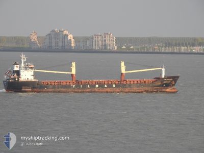
YM AMAZON
General Cargo

Current Trip
| Time Travelled | 17 days |
|---|---|
| Remaining Time | --- |
| Distance Travelled | 1133.02 nm |
| Remaining Distance | --- |
| AVG Speed | 10.1 Knots |
| MAX Speed | 11.8 Knots |
| AVG Wind | 8.1 knots |
| MAX Wind | 23 knots |
| MIN Temp | 2.6°C / 36.68°F |
| MAX Temp | 15.7°C / 60.26°F |
| Dybgang | 5 m |
| Position Modtaget | 3 d siden |
Current Position
| Longitude | --- |
|---|---|
| Latitude | --- |
| Status | Under way using engine |
| Fart | 9.7 Knots |
| Kurs | 27.4° |
| Område | Aegean Sea |
| Station | T-AIS |
| Position Modtaget | 3 d siden |
Information
The current position of YM AMAZON is in Aegean Sea with coordinates 37.90382° / 24.61607° as reported on 2025-02-18 18:37 by AIS to our vessel tracker app. The vessel's current speed is 9.7 Knots and is heading at the port of ACHLADI. The estimated time of arrival as calculated by MyShipTracking vessel tracking app is 2025-02-19 13:00 LT
The vessel YM AMAZON (IMO: 9622758, MMSI: 229594000) is a General Cargo that was built in 2013 ( 12 år gamle ). It's sailing under the flag of [MT] Malta.
In this page you can find informations about the vessels current position, last detected port calls, and current voyage information. If the vessels is not in coverage by AIS you will find the latest position.
The current position of YM AMAZON is detected by our AIS receivers and we are not responsible for the reliability of the data. The last position was recorded while the vessel was in Coverage by the Ais receivers of our vessel tracking app.
The current draught of YM AMAZON as reported by AIS is 5 meters
Weather
| Temperature | 3.2°C / 37.76°F |
|---|---|
| Wind Speed | 5 knots |
| Direction | 52° NE |
| Pressure | 1023.6 hPa |
| Humidity | 97.5 % |
| Cloud Coverage | 100 % |


Featured Company
Last Port Calls
| Port | Arrival | Departure | Time In Port |
|---|---|---|---|
| 2025-01-27 08:21 | 2025-02-04 07:40 | 7 d | |
| 2025-01-21 10:35 | 2025-01-22 10:20 | 23 h | |
| 2025-01-12 08:04 | 2025-01-18 21:07 | 6 d | |
| 2025-01-10 10:10 | 2025-01-12 06:55 | 1 d | |
| 2025-01-04 09:53 | 2025-01-07 19:47 | 3 d | |
| 2024-12-14 23:19 | 2024-12-24 10:20 | 9 d | |
| 2024-12-13 08:54 | 2024-12-14 01:10 | 16 h | |
| 2024-12-01 06:22 | 2024-12-10 10:10 | 9 d |
Last Trips
| Origin | Departure | Destination | Arrival | Distance | |
|---|---|---|---|---|---|
| 2025-01-22 10:20 | 2025-01-27 08:21 | 1133.21 nm | |||
| 2025-01-18 21:07 | 2025-01-21 10:35 | 84.55 nm | |||
| 2025-01-12 06:55 | 2025-01-12 08:04 | 9.16 nm | |||
| 2025-01-07 19:47 | 2025-01-10 10:10 | 643.95 nm | |||
| 2024-12-24 10:20 | 2025-01-04 09:53 | 2777.55 nm | |||
| 2024-12-14 01:10 | 2024-12-14 23:19 | 142.04 nm | |||
| 2024-12-10 10:10 | 2024-12-13 08:54 | 691.28 nm | |||
| 2024-11-30 18:38 | 2024-12-01 06:22 | 133.65 nm |
Events
| Tid | Hændelsen | Detaljer | Position / Dest | Info |
|---|---|---|---|---|
| 2025-02-19 08:45 | STOP Sejllads | 0.85 nm, South East of ACHLADI |
38.87658 / 22.81880
GRACL
|
Fart: 0.3 kn Kurs: 28° |
| 2025-02-18 18:40 | Status er ændret | Default Under way using engine |
37.90901 / 24.61945
GRACL
|
Fart: 9.7 kn Kurs: 27.4° |
| 2025-02-18 18:37 | Udenfor Dækning |
37.90382 / 24.61607
Aegean Sea
GRACL
|
Fart: 9.7 kn Kurs: 27.4° |
|
| 2025-02-18 15:55 | Status er ændret | Under way using engine Default |
37.51062 / 24.38624
GRACL
|
Fart: 9.9 kn Kurs: 38° |
| 2025-02-18 15:39 | Indenfor Dækning |
37.51386 / 24.38810
Aegean Sea
GRACL
|
Fart: 9.7 kn Kurs: 24.5° |
|
| 2025-02-18 14:53 | Status er ændret | Default Under way using engine |
37.37411 / 24.26137
GRACL
|
Fart: 9.9 kn Kurs: 35.2° |
| 2025-02-18 14:44 | Udenfor Dækning |
37.35348 / 24.24288
Aegean Sea
GRACL
|
Fart: 9.9 kn Kurs: 35.2° |
|
| 2025-02-18 14:32 | Status er ændret | Under way using engine Default |
37.32627 / 24.21829
GRACL
|
Fart: 9.8 kn Kurs: 35° |
| 2025-02-18 14:24 | Status er ændret | Default Under way using engine |
37.30705 / 24.20124
GRACL
|
Fart: 9.8 kn Kurs: 35° |
| 2025-02-18 13:57 | Status er ændret | Under way using engine Not under command |
37.24625 / 24.14717
GRACL
|
Fart: 10 kn Kurs: 34.7° |