
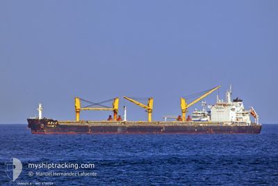
YANGZE 6
Cargo
Current Trip
| Time Travelled | 4 days |
|---|---|
| Remaining Time | --- |
| Distance Travelled | 879.49 nm |
| Remaining Distance | --- |
| AVG Speed | 10.6 Knots |
| MAX Speed | 10.6 Knots |
| AVG Wind | 10.8 knots |
| MAX Wind | 27 knots |
| MIN Temp | 14.9°C / 58.82°F |
| MAX Temp | 26.2°C / 79.16°F |
| Dybgang | 7.3 m |
| Position Modtaget | 1 d siden |
Current Position
| Longitude | --- |
|---|---|
| Latitude | --- |
| Status | Under way using engine |
| Fart | 7.2 Knots |
| Kurs | 338.4° |
| Område | Black Sea |
| Station | T-AIS |
| Position Modtaget | 1 d siden |
Info
Information
The current position of YANGZE 6 is in Black Sea with coordinates 41.45864° / 29.11175° as reported on 2024-10-01 00:54 by AIS to our vessel tracker app. The vessel's current speed is 7.2 Knots
The vessel YANGZE 6 (IMO: 9718909, MMSI: 636016707) is a Cargo It's sailing under the flag of [LR] Liberia.
In this page you can find informations about the vessels current position, last detected port calls, and current voyage information. If the vessels is not in coverage by AIS you will find the latest position.
The current position of YANGZE 6 is detected by our AIS receivers and we are not responsible for the reliability of the data. The last position was recorded while the vessel was in Coverage by the Ais receivers of our vessel tracking app.
The current draught of YANGZE 6 as reported by AIS is 7.3 meters
Weather
| Temperature | 16.5°C / 61.7°F |
|---|---|
| Wind Speed | 16 knots |
| Direction | 338° NNW |
| Pressure | 1013.7 hPa |
| Humidity | 69.3 % |
| Cloud Coverage | 7 % |
Featured Company
Last Port Calls
| Port | Arrival | Departure | Time In Port |
|---|---|---|---|
| 2024-09-13 23:36 | 2024-09-27 13:44 | 13 d | |
| 2024-09-10 22:45 | 2024-09-11 12:33 | 13 h | |
| 2024-08-23 14:30 | 2024-08-27 06:14 | 3 d | |
| 2024-08-12 11:09 | 2024-08-21 04:32 | 8 d | |
| 2024-08-06 06:54 | 2024-08-10 16:15 | 4 d |
Most Visited Ports (Last year)
| Port | Arrivals | |
|---|---|---|
| 2 | ||
| 2 | ||
| 2 | ||
| 2 | ||
| 1 | ||
| 1 |
Last Trips
| Origin | Departure | Destination | Arrival | Distance | |
|---|---|---|---|---|---|
| 2024-09-11 14:33 | 2024-09-14 01:36 | 20.30 nm | |||
| 2024-08-27 07:14 | 2024-09-11 00:45 | 3246.74 nm | |||
| 2024-08-21 05:32 | 2024-08-23 15:30 | 403.99 nm | |||
| 2024-08-10 17:15 | 2024-08-12 12:09 | 148.25 nm | |||
| 2024-07-19 17:44 | 2024-08-06 07:54 | 3968.99 nm |
Events
| Tid | Hændelsen | Detaljer | Position / Dest | Info |
|---|---|---|---|---|
| 2024-10-01 01:02 | Status er ændret | Default Under way using engine |
41.47456 / 29.10385
BG BOJ
|
Fart: 7.2 kn Kurs: 338.4° |
| 2024-10-01 00:54 | Udenfor Dækning |
41.45864 / 29.11175
Black Sea
BG BOJ
|
Fart: 7.2 kn Kurs: 338.4° |
|
| 2024-09-30 22:58 | Ændre havområde | Turkish part of the Black Sea Turkish part of the Sea of Marmara |
41.23328 / 29.14849
Black Sea
BG BOJ
|
Fart: 9.9 kn Kurs: 41° |
| 2024-09-30 17:58 | START Sejllads | 18.87 nm, South of AMBARLI |
40.65823 / 28.55526
BG BOJ
|
Fart: 3.9 kn Kurs: 33° |
| 2024-09-30 17:52 | Status er ændret | Under way using engine Default |
40.65416 / 28.55361
BG BOJ
|
Fart: 1.1 kn Kurs: 283° |
| 2024-09-30 17:52 | Indenfor Dækning |
40.65416 / 28.55361
Sea of Marmara
BG BOJ
|
Fart: 2.5 kn Kurs: 329.9° |
|
| 2024-09-30 17:12 | STOP Sejllads | 18.85 nm, South of AMBARLI |
40.65600 / 28.56779
BG BOJ
|
Fart: 0.3 kn Kurs: 349° |
| 2024-09-30 15:41 | Status er ændret | Default Under way using engine |
40.66952 / 28.59088
BG BOJ
|
Fart: 0.8 kn Kurs: 280° |
| 2024-09-30 15:41 | Status er ændret | Under way using engine Default |
40.66956 / 28.59091
BG BOJ
|
Fart: 0.9 kn Kurs: 284° |
| 2024-09-30 15:41 | Udenfor Dækning |
40.66956 / 28.59091
Sea of Marmara
BG BOJ
|
Fart: 0.8 kn Kurs: 227.3° |