
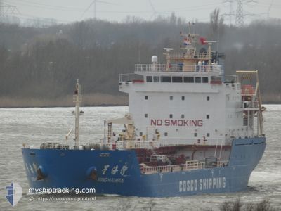
XING HAI WAN
Asphalt/Bitumen Tanker
Current Trip
| Time Travelled | 2 days |
|---|---|
| Remaining Time | --- |
| Distance Travelled | 739.68 nm |
| Remaining Distance | --- |
| AVG Speed | 10.4 Knots |
| MAX Speed | 15.1 Knots |
| AVG Wind | 9.2 knots |
| MAX Wind | 16 knots |
| MIN Temp | 11.3°C / 52.34°F |
| MAX Temp | 15°C / 59°F |
| Dybgang | 6.3 m |
| Position Modtaget | 1 d siden |
Current Position
| Longitude | -5.76046° |
|---|---|
| Latitude | 48.89910° |
| Status | Under way using engine |
| Fart | 9.6 Knots |
| Kurs | 228.1° |
| Område | Celtic Sea |
| Station | T-AIS |
| Position Modtaget | 1 d siden |
Info
Information
The current position of XING HAI WAN is in Celtic Sea with coordinates 48.89910° / -5.76046° as reported on 2024-05-11 18:19 by AIS to our vessel tracker app. The vessel's current speed is 9.6 Knots and is heading at the port of MOHAMMEDIA. The estimated time of arrival as calculated by MyShipTracking vessel tracking app is 2024-05-15 19:00 LT
The vessel XING HAI WAN (IMO: 9570113, MMSI: 371737000) is a Asphalt/Bitumen Tanker that was built in 2009 ( 15 år gamle ). It's sailing under the flag of [PA] Panama.
In this page you can find informations about the vessels current position, last detected port calls, and current voyage information. If the vessels is not in coverage by AIS you will find the latest position.
The current position of XING HAI WAN is detected by our AIS receivers and we are not responsible for the reliability of the data. The last position was recorded while the vessel was in Coverage by the Ais receivers of our vessel tracking app.
The current draught of XING HAI WAN as reported by AIS is 6.3 meters
Weather
| Temperature | 14.9°C / 58.82°F |
|---|---|
| Wind Speed | 16 knots |
| Direction | 220° SW |
| Pressure | 1014.4 hPa |
| Humidity | 95 % |
| Cloud Coverage | 100 % |
Featured Company
Last Port Calls
| Port | Arrival | Departure | Time In Port |
|---|---|---|---|
| 2024-05-09 08:52 | 2024-05-10 01:26 | 16 h | |
| 2024-05-07 18:50 | 2024-05-09 08:32 | 1 d | |
| 2024-04-28 23:32 | 2024-04-29 22:50 | 23 h | |
| 2024-04-18 19:09 | 2024-04-19 17:56 | 22 h | |
| 2024-04-16 01:57 | 2024-04-17 07:20 | 1 d | |
| 2024-04-13 23:34 | 2024-04-14 21:52 | 22 h | |
| 2024-03-28 03:39 | 2024-03-28 18:40 | 15 h | |
| 2024-03-27 14:23 | 2024-03-28 01:39 | 11 h | |
| 2024-03-17 07:43 | 2024-03-18 05:03 | 21 h | |
| 2024-03-07 09:43 | 2024-03-09 03:33 | 1 d |
Most Visited Ports (Last year)
| Port | Arrivals | |
|---|---|---|
| 10 | ||
| 9 | ||
| 6 | ||
| 6 | ||
| 6 | ||
| 3 |
Last Trips
| Origin | Departure | Destination | Arrival | Distance | |
|---|---|---|---|---|---|
| 2024-05-09 10:32 | 2024-05-09 10:52 | 1.38 nm | |||
| 2024-04-29 23:50 | 2024-05-07 20:50 | 1806.49 nm | |||
| 2024-04-19 20:56 | 2024-04-29 00:32 | 2243.98 nm | |||
| 2024-04-17 10:20 | 2024-04-18 22:09 | 298.06 nm | |||
| 2024-04-15 00:52 | 2024-04-16 04:57 | 295.81 nm | |||
| 2024-03-28 18:40 | 2024-04-14 02:34 | 2365.86 nm | |||
| 2024-03-28 01:39 | 2024-03-28 03:39 | 20.29 nm | |||
| 2024-03-18 07:03 | 2024-03-27 14:23 | 2247.72 nm | |||
| 2024-03-09 04:33 | 2024-03-17 09:43 | 1726.35 nm | |||
| 2024-02-29 15:34 | 2024-03-07 10:43 | 1442.53 nm |
Events
| Tid | Hændelsen | Detaljer | Position / Dest | Info |
|---|---|---|---|---|
| 2024-05-11 18:27 | Status er ændret | Default Under way using engine |
48.88522 / -5.78397
MOHAMMEDIA
|
Fart: 9.6 kn Kurs: 228.1° |
| 2024-05-11 18:19 | Status er ændret | Under way using engine Default |
48.89910 / -5.76047
MOHAMMEDIA
|
Fart: 9.6 kn Kurs: 227° |
| 2024-05-11 18:19 | Udenfor Dækning |
48.89910 / -5.76047
Celtic Sea
MOHAMMEDIA
|
Fart: 9.6 kn Kurs: 228.1° |
|
| 2024-05-11 18:11 | Status er ændret | Default Under way using engine |
48.91392 / -5.73500
MOHAMMEDIA
|
Fart: 9.6 kn Kurs: 227.8° |
| 2024-05-11 18:02 | Status er ændret | Under way using engine Default |
48.92832 / -5.71019
MOHAMMEDIA
|
Fart: 9.4 kn Kurs: 229° |
| 2024-05-11 17:18 | Status er ændret | Default Under way using engine |
49.00405 / -5.57561
MOHAMMEDIA
|
Fart: 9.5 kn Kurs: 237.4° |
| 2024-05-11 14:52 | Ændre havområde | French part of the Celtic Sea French part of the English Channel |
49.19865 / -5.02264
Celtic Sea
MOHAMMEDIA
|
Fart: 11.2 kn Kurs: 239.8° |
| 2024-05-11 11:46 | Ændre havområde | French part of the English Channel United Kingdom part of the English Channel |
49.51944 / -4.18914
English Channel
MOHAMMEDIA
|
Fart: 12 kn Kurs: 233.9° |
| 2024-05-11 08:21 | Status er ændret | Under way using engine Default |
49.82152 / -3.37045
MOHAMMEDIA
|
Fart: 9.5 kn Kurs: 240° |
| 2024-05-11 08:14 | Status er ændret | Default Under way using engine |
49.82969 / -3.34782
MOHAMMEDIA
|
Fart: 9.6 kn Kurs: 238.1° |