

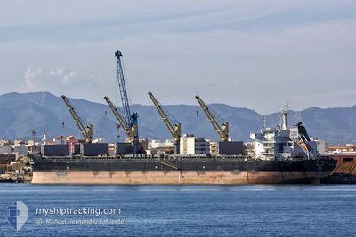
XIN HAI TONG 57
Bulk Carrier

Current Trip
| Trip Time | 4 days |
|---|---|
| Trip Distance | 239.53 nm |
| AVG Speed | 11.2 Knots |
| MAX Speed | 11.2 Knots |
| Dybgang | 13 m |
| AVG Wind | 12.7 knots |
| MAX Wind | 27 knots |
| MIN Temp | 1.6°C / 34.88°F |
| MAX Temp | 6.1°C / 42.98°F |
| Position Modtaget | 18 d siden |
Current Position
| Longitude | --- |
|---|---|
| Latitude | --- |
| Status | Under way using engine |
| Fart | 8.9 Knots |
| Kurs | 80.1° |
| Område | Singapore Strait |
| Station | T-AIS |
| Position Modtaget | 18 d siden |
Information
The current position of XIN HAI TONG 57 is in Singapore Strait with coordinates 1.27762° / 104.29868° as reported on 2025-02-26 14:09 by AIS to our vessel tracker app. The vessel's current speed is 8.9 Knots and is currently inside the port of TIANJIN.
The vessel XIN HAI TONG 57 (IMO: 9632296, MMSI: 477767300) is a Bulk Carrier that was built in 2013 ( 12 år gamle ). It's sailing under the flag of [HK] Hong Kong.
In this page you can find informations about the vessels current position, last detected port calls, and current voyage information. If the vessels is not in coverage by AIS you will find the latest position.
The current position of XIN HAI TONG 57 is detected by our AIS receivers and we are not responsible for the reliability of the data. The last position was recorded while the vessel was in Coverage by the Ais receivers of our vessel tracking app.
The current draught of XIN HAI TONG 57 as reported by AIS is 13 meters
Weather
| Temperature | 4.5°C / 40.1°F |
|---|---|
| Wind Speed | 20 knots |
| Direction | 342° NNW |
| Pressure | 1023.4 hPa |
| Humidity | 29 % |
| Cloud Coverage | 1 % |


Featured Company
Last Port Calls
| Port | Arrival | Departure | Time In Port |
|---|---|---|---|
| 2025-03-16 20:32 | |||
| 2025-03-10 22:45 | 2025-03-12 15:21 | 1 d | |
| 2025-02-18 19:04 | 2025-02-20 13:20 | 1 d | |
| 2025-01-05 07:00 | 2025-01-05 18:52 | 11 h |
Last Trips
Events
| Tid | Hændelsen | Detaljer | Position / Dest | Info |
|---|---|---|---|---|
| 2025-03-16 12:32 | STOP Sejllads |
38.94640 / 117.76502
[CN] TIANJIN
|
Fart: 0.1 kn Kurs: 289° |
|
| 2025-03-16 12:32 | Skibe i havn |
|
38.94640 / 117.76502
[CN] TIANJIN
|
Fart: 1 kn Kurs: 279° |
| 2025-03-16 10:06 | START Sejllads | 15.86 nm, South East of TIANJIN |
38.87450 / 118.05748
CN YIK
|
Fart: 7.2 kn Kurs: 255° |
| 2025-03-13 03:02 | STOP Sejllads | 15.89 nm, South East of TIANJIN |
38.87843 / 118.06044
CN YIK
|
Fart: Kurs: 98° |
| 2025-03-12 07:21 | Afsejlet fra sidste havn |
|
40.29352 / 122.02891
CN YIK
|
Fart: 7.4 kn Kurs: 278° |
| 2025-03-12 07:06 | START Sejllads |
40.29352 / 122.07510
[CN] BAYUQUAN
|
Fart: 6.5 kn Kurs: 245° |
|
| 2025-03-10 15:30 | STOP Sejllads |
40.29326 / 122.08495
[CN] BAYUQUAN
|
Fart: 0.1 kn Kurs: 63° |
|
| 2025-03-10 14:45 | Skibe i havn |
|
40.29146 / 122.04499
[CN] BAYUQUAN
|
Fart: 7.8 kn Kurs: 96° |
| 2025-03-10 12:53 | START Sejllads | 16.45 nm, West of BAYUQUAN |
40.24432 / 121.70589
CN YIK
|
Fart: 3.1 kn Kurs: 61° |
| 2025-03-09 18:12 | STOP Sejllads | 16.66 nm, West of BAYUQUAN |
40.24802 / 121.70080
CN YIK
|
Fart: 0.1 kn Kurs: 152° |