

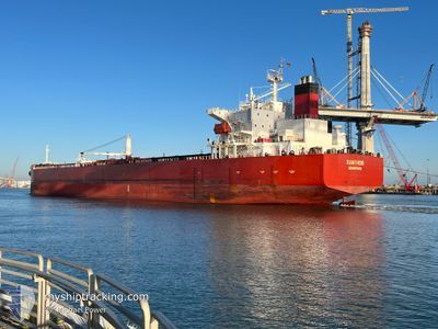
XANTHOS
Crude Oil Tanker

Current Trip
| Time Travelled | 13 days |
|---|---|
| Remaining Time | --- |
| Distance Travelled | 2337.85 nm |
| Remaining Distance | --- |
| AVG Speed | 9.7 Knots |
| MAX Speed | 13.8 Knots |
| AVG Wind | 13.6 knots |
| MAX Wind | 35 knots |
| MIN Temp | 21.6°C / 70.88°F |
| MAX Temp | 32.6°C / 90.68°F |
| Dybgang | 11.8 m |
| Position Modtaget | 3 m siden |
Current Position
| Longitude | --- |
|---|---|
| Latitude | --- |
| Status | Under way using engine |
| Fart | 11.9 Knots |
| Kurs | 63° |
| Område | Caribbean Sea |
| Station | T-AIS |
| Position Modtaget | 3 m siden |
Information
The current position of XANTHOS is in Caribbean Sea with coordinates 17.17288° / -63.38280° as reported on 2025-03-28 13:25 by AIS to our vessel tracker app. The vessel's current speed is 11.9 Knots and is heading at the port of BALBOA. The estimated time of arrival as calculated by MyShipTracking vessel tracking app is 2025-03-19 09:00 LT
The vessel XANTHOS (IMO: 9289178, MMSI: 636012425) is a Crude Oil Tanker that was built in 2005 ( 20 år gamle ). It's sailing under the flag of [LR] Liberia.
In this page you can find informations about the vessels current position, last detected port calls, and current voyage information. If the vessels is not in coverage by AIS you will find the latest position.
The current position of XANTHOS is detected by our AIS receivers and we are not responsible for the reliability of the data. The last position was recorded while the vessel was in Coverage by the Ais receivers of our vessel tracking app.
The current draught of XANTHOS as reported by AIS is 11.8 meters
Weather
| Temperature | 26.4°C / 79.52°F |
|---|---|
| Wind Speed | 15 knots |
| Direction | 94° E |
| Pressure | 1016.8 hPa |
| Humidity | 66.1 % |
| Cloud Coverage | 12 % |


Featured Company
Last Port Calls
| Port | Arrival | Departure | Time In Port |
|---|---|---|---|
| 2025-03-11 12:16 | 2025-03-15 03:16 | 3 d | |
| 2025-02-23 13:52 | 2025-02-25 09:02 | 1 d | |
| 2025-02-21 22:59 | 2025-02-22 20:28 | 21 h | |
| 2025-02-17 17:04 | 2025-02-19 01:56 | 1 d | |
| 2025-02-06 20:13 | 2025-02-10 12:03 | 3 d | |
| 2025-01-25 20:19 | 2025-01-30 01:03 | 4 d | |
| 2025-01-16 18:32 | 2025-01-19 00:05 | 2 d |
Most Visited Ports (Last year)
| Port | Arrivals | |
|---|---|---|
| 8 | ||
| 3 | ||
| 3 | ||
| 2 | ||
| 2 | ||
| 2 |
Last Trips
| Origin | Departure | Destination | Arrival | Distance | |
|---|---|---|---|---|---|
| 2025-02-25 09:02 | 2025-03-11 12:16 | 1334.17 nm | |||
| 2025-02-22 20:28 | 2025-02-23 13:52 | 49.65 nm | |||
| 2025-02-19 01:56 | 2025-02-21 22:59 | 844.35 nm | |||
| 2025-02-10 12:03 | 2025-02-17 17:04 | 1753.26 nm | |||
| 2025-01-30 01:03 | 2025-02-06 20:13 | 1876.06 nm | |||
| 2025-01-19 00:05 | 2025-01-25 20:19 | 1935.13 nm | |||
| 2024-12-27 03:33 | 2025-01-16 18:32 | 2626.97 nm |
Events
| Tid | Hændelsen | Detaljer | Position / Dest | Info |
|---|---|---|---|---|
| 2025-03-28 13:15 | Status er ændret | Under way using engine Default |
17.15837 / -63.41322
BALBOA
|
Fart: 11.7 kn Kurs: 63° |
| 2025-03-28 13:15 | Indenfor Dækning |
17.15837 / -63.41322
Caribbean Sea
|
Fart: 11.8 kn Kurs: 63° |
|
| 2025-03-28 10:41 | Status er ændret | Default Under way using engine |
16.94657 / -63.87747
BALBOA
|
Fart: 11.4 kn Kurs: 65° |
| 2025-03-28 10:30 | Udenfor Dækning |
16.93213 / -63.91009
Caribbean Sea
|
Fart: 11.4 kn Kurs: 65° |
|
| 2025-03-28 10:22 | Fundet i havområde | Saba part of the Caribbean Sea |
16.92062 / -63.93631
Caribbean Sea
|
Fart: 11.4 kn Kurs: 66° |
| 2025-03-28 10:22 | Status er ændret | Under way using engine Default |
16.92062 / -63.93631
BALBOA
|
Fart: 11.5 kn Kurs: 65° |
| 2025-03-28 10:03 | Status er ændret | Default Under way using engine |
16.89713 / -63.99545
BALBOA
|
Fart: 11.4 kn Kurs: 67° |
| 2025-03-28 08:05 | Status er ændret | Under way using engine Default |
16.75882 / -64.34916
BALBOA
|
Fart: 11.2 kn Kurs: 65° |
| 2025-03-28 07:47 | Status er ændret | Default Under way using engine |
16.73485 / -64.40147
BALBOA
|
Fart: 11.2 kn Kurs: 64° |
| 2025-03-28 07:42 | Ændre havområde | Puerto Rican part of the Caribbean Sea Panamanian part of the Caribbean Sea |
16.72799 / -64.41595
Caribbean Sea
|
Fart: 11.2 kn Kurs: 64° |