
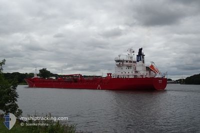
XANTHIA
Oil/Chemical Tanker
Current Trip
| Time Travelled | 7 h, 6 mins |
|---|---|
| Remaining Time | 1 day |
| Distance Travelled | 74.42 nm |
| Remaining Distance | 680.97 nm |
| AVG Speed | 11.3 Knots |
| MAX Speed | 15.5 Knots |
| AVG Wind | 7.5 knots |
| MAX Wind | 13 knots |
| MIN Temp | 3.3°C / 37.94°F |
| MAX Temp | 6.1°C / 42.98°F |
| Dybgang | 6.6 m |
| Position Modtaget | 59 m siden |
Current Position
| Longitude | --- |
|---|---|
| Latitude | --- |
| Status | Under way using engine |
| Fart | 14.1 Knots |
| Kurs | 353.2° |
| Område | North Sea |
| Station | T-AIS |
| Position Modtaget | 59 m siden |
Info
Information
The current position of XANTHIA is in North Sea with coordinates 52.45154° / 3.26351° as reported on 2025-03-17 05:23 by AIS to our vessel tracker app. The vessel's current speed is 14.1 Knots and is heading at the port of ELNESVAGEN. The estimated time of arrival as calculated by MyShipTracking vessel tracking app is 2025-03-19 06:58 LT
The vessel XANTHIA (IMO: 9246152, MMSI: 257970000) is a Oil/Chemical Tanker that was built in 2003 ( 22 år gamle ). It's sailing under the flag of [NO] Norway.
In this page you can find informations about the vessels current position, last detected port calls, and current voyage information. If the vessels is not in coverage by AIS you will find the latest position.
The current position of XANTHIA is detected by our AIS receivers and we are not responsible for the reliability of the data. The last position was recorded while the vessel was in Coverage by the Ais receivers of our vessel tracking app.
The current draught of XANTHIA as reported by AIS is 6.6 meters
Weather
| Temperature | 6.3°C / 43.34°F |
|---|---|
| Wind Speed | 15 knots |
| Direction | 66° ENE |
| Pressure | 1027.6 hPa |
| Humidity | 82 % |
| Cloud Coverage | 50 % |
Featured Company
Last Port Calls
| Port | Arrival | Departure | Time In Port |
|---|---|---|---|
| 2025-03-16 13:49 | 2025-03-17 00:16 | 10 h | |
| 2025-03-15 00:43 | 2025-03-15 17:43 | 17 h | |
| 2025-03-12 06:42 | 2025-03-13 02:14 | 19 h | |
| 2025-03-02 22:15 | 2025-03-02 22:51 | 36 m | |
| 2025-03-01 18:45 | 2025-03-02 20:06 | 1 d | |
| 2025-02-18 17:48 | 2025-02-19 16:57 | 23 h | |
| 2025-02-08 06:18 | 2025-02-09 00:40 | 18 h | |
| 2025-02-05 03:28 | 2025-02-05 19:42 | 16 h | |
| 2025-02-03 03:32 | 2025-02-04 05:52 | 1 d | |
| 2025-01-30 16:40 | 2025-01-31 20:36 | 1 d |
Most Visited Ports (Last year)
| Port | Arrivals | |
|---|---|---|
| 30 | ||
| 8 | ||
| 8 | ||
| 3 | ||
| 2 | ||
| 1 |
Last Trips
| Origin | Departure | Destination | Arrival | Distance | |
|---|---|---|---|---|---|
| 2025-03-15 17:43 | 2025-03-16 13:49 | 247.62 nm | |||
| 2025-03-13 02:14 | 2025-03-15 00:43 | 664.47 nm | |||
| 2025-03-02 22:51 | 2025-03-12 06:42 | 2546.40 nm | |||
| 2025-03-02 20:06 | 2025-03-02 22:15 | 0.54 nm | |||
| 2025-02-19 16:57 | 2025-03-01 18:45 | 2539.40 nm | |||
| 2025-02-09 00:40 | 2025-02-18 17:48 | 2521.44 nm | |||
| 2025-02-05 19:42 | 2025-02-08 06:18 | 762.79 nm | |||
| 2025-02-04 05:52 | 2025-02-05 03:28 | 250.75 nm | |||
| 2025-01-31 20:36 | 2025-02-03 03:32 | 666.90 nm | |||
| 2025-01-28 09:10 | 2025-01-30 16:40 | 2.87 nm |
Events
| Tid | Hændelsen | Detaljer | Position / Dest | Info |
|---|---|---|---|---|
| 2025-03-17 05:27 | Status er ændret | Default Under way using engine |
52.46635 / 3.26069
NOELN
|
Fart: 14.1 kn Kurs: 353.2° |
| 2025-03-17 04:15 | Status er ændret | Under way using engine Default |
52.20631 / 3.36859
NOELN
|
Fart: 13.1 kn Kurs: 301° |
| 2025-03-17 03:54 | Status er ændret | Default Under way using engine |
52.17044 / 3.47363
NOELN
|
Fart: 13.2 kn Kurs: 298.8° |
| 2025-03-17 03:48 | Status er ændret | Under way using engine Default |
52.15986 / 3.50508
NOELN
|
Fart: 14.3 kn Kurs: 300° |
| 2025-03-17 03:40 | Status er ændret | Default Under way using engine |
52.14485 / 3.54763
NOELN
|
Fart: 14.3 kn Kurs: 301.3° |
| 2025-03-17 03:37 | Status er ændret | Under way using engine Default |
52.13770 / 3.56684
NOELN
|
Fart: 14.2 kn Kurs: 302° |
| 2025-03-17 03:33 | Status er ændret | Default Under way using engine |
52.12968 / 3.58822
NOELN
|
Fart: 13.8 kn Kurs: 290.7° |
| 2025-03-17 01:00 | ETA er ændret | 2025/03/19 10:00 2025/03/19 08:00 |
51.86419 / 4.33585
NOELN
|
Fart: 9.2 kn Kurs: 339° |
| 2025-03-16 23:16 | Afsejlet fra sidste havn |
|
51.70716 / 4.61374
NOELN
|
Fart: 8.7 kn Kurs: 38° |
| 2025-03-16 23:08 | Dybgangen er ændret | 6.6 6.7 |
51.69693 / 4.59170
[NL] MOERDIJK
|
Fart: 5.1 kn Kurs: 66° |