
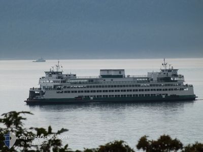
WSF YAKIMA
Passenger
Current Trip
| Time Travelled | 50 mins |
|---|---|
| Remaining Time | 24 mins |
| Distance Travelled | 9.93 nm |
| Remaining Distance | --- |
| AVG Speed | 12.3 Knots |
| MAX Speed | 15.9 Knots |
| AVG Wind | 3.2 knots |
| MAX Wind | 3.8 knots |
| MIN Temp | 13.8°C / 56.84°F |
| MAX Temp | 16.9°C / 62.42°F |
| Dybgang | 5.6 m |
| Position Modtaget | 1 m siden |
Current Position
| Longitude | -122.83217° |
|---|---|
| Latitude | 48.53775° |
| Status | Under way using engine |
| Fart | 15.1 Knots |
| Kurs | 154° |
| Område | The Coastal Waters of Southeast Alaska and British Columbia |
| Station | T-AIS |
| Position Modtaget | 1 m siden |
Info
Information
The current position of WSF YAKIMA is in The Coastal Waters of Southeast Alaska and British Columbia with coordinates 48.53775° / -122.83217° as reported on 2024-07-04 00:07 by AIS to our vessel tracker app. The vessel's current speed is 15.1 Knots and is heading at the port of ANACORTES. The estimated time of arrival as calculated by MyShipTracking vessel tracking app is 2024-07-04 00:32 LT
The vessel WSF YAKIMA (IMO: 8835360, MMSI: 366772750) is a Passenger It's sailing under the flag of [US] USA.
In this page you can find informations about the vessels current position, last detected port calls, and current voyage information. If the vessels is not in coverage by AIS you will find the latest position.
The current position of WSF YAKIMA is detected by our AIS receivers and we are not responsible for the reliability of the data. The last position was recorded while the vessel was in Coverage by the Ais receivers of our vessel tracking app.
The current draught of WSF YAKIMA as reported by AIS is 5.6 meters
Weather
| Temperature | 13.9°C / 57.02°F |
|---|---|
| Wind Speed | 2 knots |
| Direction | 278° W |
| Pressure | 1023.7 hPa |
| Humidity | 84.9 % |
| Cloud Coverage | 21 % |
Featured Company
Last Port Calls
| Port | Arrival | Departure | Time In Port |
|---|---|---|---|
| 2024-07-03 22:18 | 2024-07-03 23:18 | 1 h | |
| 2024-07-03 20:31 | 2024-07-03 21:08 | 36 m | |
| 2024-07-03 18:43 | 2024-07-03 19:23 | 40 m | |
| 2024-07-03 17:12 | 2024-07-03 17:43 | 30 m | |
| 2024-07-03 15:17 | 2024-07-03 15:51 | 33 m | |
| 2024-07-03 14:02 | 2024-07-03 14:29 | 26 m | |
| 2024-07-03 12:22 | 2024-07-03 12:40 | 18 m | |
| 2024-07-03 05:00 | 2024-07-03 11:21 | 6 h | |
| 2024-07-03 03:42 | 2024-07-03 04:09 | 26 m | |
| 2024-07-03 02:19 | 2024-07-03 02:44 | 25 m |
Most Visited Ports (Last year)
| Port | Arrivals | |
|---|---|---|
| 1425 | ||
| 775 | ||
| 714 | ||
| 2 | ||
| 1 | ||
| 1 |
Last Trips
| Origin | Departure | Destination | Arrival | Distance | |
|---|---|---|---|---|---|
| 2024-07-03 14:08 | 2024-07-03 15:18 | 16.10 nm | |||
| 2024-07-03 12:23 | 2024-07-03 13:31 | 13.62 nm | |||
| 2024-07-03 10:43 | 2024-07-03 11:43 | 13.07 nm | |||
| 2024-07-03 08:51 | 2024-07-03 10:12 | 14.35 nm | |||
| 2024-07-03 07:29 | 2024-07-03 08:17 | 12.65 nm | |||
| 2024-07-03 05:40 | 2024-07-03 07:02 | 17.65 nm | |||
| 2024-07-03 04:21 | 2024-07-03 05:22 | 16.11 nm | |||
| 2024-07-02 21:09 | 2024-07-02 22:00 | 12.90 nm | |||
| 2024-07-02 19:44 | 2024-07-02 20:42 | 12.93 nm | |||
| 2024-07-02 17:39 | 2024-07-02 19:19 | 20.09 nm |
Events
| Tid | Hændelsen | Detaljer | Position / Dest | Info |
|---|---|---|---|---|
| 2024-07-03 23:59 | Dybgangen er ændret | 5.6 5 |
48.56299 / -122.85721
WSF TERMINAL
|
Fart: 14.6 kn Kurs: 140.2° |
| 2024-07-03 23:54 | START Sejllads | 2.86 nm, South East of ORCAS |
48.57236 / -122.88110
WSF TERMINAL
|
Fart: 7.5 kn Kurs: 45° |
| 2024-07-03 23:54 | Dybgangen er ændret | 5 5.6 |
48.57195 / -122.88167
WSF TERMINAL
|
Fart: 5.6 kn Kurs: 41° |
| 2024-07-03 23:50 | STOP Sejllads | 2.85 nm, South East of ORCAS |
48.57096 / -122.88285
WSF TERMINAL
|
Fart: 0.3 kn Kurs: 219° |
| 2024-07-03 23:48 | START Sejllads | 2.9 nm, South East of ORCAS |
48.57299 / -122.87939
WSF TERMINAL
|
Fart: 8.8 kn Kurs: 231.5° |
| 2024-07-03 23:46 | STOP Sejllads | 2.97 nm, South East of ORCAS |
48.57418 / -122.87661
WSF TERMINAL
|
Fart: 0.3 kn Kurs: 254° |
| 2024-07-03 23:18 | Afsejlet fra sidste havn |
|
48.53930 / -123.01171
WSF TERMINAL
|
Fart: 8.4 kn Kurs: 14° |
| 2024-07-03 23:18 | START Sejllads |
48.53749 / -123.01253
[US] FRIDAY HARBOR
|
Fart: 6.8 kn Kurs: 18° |
|
| 2024-07-03 22:50 | Status er ændret | Under way using engine Default |
48.53585 / -123.01387
[US] FRIDAY HARBOR
|
Fart: Kurs: 205° |
| 2024-07-03 22:47 | Status er ændret | Default Under way using engine |
48.53583 / -123.01379
[US] FRIDAY HARBOR
|
Fart: Kurs: 209° |