
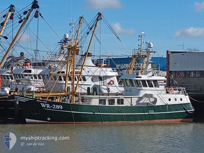
WR289 BONA FIDE
Fishing
Current Trip
| Trip Time | 1 day |
|---|---|
| Trip Distance | 107.38 nm |
| AVG Speed | 3.8 Knots |
| MAX Speed | 10.2 Knots |
| Dybgang | 5 m |
| AVG Wind | 12.8 knots |
| MAX Wind | 19 knots |
| MIN Temp | 11.6°C / 52.88°F |
| MAX Temp | 14.5°C / 58.1°F |
| Position Modtaget | 1 d siden |
Current Position
| Longitude | 5.03725° |
|---|---|
| Latitude | 52.93435° |
| Status | Engaged in Fishing |
| Fart | |
| Kurs | 228° |
| Område | North Sea |
| Station | T-AIS |
| Position Modtaget | 1 d siden |
Info
Information
The current position of WR289 BONA FIDE is in North Sea with coordinates 52.93435° / 5.03725° as reported on 2024-06-14 11:40 by AIS to our vessel tracker app. The vessel's current speed is 0 Knots and is currently inside the port of DEN OEVER.
The vessel WR289 BONA FIDE (IMO: 9783849, MMSI: 244860538) is a Fishing It's sailing under the flag of [NL] Netherlands.
In this page you can find informations about the vessels current position, last detected port calls, and current voyage information. If the vessels is not in coverage by AIS you will find the latest position.
The current position of WR289 BONA FIDE is detected by our AIS receivers and we are not responsible for the reliability of the data. The last position was recorded while the vessel was in Coverage by the Ais receivers of our vessel tracking app.
The current draught of WR289 BONA FIDE as reported by AIS is 5 meters
Weather
| Temperature | 13.8°C / 56.84°F |
|---|---|
| Wind Speed | 20 knots |
| Direction | 186° S |
| Pressure | 1004.7 hPa |
| Humidity | 86.5 % |
| Cloud Coverage | 100 % |
Featured Company
Last Port Calls
| Port | Arrival | Departure | Time In Port |
|---|---|---|---|
| 2024-06-14 05:42 | |||
| 2024-06-12 17:28 | 2024-06-12 18:43 | 1 h | |
| 2024-06-07 05:00 | 2024-06-09 23:03 | 2 d | |
| 2024-06-05 17:59 | 2024-06-05 19:07 | 1 h | |
| 2024-05-31 02:58 | 2024-06-02 22:24 | 2 d | |
| 2024-05-24 02:48 | 2024-05-27 06:42 | 3 d | |
| 2024-05-17 05:01 | 2024-05-20 03:49 | 2 d | |
| 2024-05-10 05:50 | 2024-05-12 23:12 | 2 d | |
| 2024-05-02 04:28 | 2024-05-05 21:48 | 3 d | |
| 2024-04-30 11:41 | 2024-04-30 13:07 | 1 h |
Last Trips
| Origin | Departure | Destination | Arrival | Distance | |
|---|---|---|---|---|---|
| 2024-06-12 20:43 | 2024-06-14 07:42 | 107.38 nm | |||
| 2024-06-10 01:03 | 2024-06-12 19:28 | 231.78 nm | |||
| 2024-06-05 21:07 | 2024-06-07 07:00 | 85.07 nm | |||
| 2024-06-03 00:24 | 2024-06-05 19:59 | 218.92 nm | |||
| 2024-05-27 08:42 | 2024-05-31 04:58 | 338.41 nm | |||
| 2024-05-20 05:49 | 2024-05-24 04:48 | 283.05 nm | |||
| 2024-05-13 01:12 | 2024-05-17 07:01 | 248.81 nm | |||
| 2024-05-05 23:48 | 2024-05-10 07:50 | 247.91 nm | |||
| 2024-04-30 15:07 | 2024-05-02 06:28 | 110.00 nm | |||
| 2024-04-17 21:30 | 2024-04-30 13:41 | 497.09 nm |
Events
| Tid | Hændelsen | Detaljer | Position / Dest | Info |
|---|---|---|---|---|
| 2024-06-14 11:40 | Udenfor Dækning |
52.93435 / 5.03725
North Sea
[NL] DEN OEVER
|
Fart: Kurs: 303° |
|
| 2024-06-14 10:36 | STOP Sejllads |
52.93435 / 5.03725
[NL] DEN OEVER
|
Fart: 0.1 kn Kurs: 227° |
|
| 2024-06-14 10:33 | START Sejllads |
52.93523 / 5.03682
[NL] DEN OEVER
|
Fart: 3.9 kn Kurs: 133° |
|
| 2024-06-14 05:43 | STOP Sejllads |
52.93617 / 5.03422
[NL] DEN OEVER
|
Fart: 0.2 kn Kurs: 127° |
|
| 2024-06-14 05:42 | Skibe i havn |
|
52.93617 / 5.03422
[NL] DEN OEVER
|
Fart: 0.7 kn Kurs: 139° |
| 2024-06-14 02:50 | START Sejllads | 5.13 nm, South West of DEN HELDER |
52.90007 / 4.68436
CH16 FOR INFO
|
Fart: 4.9 kn Kurs: 30° |
| 2024-06-14 02:47 | STOP Sejllads | 5.24 nm, South West of DEN HELDER |
52.89847 / 4.68247
CH16 FOR INFO
|
Fart: 0.1 kn Kurs: 40° |
| 2024-06-13 21:32 | START Sejllads | 8.02 nm, South West of DEN HELDER |
52.87760 / 4.61153
CH16 FOR INFO
|
Fart: 3.1 kn Kurs: 101° |
| 2024-06-13 21:15 | STOP Sejllads | 7.84 nm, South West of DEN HELDER |
52.88673 / 4.60689
CH16 FOR INFO
|
Fart: 0.1 kn Kurs: 183° |
| 2024-06-13 03:26 | START Sejllads | 2.53 nm, South East of TEXEL |
52.99090 / 4.86041
CH16 FOR INFO
|
Fart: 3.3 kn Kurs: 244° |