
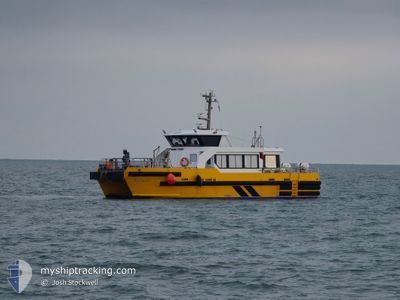
WINDCAT 39
High speed craft
Current Trip
| Trip Time | 5 h, 11 mins |
|---|---|
| Trip Distance | 45.25 nm |
| AVG Speed | 19.1 Knots |
| MAX Speed | 21.8 Knots |
| Dybgang | 2.2 m |
| AVG Wind | 18.2 knots |
| MAX Wind | 21.5 knots |
| MIN Temp | 9.6°C / 49.28°F |
| MAX Temp | 10.8°C / 51.44°F |
| Position Modtaget | Nu |
Current Position
| Longitude | --- |
|---|---|
| Latitude | --- |
| Status | Under way using engine |
| Fart | |
| Kurs | --- |
| Område | North Sea |
| Station | T-AIS |
| Position Modtaget | Nu |
Info
Information
The current position of WINDCAT 39 is in North Sea with coordinates 51.32959° / 1.42157° as reported on 2025-12-07 08:43 by AIS to our vessel tracker app. The vessel's current speed is 0 Knots and is currently inside the port of RAMSGATE.
The vessel WINDCAT 39 (MMSI: 235114376) is a High speed craft It's sailing under the flag of [GB] United Kingdom.
In this page you can find informations about the vessels current position, last detected port calls, and current voyage information. If the vessels is not in coverage by AIS you will find the latest position.
The current position of WINDCAT 39 is detected by our AIS receivers and we are not responsible for the reliability of the data. The last position was recorded while the vessel was in Coverage by the Ais receivers of our vessel tracking app.
The current draught of WINDCAT 39 as reported by AIS is 2.2 meters
Weather
| Temperature | 11.4°C / 52.52°F |
|---|---|
| Wind Speed | 16 knots |
| Direction | 202° SSW |
| Pressure | 1004.6 hPa |
| Humidity | 93.7 % |
| Cloud Coverage | 100 % |
Featured Company
Last Port Calls
| Port | Arrival | Departure | Time In Port |
|---|---|---|---|
| 2025-12-07 02:37 | |||
| 2025-12-05 03:17 | 2025-12-06 21:26 | 1 d | |
| 2025-12-04 01:05 | 2025-12-04 19:20 | 18 h | |
| 2025-12-03 03:56 | 2025-12-03 19:17 | 15 h | |
| 2025-11-30 23:39 | 2025-12-02 19:27 | 1 d | |
| 2025-11-30 01:29 | 2025-11-30 19:28 | 17 h | |
| 2025-11-29 00:39 | 2025-11-29 19:21 | 18 h | |
| 2025-11-28 04:49 | 2025-11-28 19:30 | 14 h | |
| 2025-11-27 20:33 | 2025-11-27 23:06 | 2 h | |
| 2025-11-27 03:41 | 2025-11-27 19:49 | 16 h |
Most Visited Ports (Last year)
| Port | Arrivals | |
|---|---|---|
| 249 | ||
| 3 | ||
| 3 | ||
| 2 |
Last Trips
| Origin | Departure | Destination | Arrival | Distance | |
|---|---|---|---|---|---|
| 2025-12-06 21:26 | 2025-12-07 02:37 | 45.25 nm | |||
| 2025-12-04 19:20 | 2025-12-05 03:17 | 53.68 nm | |||
| 2025-12-03 19:17 | 2025-12-04 01:05 | 54.59 nm | |||
| 2025-12-02 19:27 | 2025-12-03 03:56 | 60.79 nm | |||
| 2025-11-30 19:28 | 2025-11-30 23:39 | 46.18 nm | |||
| 2025-11-29 19:21 | 2025-11-30 01:29 | 55.97 nm | |||
| 2025-11-28 19:30 | 2025-11-29 00:39 | 55.65 nm | |||
| 2025-11-27 23:06 | 2025-11-28 04:49 | 47.61 nm | |||
| 2025-11-27 19:49 | 2025-11-27 20:33 | 15.27 nm | |||
| 2025-11-26 19:11 | 2025-11-27 03:41 | 54.02 nm |
Events
| Tid | Hændelsen | Detaljer | Position / Dest | Info |
|---|---|---|---|---|
| 2025-12-07 02:54 | STOP Sejllads |
51.32960 / 1.42156
[GB] RAMSGATE
|
Fart: Kurs: 172° |
|
| 2025-12-07 02:47 | START Sejllads |
51.32617 / 1.41840
[GB] RAMSGATE
|
Fart: 5.7 kn Kurs: 102° |
|
| 2025-12-07 02:40 | STOP Sejllads |
51.32734 / 1.41605
[GB] RAMSGATE
|
Fart: 0.2 kn Kurs: 347° |
|
| 2025-12-07 02:37 | Skibe i havn |
|
51.32559 / 1.42264
[GB] RAMSGATE
|
Fart: 12.5 kn Kurs: 272.7° |
| 2025-12-07 01:40 | START Sejllads | 17.4 nm, North of RAMSGATE |
51.60372 / 1.55143
RAMSGATE> |
Fart: 17.7 kn Kurs: 227.9° |
| 2025-12-07 01:28 | STOP Sejllads | 17.66 nm, North of RAMSGATE |
51.60678 / 1.55954
RAMSGATE> |
Fart: 0.2 kn Kurs: 23° |
| 2025-12-07 00:32 | START Sejllads | 16.14 nm, South East of HOLLAND ON SEA |
51.59636 / 1.46750
RAMSGATE> |
Fart: 4 kn Kurs: 181° |
| 2025-12-06 23:36 | STOP Sejllads | 16.85 nm, South East of F HALLS COMPANY BOAT |
51.60216 / 1.50324
RAMSGATE> |
Fart: Kurs: 211° |
| 2025-12-06 22:58 | START Sejllads | 17.57 nm, North of RAMSGATE |
51.60573 / 1.55645
RAMSGATE> |
Fart: 12.5 kn Kurs: 283.8° |
| 2025-12-06 22:42 | STOP Sejllads | 17.67 nm, North of RAMSGATE |
51.60685 / 1.55945
RAMSGATE> |
Fart: 0.3 kn Kurs: 90° |