
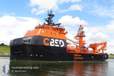
WIND CREATION
Cargo
Current Trip
STB-OWF
| Time Travelled | 3 days |
|---|---|
| Remaining Time | --- |
| Distance Travelled | 61.94 nm |
| Remaining Distance | --- |
| AVG Speed | 8.3 Knots |
| MAX Speed | 12.7 Knots |
| AVG Wind | 8.3 knots |
| MAX Wind | 16.4 knots |
| MIN Temp | 14.5°C / 58.1°F |
| MAX Temp | 18.5°C / 65.3°F |
| Dybgang | 5.7 m |
| Position Modtaget | 2 m siden |
Current Position
| Longitude | -2.42860° |
|---|---|
| Latitude | 48.82337° |
| Status | Restricted manoeuverability |
| Fart | 0.3 Knots |
| Kurs | 152° |
| Område | English Channel |
| Station | T-AIS |
| Position Modtaget | 2 m siden |
Info
Information
The current position of WIND CREATION is in English Channel with coordinates 48.82337° / -2.42860° as reported on 2024-06-23 20:03 by AIS to our vessel tracker app. The vessel's current speed is 0.3 Knots
The vessel WIND CREATION (IMO: 9730517, MMSI: 232054785) is a Cargo It's sailing under the flag of [GB] United Kingdom.
In this page you can find informations about the vessels current position, last detected port calls, and current voyage information. If the vessels is not in coverage by AIS you will find the latest position.
The current position of WIND CREATION is detected by our AIS receivers and we are not responsible for the reliability of the data. The last position was recorded while the vessel was in Coverage by the Ais receivers of our vessel tracking app.
The current draught of WIND CREATION as reported by AIS is 5.7 meters
Weather
| Temperature | 17.9°C / 64.22°F |
|---|---|
| Wind Speed | 6 knots |
| Direction | 63° ENE |
| Pressure | 1020.5 hPa |
| Humidity | 80.9 % |
| Cloud Coverage | 96 % |
Featured Company
Last Port Calls
| Port | Arrival | Departure | Time In Port |
|---|---|---|---|
| 2024-06-18 16:42 | 2024-06-20 03:23 | 1 d | |
| 2024-06-10 18:11 | 2024-06-16 00:41 | 5 d | |
| 2024-06-04 17:18 | 2024-06-06 18:22 | 2 d | |
| 2024-05-31 12:31 | 2024-06-02 22:19 | 2 d | |
| 2024-05-28 20:05 | 2024-05-28 22:04 | 1 h | |
| 2024-05-23 11:00 |
Most Visited Ports (Last year)
| Port | Arrivals | |
|---|---|---|
| 2 | ||
| 2 | ||
| 1 |
Last Trips
| Origin | Departure | Destination | Arrival | Distance | |
|---|---|---|---|---|---|
| 2024-06-16 02:41 | 2024-06-18 18:42 | 43.17 nm | |||
| 2024-06-06 20:22 | 2024-06-10 20:11 | 391.61 nm | |||
| 2024-06-03 00:19 | 2024-06-04 19:18 | 64.68 nm | |||
| 2024-05-29 00:04 | 2024-05-31 14:31 | 291.03 nm | |||
| 2024-05-23 13:00 | 2024-05-28 22:05 | 220.33 nm |
Events
| Tid | Hændelsen | Detaljer | Position / Dest | Info |
|---|---|---|---|---|
| 2024-06-23 17:58 | STOP Sejllads | 13.21 nm, North West of SAINT CAST LE GUIDO |
48.82527 / -2.42431
STB-OWF
|
Fart: 0.3 kn Kurs: 134° |
| 2024-06-23 17:43 | Ændre havområde | French part of the English Channel Jersey part of the English Channel |
48.85217 / -2.44640
English Channel
|
Fart: 8.8 kn Kurs: 149.6° |
| 2024-06-23 16:41 | START Sejllads | 18.85 nm, North East of SAINT QUAY PORTRIEUX |
48.91486 / -2.56939
STB-OWF
|
Fart: 3.1 kn Kurs: 316° |
| 2024-06-23 08:35 | STOP Sejllads | 18.99 nm, North East of SAINT QUAY PORTRIEUX |
48.91347 / -2.55941
STB-OWF
|
Fart: 0.3 kn Kurs: 356° |
| 2024-06-23 08:24 | START Sejllads | 18.66 nm, North East of SAINT QUAY PORTRIEUX |
48.89971 / -2.54336
STB-OWF
|
Fart: 5.7 kn Kurs: 311.5° |
| 2024-06-23 06:56 | STOP Sejllads | 18.65 nm, North East of SAINT QUAY PORTRIEUX |
48.89846 / -2.54136
STB-OWF
|
Fart: 0.3 kn Kurs: 311° |
| 2024-06-23 06:24 | START Sejllads | 15.55 nm, North West of SAINT CAST LE GUIDO |
48.85753 / -2.45736
STB-OWF
|
Fart: 6.3 kn Kurs: 304° |
| 2024-06-23 01:12 | STOP Sejllads | 15.62 nm, North West of SAINT CAST LE GUIDO |
48.86208 / -2.44953
STB-OWF
|
Fart: 0.1 kn Kurs: 125° |
| 2024-06-23 00:55 | Ændre havområde | Jersey part of the English Channel French part of the English Channel |
48.85471 / -2.45130
English Channel
|
Fart: 3.6 kn Kurs: 61.6° |
| 2024-06-23 00:48 | START Sejllads | 15.3 nm, North West of SAINT CAST LE GUIDO |
48.85160 / -2.45951
STB-OWF
|
Fart: 3.1 kn Kurs: 47° |