
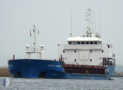
WILSON HUMBER
General Cargo
Current Trip
| Time Travelled | 1 day |
|---|---|
| Remaining Time | --- |
| Distance Travelled | 447.39 nm |
| Remaining Distance | --- |
| AVG Speed | 9.2 Knots |
| MAX Speed | 11.4 Knots |
| AVG Wind | 9.6 knots |
| MAX Wind | 22 knots |
| MIN Temp | 11.6°C / 52.88°F |
| MAX Temp | 17.1°C / 62.78°F |
| Dybgang | 5.7 m |
| Position Modtaget | 1 h, 21 m siden |
Current Position
| Longitude | --- |
|---|---|
| Latitude | --- |
| Status | Under way using engine |
| Fart | 4.7 Knots |
| Kurs | 260° |
| Område | North Atlantic Ocean |
| Station | T-AIS |
| Position Modtaget | 1 h, 21 m siden |
Info
Information
The current position of WILSON HUMBER is in North Atlantic Ocean with coordinates 35.96826° / -6.18652° as reported on 2026-01-04 14:57 by AIS to our vessel tracker app. The vessel's current speed is 4.7 Knots and is heading at the port of DROGHEDA. The estimated time of arrival as calculated by MyShipTracking vessel tracking app is 2026-01-11 14:00 LT
The vessel WILSON HUMBER (IMO: 9017381, MMSI: 314207000) is a General Cargo that was built in 1999 ( 27 år gamle ). It's sailing under the flag of [BB] Barbados.
In this page you can find informations about the vessels current position, last detected port calls, and current voyage information. If the vessels is not in coverage by AIS you will find the latest position.
The current position of WILSON HUMBER is detected by our AIS receivers and we are not responsible for the reliability of the data. The last position was recorded while the vessel was in Coverage by the Ais receivers of our vessel tracking app.
The current draught of WILSON HUMBER as reported by AIS is 5.7 meters
Weather
| Temperature | 15.8°C / 60.44°F |
|---|---|
| Wind Speed | 21 knots |
| Direction | 289° WNW |
| Pressure | 994.7 hPa |
| Humidity | 89.4 % |
| Cloud Coverage | 34 % |
Featured Company
Last Port Calls
| Port | Arrival | Departure | Time In Port |
|---|---|---|---|
| 2025-12-31 18:04 | 2026-01-02 18:48 | 2 d | |
| 2025-12-29 10:14 | 2025-12-30 15:51 | 1 d | |
| 2025-12-19 21:19 | 2025-12-21 03:24 | 1 d | |
| 2025-12-16 11:31 | 2025-12-17 20:40 | 1 d | |
| 2025-12-01 17:28 | 2025-12-07 09:55 | 5 d | |
| 2025-11-26 22:11 | 2025-11-27 01:40 | 3 h | |
| 2025-11-17 07:22 | 2025-11-17 17:07 | 9 h | |
| 2025-11-14 08:23 | 2025-11-15 12:24 | 1 d | |
| 2025-11-12 07:51 |
Last Trips
| Origin | Departure | Destination | Arrival | Distance | |
|---|---|---|---|---|---|
| 2025-12-30 15:51 | 2025-12-31 18:04 | 6.43 nm | |||
| 2025-12-21 03:24 | 2025-12-29 10:14 | 1881.22 nm | |||
| 2025-12-17 20:40 | 2025-12-19 21:19 | 149.03 nm | |||
| 2025-12-07 09:55 | 2025-12-16 11:31 | 976.86 nm | |||
| 2025-11-27 01:40 | 2025-12-01 17:28 | 784.33 nm | |||
| 2025-11-17 17:07 | 2025-11-26 22:11 | 1750.29 nm | |||
| 2025-11-15 12:24 | 2025-11-17 07:22 | 1.02 nm | |||
| 2025-11-12 07:51 | 2025-11-14 08:23 | 16.14 nm |
Events
| Tid | Hændelsen | Detaljer | Position / Dest | Info |
|---|---|---|---|---|
| 2026-01-04 14:58 | Status er ændret | Default Under way using engine |
35.96828 / -6.18856
IEDRO
|
Fart: 4.7 kn Kurs: 260° |
| 2026-01-04 14:57 | Udenfor Dækning |
35.96826 / -6.18652
North Atlantic Ocean
IEDRO
|
Fart: 4.7 kn Kurs: 268.8° |
|
| 2026-01-04 14:56 | Status er ændret | Under way using engine Default |
35.96828 / -6.18411
IEDRO
|
Fart: 4.4 kn Kurs: 257° |
| 2026-01-04 14:39 | Indenfor Dækning |
35.96826 / -6.18652
North Atlantic Ocean
IEDRO
|
Fart: 4.7 kn Kurs: 268.8° |
|
| 2026-01-04 13:52 | Status er ændret | Default Under way using engine |
35.96829 / -6.08535
IEDRO
|
Fart: 4.4 kn Kurs: 260° |
| 2026-01-04 13:46 | Udenfor Dækning |
35.96835 / -6.07648
North Atlantic Ocean
IEDRO
|
Fart: 4.4 kn Kurs: 263.6° |
|
| 2026-01-04 12:46 | Fundet i havområde | Spanish part of the North Atlantic Ocean |
35.96825 / -5.97294
North Atlantic Ocean
IEDRO
|
Fart: 7.8 kn Kurs: 273.6° |
| 2026-01-04 08:54 | Ændre havområde | Spanish part of the Strait of Gibraltar Gibraltarian part of the Strait of Gibraltar |
36.02727 / -5.34182
Strait of Gibraltar
IEDRO
|
Fart: 6.1 kn Kurs: 252.3° |
| 2026-01-04 08:49 | Ændre havområde | Gibraltarian part of the Strait of Gibraltar Gibraltarian part of the Alboran Sea |
36.02975 / -5.33191
Strait of Gibraltar
IEDRO
|
Fart: 6 kn Kurs: 251.2° |
| 2026-01-04 07:36 | ETA er ændret | 2026/01/11 14:00 2026/01/11 13:00 |
36.05497 / -5.17699
IEDRO
|
Fart: 7.6 kn Kurs: 260.3° |