
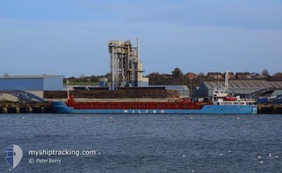
WILSON DORDRECHT
General Cargo
Current Trip
| Time Travelled | 5 days |
|---|---|
| Remaining Time | --- |
| Distance Travelled | 803.30 nm |
| Remaining Distance | --- |
| AVG Speed | 5.7 Knots |
| MAX Speed | 9.7 Knots |
| AVG Wind | 32.6 knots |
| MAX Wind | 45 knots |
| MIN Temp | 5.8°C / 42.44°F |
| MAX Temp | 12.4°C / 54.32°F |
| Dybgang | 4.8 m |
| Position Modtaget | 17 h, 45 m siden |
Current Position
| Longitude | --- |
|---|---|
| Latitude | --- |
| Status | Under way using engine |
| Fart | 7.2 Knots |
| Kurs | 250.7° |
| Område | English Channel |
| Station | T-AIS |
| Position Modtaget | 17 h, 45 m siden |
Info
Information
The current position of WILSON DORDRECHT is in English Channel with coordinates 50.37631° / -0.81643° as reported on 2024-12-23 10:45 by AIS to our vessel tracker app. The vessel's current speed is 7.2 Knots and is heading at the port of ORAN. The estimated time of arrival as calculated by MyShipTracking vessel tracking app is 2024-12-30 07:00 LT
The vessel WILSON DORDRECHT (IMO: 9145140, MMSI: 314474000) is a General Cargo that was built in 1996 ( 28 år gamle ). It's sailing under the flag of [BB] Barbados.
In this page you can find informations about the vessels current position, last detected port calls, and current voyage information. If the vessels is not in coverage by AIS you will find the latest position.
The current position of WILSON DORDRECHT is detected by our AIS receivers and we are not responsible for the reliability of the data. The last position was recorded while the vessel was in Coverage by the Ais receivers of our vessel tracking app.
The current draught of WILSON DORDRECHT as reported by AIS is 4.8 meters
Weather
| Temperature | 12.3°C / 54.14°F |
|---|---|
| Wind Speed | 13 knots |
| Direction | 305° NW |
| Pressure | 1027.2 hPa |
| Humidity | 96.5 % |
| Cloud Coverage | 92 % |
Featured Company
Last Port Calls
| Port | Arrival | Departure | Time In Port |
|---|---|---|---|
| 2024-12-18 06:21 | 2024-12-18 19:21 | 12 h | |
| 2024-12-11 00:30 | 2024-12-11 14:05 | 13 h | |
| 2024-12-05 12:13 | 2024-12-07 02:01 | 1 d | |
| 2024-11-27 02:26 | 2024-11-29 15:18 | 2 d | |
| 2024-11-24 17:46 | 2024-11-26 11:34 | 1 d | |
| 2024-11-08 20:35 | 2024-11-17 11:26 | 8 d | |
| 2024-10-03 07:37 | 2024-11-08 11:37 |
Last Trips
| Origin | Departure | Destination | Arrival | Distance | |
|---|---|---|---|---|---|
| 2024-12-11 15:05 | 2024-12-18 07:21 | 715.65 nm | |||
| 2024-12-07 03:01 | 2024-12-11 01:30 | 642.24 nm | |||
| 2024-11-29 16:18 | 2024-12-05 13:13 | 1107.01 nm | |||
| 2024-11-26 12:34 | 2024-11-27 03:26 | 110.04 nm | |||
| 2024-11-17 12:26 | 2024-11-24 18:46 | 924.78 nm | |||
| 2024-11-08 12:37 | 2024-11-08 21:35 | 30.54 nm | |||
| 2024-09-28 18:37 | 2024-10-03 09:37 | 659.12 nm |
Events
| Tid | Hændelsen | Detaljer | Position / Dest | Info |
|---|---|---|---|---|
| 2024-12-23 10:51 | Status er ændret | Default Under way using engine |
50.37255 / -.83376
DZ ORN
|
Fart: 7.2 kn Kurs: 250.7° |
| 2024-12-23 10:45 | Status er ændret | Under way using engine Default |
50.37631 / -.81643
DZ ORN
|
Fart: 7.6 kn Kurs: 252° |
| 2024-12-23 10:45 | Udenfor Dækning |
50.37631 / -.81643
English Channel
DZ ORN
|
Fart: 7.2 kn Kurs: 250.7° |
|
| 2024-12-23 10:39 | Status er ændret | Default Under way using engine |
50.38072 / -.79618
DZ ORN
|
Fart: 7.2 kn Kurs: 251.7° |
| 2024-12-23 09:56 | Status er ændret | Under way using engine Default |
50.40537 / -.66107
DZ ORN
|
Fart: 7.9 kn Kurs: 254° |
| 2024-12-23 09:19 | Status er ændret | Default Under way using engine |
50.42675 / -.53838
DZ ORN
|
Fart: 7.8 kn Kurs: 253.5° |
| 2024-12-23 04:21 | Status er ændret | Under way using engine Default |
50.61043 / .40863
DZ ORN
|
Fart: 7.4 kn Kurs: 256° |
| 2024-12-23 04:17 | Status er ændret | Default Under way using engine |
50.61277 / .42067
DZ ORN
|
Fart: 7 kn Kurs: 257.2° |
| 2024-12-23 04:07 | Status er ændret | Under way using engine Default |
50.61723 / .44985
DZ ORN
|
Fart: 6.2 kn Kurs: 259° |
| 2024-12-23 04:01 | Status er ændret | Default Under way using engine |
50.61979 / .46669
DZ ORN
|
Fart: 6.3 kn Kurs: 253° |