
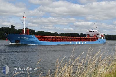
WILSON BREST
General Cargo
Current Trip
| Trip Time | 22 days |
|---|---|
| Trip Distance | 3881.28 nm |
| AVG Speed | 8.6 Knots |
| MAX Speed | 12.4 Knots |
| Dybgang | 3.7 m |
| AVG Wind | 9.8 knots |
| MAX Wind | 27.8 knots |
| MIN Temp | 0.3°C / 32.54°F |
| MAX Temp | 17.1°C / 62.78°F |
| Position Modtaget | 2 d siden |
Current Position
| Longitude | --- |
|---|---|
| Latitude | --- |
| Status | Under way using engine |
| Fart | 9.3 Knots |
| Kurs | 84.1° |
| Område | Black Sea |
| Station | T-AIS |
| Position Modtaget | 2 d siden |
Info
Information
The current position of WILSON BREST is in Black Sea with coordinates 41.32059° / 29.88785° as reported on 2025-03-02 00:35 by AIS to our vessel tracker app. The vessel's current speed is 9.3 Knots and is currently inside the port of EREGLI.
The vessel WILSON BREST (IMO: 9126900, MMSI: 314547000) is a General Cargo that was built in 1995 ( 30 år gamle ). It's sailing under the flag of [BB] Barbados.
In this page you can find informations about the vessels current position, last detected port calls, and current voyage information. If the vessels is not in coverage by AIS you will find the latest position.
The current position of WILSON BREST is detected by our AIS receivers and we are not responsible for the reliability of the data. The last position was recorded while the vessel was in Coverage by the Ais receivers of our vessel tracking app.
The current draught of WILSON BREST as reported by AIS is 3.7 meters
Weather
| Temperature | 1.8°C / 35.24°F |
|---|---|
| Wind Speed | 5 knots |
| Direction | 66° ENE |
| Pressure | 1026.2 hPa |
| Humidity | 86.5 % |
| Cloud Coverage | 11 % |
Featured Company
Last Port Calls
| Port | Arrival | Departure | Time In Port |
|---|---|---|---|
| 2025-03-02 11:45 | |||
| 2025-02-07 07:52 | 2025-02-08 00:22 | 16 h | |
| 2025-01-31 07:33 | 2025-01-31 20:28 | 12 h | |
| 2025-01-23 02:28 | 2025-01-25 13:59 | 2 d | |
| 2025-01-19 08:39 | 2025-01-21 20:26 | 2 d | |
| 2025-01-15 07:37 | 2025-01-16 17:21 | 1 d | |
| 2025-01-11 21:51 | 2025-01-13 21:51 | 1 d | |
| 2025-01-09 02:44 |
Last Trips
| Origin | Departure | Destination | Arrival | Distance | |
|---|---|---|---|---|---|
| 2025-02-08 00:22 | 2025-03-02 11:45 | 3881.28 nm | |||
| 2025-01-31 20:28 | 2025-02-07 07:52 | 652.29 nm | |||
| 2025-01-25 13:59 | 2025-01-31 07:33 | 605.37 nm | |||
| 2025-01-21 20:26 | 2025-01-23 02:28 | 196.34 nm | |||
| 2025-01-16 17:21 | 2025-01-19 08:39 | 591.20 nm | |||
| 2025-01-13 21:51 | 2025-01-15 07:37 | 294.14 nm | |||
| 2025-01-09 02:44 | 2025-01-11 21:51 | 576.38 nm |
Events
| Tid | Hændelsen | Detaljer | Position / Dest | Info |
|---|---|---|---|---|
| 2025-03-02 09:09 | STOP Sejllads |
41.28381 / 31.41047
[TR] EREGLI
|
Fart: Kurs: 79° |
|
| 2025-03-02 08:45 | Skibe i havn |
|
41.27834 / 31.39907
[TR] EREGLI
|
Fart: 5.8 kn Kurs: 92° |
| 2025-03-02 00:38 | Status er ændret | Default Under way using engine |
41.32142 / 29.89643
TRERE
|
Fart: 9.3 kn Kurs: 84.1° |
| 2025-03-02 00:35 | Udenfor Dækning |
41.32059 / 29.88785
Black Sea
TRERE
|
Fart: 9.3 kn Kurs: 84.1° |
|
| 2025-03-01 20:53 | ETA er ændret | 2025/03/02 09:00 2026/02/28 16:00 |
41.22820 / 29.14926
TRERE
|
Fart: 8.7 kn Kurs: 43.2° |
| 2025-03-01 20:53 | Ændre havområde | Turkish part of the Black Sea Turkish part of the Sea of Marmara |
41.22820 / 29.14926
Black Sea
|
Fart: 8.7 kn Kurs: 43.2° |
| 2025-03-01 16:32 | START Sejllads | 1.97 nm, South West of KARTAL |
40.85529 / 29.17820
TRERE
|
Fart: 3.5 kn Kurs: 223° |
| 2025-03-01 16:29 | Status er ændret | Under way using engine At anchor |
40.85560 / 29.17956
TRERE
|
Fart: 0.4 kn Kurs: 310° |
| 2025-03-01 11:15 | Status er ændret | At anchor Default |
40.85798 / 29.17964
TRERE
|
Fart: Kurs: 263° |
| 2025-03-01 11:12 | Status er ændret | Default At anchor |
40.85804 / 29.17964
TRERE
|
Fart: Kurs: 264° |