

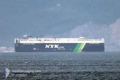
WILD ROSE LEADER
Cargo

Current Trip
| Time Travelled | 3 days |
|---|---|
| Remaining Time | 4 days |
| Distance Travelled | 1036.13 nm |
| Remaining Distance | 1629.74 nm |
| AVG Speed | 13 Knots |
| MAX Speed | 16.4 Knots |
| AVG Wind | 8.8 knots |
| MAX Wind | 19 knots |
| MIN Temp | 7.9°C / 46.22°F |
| MAX Temp | 25.1°C / 77.18°F |
| Dybgang | 8.2 m |
| Position Modtaget | 11 d siden |
Current Position
| Longitude | --- |
|---|---|
| Latitude | --- |
| Status | Under way using engine |
| Fart | 11.9 Knots |
| Kurs | 34.1° |
| Område | Philippine Sea |
| Station | T-AIS |
| Position Modtaget | 11 d siden |
Information
The current position of WILD ROSE LEADER is in Philippine Sea with coordinates 34.98832° / 136.81814° as reported on 2025-02-18 21:16 by AIS to our vessel tracker app. The vessel's current speed is 11.9 Knots and is heading at the port of NAGOYA. The estimated time of arrival as calculated by MyShipTracking vessel tracking app is 2025-03-07 02:58 LT
The vessel WILD ROSE LEADER (IMO: 9925370, MMSI: 636022333) is a Cargo It's sailing under the flag of [LR] Liberia.
In this page you can find informations about the vessels current position, last detected port calls, and current voyage information. If the vessels is not in coverage by AIS you will find the latest position.
The current position of WILD ROSE LEADER is detected by our AIS receivers and we are not responsible for the reliability of the data. The last position was recorded while the vessel was in Coverage by the Ais receivers of our vessel tracking app.
The current draught of WILD ROSE LEADER as reported by AIS is 8.2 meters
Weather
| Temperature | 26.2°C / 79.16°F |
|---|---|
| Wind Speed | 10 knots |
| Direction | 60° ENE |
| Pressure | 1010.1 hPa |
| Humidity | 79.1 % |
| Cloud Coverage | 89 % |


Featured Company
Last Port Calls
| Port | Arrival | Departure | Time In Port |
|---|---|---|---|
| 2025-02-26 03:12 | 2025-02-26 14:59 | 11 h | |
| 2025-02-18 21:21 | 2025-02-19 08:45 | 11 h | |
| 2025-02-17 21:41 | 2025-02-18 18:09 | 20 h | |
| 2025-02-16 08:45 | 2025-02-17 07:25 | 22 h | |
| 2025-02-15 21:25 | 2025-02-16 08:09 | 10 h | |
| 2025-01-28 13:55 | 2025-01-28 23:03 | 9 h | |
| 2025-01-27 12:52 | 2025-01-28 02:09 | 13 h | |
| 2025-01-12 15:47 | 2025-01-13 06:07 | 14 h |
Last Trips
| Origin | Departure | Destination | Arrival | Distance | |
|---|---|---|---|---|---|
| 2025-02-19 17:45 | 2025-02-26 11:12 | 1744.41 nm | |||
| 2025-02-19 03:09 | 2025-02-19 06:21 | 43.34 nm | |||
| 2025-02-17 16:25 | 2025-02-18 06:41 | 125.34 nm | |||
| 2025-02-16 17:09 | 2025-02-16 17:45 | 6.50 nm | |||
| 2025-01-28 15:03 | 2025-02-16 06:25 | 6166.67 nm | |||
| 2025-01-27 18:09 | 2025-01-28 05:55 | 147.78 nm | |||
| 2025-01-13 00:07 | 2025-01-27 04:52 | 4513.74 nm | |||
| 2024-12-27 23:13 | 2025-01-12 09:47 | 6224.22 nm |
Events
| Tid | Hændelsen | Detaljer | Position / Dest | Info |
|---|---|---|---|---|
| 2025-02-26 14:59 | START Sejllads | 4.79 nm, South East of SHANGHAI |
31.32844 / 121.68749
JP NGO
|
Fart: 3.4 kn Kurs: 105° |
| 2025-02-26 14:59 | Afsejlet fra sidste havn |
|
31.32844 / 121.68749
JP NGO
|
Fart: 2.9 kn Kurs: 90° |
| 2025-02-26 03:12 | STOP Sejllads |
31.32357 / 121.67947
[CN] SHANGHAI
|
Fart: Kurs: 126° |
|
| 2025-02-26 03:12 | Skibe i havn |
|
31.32357 / 121.67947
[CN] SHANGHAI
|
Fart: 0.6 kn Kurs: 130° |
| 2025-02-25 21:08 | START Sejllads |
31.23082 / 122.48549
JP NGO
|
Fart: 5.3 kn Kurs: 76° |
|
| 2025-02-24 19:45 | STOP Sejllads |
31.22418 / 122.46991
JP NGO
|
Fart: 0.1 kn Kurs: 352° |
|
| 2025-02-23 04:53 | START Sejllads | 8.76 nm, North East of DALIAN |
39.03150 / 121.84911
JP NGO
|
Fart: 3.6 kn Kurs: 103° |
| 2025-02-22 22:09 | STOP Sejllads | 8.51 nm, North East of DALIAN |
39.03126 / 121.84299
JP NGO
|
Fart: 0.2 kn Kurs: 194° |