
WIELAND
Cargo
Current Trip
| Time Travelled | 5 days |
|---|---|
| Remaining Time | 20 h, 13 mins |
| Distance Travelled | 2268.71 nm |
| Remaining Distance | 314.08 nm |
| AVG Speed | 15.9 Knots |
| MAX Speed | 17.9 Knots |
| AVG Wind | 15.3 knots |
| MAX Wind | 28.3 knots |
| MIN Temp | 11.7°C / 53.06°F |
| MAX Temp | 23.6°C / 74.48°F |
| Dybgang | 9.8 m |
| Position Modtaget | Nu |
Current Position
| Longitude | -3.93550° |
|---|---|
| Latitude | 49.39250° |
| Status | Under way using engine |
| Fart | 15.9 Knots |
| Kurs | 65° |
| Område | English Channel |
| Station | T-AIS |
| Position Modtaget | Nu |
Info
Information
The current position of WIELAND is in English Channel with coordinates 49.39250° / -3.93550° as reported on 2024-05-06 11:27 by AIS to our vessel tracker app. The vessel's current speed is 15.9 Knots and is heading at the port of TILBURY. The estimated time of arrival as calculated by MyShipTracking vessel tracking app is 2024-05-07 07:41 LT
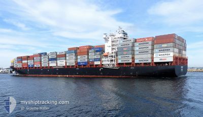
The vessel WIELAND (IMO: 9654464, MMSI: 255805563) is a Cargo It's sailing under the flag of [PT] Portugal.
In this page you can find informations about the vessels current position, last detected port calls, and current voyage information. If the vessels is not in coverage by AIS you will find the latest position.
The current position of WIELAND is detected by our AIS receivers and we are not responsible for the reliability of the data. The last position was recorded while the vessel was in Coverage by the Ais receivers of our vessel tracking app.
The current draught of WIELAND as reported by AIS is 9.8 meters
Weather
| Temperature | 12.3°C / 54.14°F |
|---|---|
| Wind Speed | 11 knots |
| Direction | 12° NNE |
| Pressure | 1008.8 hPa |
| Humidity | 75 % |
| Cloud Coverage | 84 % |
Featured Company
Last Port Calls
| Port | Arrival | Departure | Time In Port |
|---|---|---|---|
| 2024-04-29 21:30 | 2024-04-30 17:10 | 19 h | |
| 2024-04-22 22:14 | 2024-04-25 15:34 | 2 d | |
| 2024-04-17 13:06 | 2024-04-18 19:34 | 1 d | |
| 2024-04-09 12:40 | 2024-04-10 22:27 | 1 d | |
| 2024-04-08 19:52 | 2024-04-09 05:59 | 10 h | |
| 2024-04-01 19:08 | 2024-04-02 15:40 | 20 h | |
| 2024-03-29 13:25 | 2024-03-30 12:05 | 22 h | |
| 2024-03-28 10:01 | 2024-03-29 02:02 | 16 h | |
| 2024-03-27 13:49 | 2024-03-28 01:29 | 11 h | |
| 2024-03-14 22:07 |
Last Trips
| Origin | Departure | Destination | Arrival | Distance | |
|---|---|---|---|---|---|
| 2024-04-25 15:34 | 2024-04-29 21:30 | 1254.78 nm | |||
| 2024-04-18 19:34 | 2024-04-22 22:14 | 1226.12 nm | |||
| 2024-04-10 22:27 | 2024-04-17 13:06 | 1572.25 nm | |||
| 2024-04-09 07:59 | 2024-04-09 12:40 | 51.82 nm | |||
| 2024-04-02 17:40 | 2024-04-08 21:52 | 1347.97 nm | |||
| 2024-03-30 13:05 | 2024-04-01 21:08 | 310.99 nm | |||
| 2024-03-29 03:02 | 2024-03-29 14:25 | 130.44 nm | |||
| 2024-03-28 01:29 | 2024-03-28 11:01 | 112.21 nm | |||
| 2024-03-28 01:29 | 2024-03-27 13:49 | 112.21 nm | |||
| 2024-03-10 08:29 | 2024-03-14 22:07 | 1267.67 nm |
Events
| Tid | Hændelsen | Detaljer | Position / Dest | Info |
|---|---|---|---|---|
| 2024-05-06 11:09 | Status er ændret | Under way using engine Default |
49.35433 / -4.04100
GBTIL
|
Fart: 15.3 kn Kurs: 59° |
| 2024-05-06 11:06 | Status er ændret | Default Under way using engine |
49.34934 / -4.05383
GBTIL
|
Fart: 15.2 kn Kurs: 59° |
| 2024-05-06 08:38 | Ændre havområde | French part of the English Channel French part of the Celtic Sea |
49.01636 / -4.87348
English Channel
GBTIL
|
Fart: 15.1 kn Kurs: 66° |
| 2024-05-06 06:35 | Ændre havområde | French part of the Celtic Sea Spanish part of the North Atlantic Ocean |
48.78045 / -5.55189
Celtic Sea
GBTIL
|
Fart: 14.6 kn Kurs: 60° |
| 2024-05-06 06:35 | Status er ændret | Under way using engine Default |
48.78045 / -5.55189
GBTIL
|
Fart: 14.5 kn Kurs: 63° |
| 2024-05-06 06:35 | Indenfor Dækning |
48.78045 / -5.55189
Celtic Sea
GBTIL
|
Fart: 14.6 kn Kurs: 60° |
|
| 2024-05-05 08:33 | Status er ændret | Default Under way using engine |
43.77883 / -9.37692
GBTIL
|
Fart: 15.8 kn Kurs: 27° |
| 2024-05-05 08:23 | Udenfor Dækning |
43.73900 / -9.40517
North Atlantic Ocean
GBTIL
|
Fart: 15.8 kn Kurs: 27° |
|
| 2024-05-05 07:39 | Status er ændret | Under way using engine Default |
43.56567 / -9.51583
GBTIL
|
Fart: 15.7 kn Kurs: 25° |
| 2024-05-05 07:33 | Status er ændret | Default Under way using engine |
43.54267 / -9.53067
GBTIL
|
Fart: 16.1 kn Kurs: 30° |