
WAVEWALKER 1
Dredging or underwater ops
Current Trip
RATTRBBURGH
| Time Travelled | 3 days |
|---|---|
| Remaining Time | --- |
| Distance Travelled | 195.90 nm |
| Remaining Distance | --- |
| AVG Speed | 4.3 Knots |
| MAX Speed | 5.8 Knots |
| AVG Wind | 9.9 knots |
| MAX Wind | 18 knots |
| MIN Temp | 5.1°C / 41.18°F |
| MAX Temp | 10.9°C / 51.62°F |
| Dybgang | 4 m |
| Position Modtaget | 9 h, 15 m siden |
Current Position
| Longitude | --- |
|---|---|
| Latitude | --- |
| Status | Restricted manoeuverability |
| Fart | |
| Kurs | --- |
| Område | North Sea |
| Station | T-AIS |
| Position Modtaget | 9 h, 15 m siden |
Info
Information
The current position of WAVEWALKER 1 is in North Sea with coordinates 52.57955° / 1.74392° as reported on 2026-04-02 22:24 by AIS to our vessel tracker app. The vessel's current speed is 0 Knots
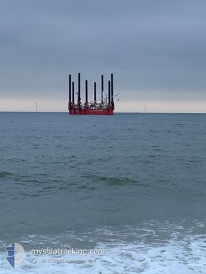
The vessel WAVEWALKER 1 (MMSI: 244780105) is a Dredging or underwater ops It's sailing under the flag of [NL] Netherlands.
In this page you can find informations about the vessels current position, last detected port calls, and current voyage information. If the vessels is not in coverage by AIS you will find the latest position.
The current position of WAVEWALKER 1 is detected by our AIS receivers and we are not responsible for the reliability of the data. The last position was recorded while the vessel was in Coverage by the Ais receivers of our vessel tracking app.
The current draught of WAVEWALKER 1 as reported by AIS is 4 meters
Weather
| Temperature | 5.1°C / 41.18°F |
|---|---|
| Wind Speed | 10 knots |
| Direction | 181° S |
| Pressure | 1018.7 hPa |
| Humidity | 78.6 % |
| Cloud Coverage | 84 % |
Featured Company
Most Visited Ports (Last year)
| Port | Arrivals | |
|---|---|---|
| 1 | ||
| 1 | ||
| 1 | ||
| 1 |
Last Trips
| Origin | Departure | Destination | Arrival | Distance | |
|---|---|---|---|---|---|
| 2026-01-13 12:36 | 2026-03-22 17:39 | 381.89 nm |
Events
| Tid | Hændelsen | Detaljer | Position / Dest | Info |
|---|---|---|---|---|
| 2026-04-02 22:24 | Udenfor Dækning |
52.57955 / 1.74392
North Sea
|
Fart: Kurs: 200.1° |
|
| 2026-04-02 22:24 | Indenfor Dækning |
52.57955 / 1.74392
North Sea
|
Fart: Kurs: 200.1° |
|
| 2026-04-02 19:40 | Udenfor Dækning |
52.57954 / 1.74389
North Sea
|
Fart: Kurs: 4.8° |
|
| 2026-04-02 19:36 | ETA er ændret | 2027/03/28 22:00 2026/02/21 22:00 |
52.57962 / 1.74381
RATTRBBURGH
|
Fart: Kurs: 511° |
| 2026-04-02 18:05 | Indenfor Dækning |
52.57958 / 1.74389
North Sea
|
Fart: Kurs: 20.4° |
|
| 2026-04-02 10:26 | Udenfor Dækning |
52.57531 / 1.76571
North Sea
|
Fart: 1.5 kn Kurs: 300.1° |
|
| 2026-04-02 10:13 | Indenfor Dækning |
52.57524 / 1.77110
North Sea
|
Fart: 0.8 kn Kurs: 267.2° |
|
| 2026-04-02 08:50 | Udenfor Dækning |
52.58255 / 1.76931
North Sea
|
Fart: 0.4 kn Kurs: 185.5° |
|
| 2026-04-02 08:40 | STOP Sejllads | --- |
52.58328 / 1.76872
RATTRBBURGH
|
Fart: 0.2 kn Kurs: 511° |
| 2026-04-02 08:17 | Indenfor Dækning |
52.58578 / 1.76786
North Sea
|
Fart: 0.6 kn Kurs: 180.7° |