

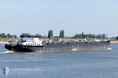
WATERPOORT
Tanker

Current Trip
| Time Travelled | 9 h, 38 mins |
|---|---|
| Remaining Time | --- |
| Distance Travelled | 64.75 nm |
| Remaining Distance | --- |
| AVG Speed | 7.8 Knots |
| MAX Speed | 9.6 Knots |
| AVG Wind | 5.2 knots |
| MAX Wind | 7.7 knots |
| MIN Temp | 3.8°C / 38.84°F |
| MAX Temp | 7.4°C / 45.32°F |
| Dybgang | 0 m |
| Position Modtaget | 1 m siden |
Current Position
| Longitude | --- |
|---|---|
| Latitude | --- |
| Status | Under way using engine |
| Fart | 6.9 Knots |
| Kurs | 24.2° |
| Område | North Sea |
| Station | T-AIS |
| Position Modtaget | 1 m siden |
Information
The current position of WATERPOORT is in North Sea with coordinates 51.81892° / 5.37756° as reported on 2025-03-25 04:21 by AIS to our vessel tracker app. The vessel's current speed is 6.9 Knots and is heading at the port of HOCHST. The estimated time of arrival as calculated by MyShipTracking vessel tracking app is 2025-03-27 12:43 LT
The vessel WATERPOORT (MMSI: 244620890) is a Tanker It's sailing under the flag of [NL] Netherlands.
In this page you can find informations about the vessels current position, last detected port calls, and current voyage information. If the vessels is not in coverage by AIS you will find the latest position.
The current position of WATERPOORT is detected by our AIS receivers and we are not responsible for the reliability of the data. The last position was recorded while the vessel was in Coverage by the Ais receivers of our vessel tracking app.
Weather
| Temperature | 3.8°C / 38.84°F |
|---|---|
| Wind Speed | 5 knots |
| Direction | 279° W |
| Pressure | 1019.8 hPa |
| Humidity | 92.1 % |
| Cloud Coverage | 59 % |


Featured Company
Last Port Calls
| Port | Arrival | Departure | Time In Port |
|---|---|---|---|
| 2025-03-23 07:45 | 2025-03-24 19:44 | 1 d | |
| 2025-03-22 07:44 | 2025-03-22 08:16 | 32 m | |
| 2025-03-21 19:09 | 2025-03-21 20:07 | 58 m | |
| 2025-03-19 23:13 | 2025-03-19 23:46 | 32 m | |
| 2025-03-15 16:29 | 2025-03-17 16:50 | 2 d | |
| 2025-03-14 21:40 | 2025-03-15 06:27 | 8 h | |
| 2025-03-14 18:24 | 2025-03-14 19:34 | 1 h | |
| 2025-03-14 10:16 | 2025-03-14 11:34 | 1 h | |
| 2025-03-12 07:04 | |||
| 2025-03-08 02:18 | 2025-03-09 22:09 | 1 d |
Last Trips
| Origin | Departure | Destination | Arrival | Distance | |
|---|---|---|---|---|---|
| 2025-03-22 08:16 | 2025-03-23 07:45 | 188.46 nm | |||
| 2025-03-21 20:07 | 2025-03-22 07:44 | 96.53 nm | |||
| 2025-03-19 23:46 | 2025-03-21 19:09 | 19.21 nm | |||
| 2025-03-17 16:50 | 2025-03-19 23:13 | 274.91 nm | |||
| 2025-03-15 06:27 | 2025-03-15 16:29 | 77.15 nm | |||
| 2025-03-14 19:34 | 2025-03-14 21:40 | 21.56 nm | |||
| 2025-03-14 11:34 | 2025-03-14 18:24 | 60.60 nm | |||
| 2025-03-14 11:34 | 2025-03-14 10:16 | 60.60 nm | |||
| 2025-03-09 22:09 | 2025-03-12 07:04 | 288.51 nm | |||
| 2025-03-08 00:33 | 2025-03-08 02:18 | 15.88 nm |
Events
| Tid | Hændelsen | Detaljer | Position / Dest | Info |
|---|---|---|---|---|
| 2025-03-25 04:02 | ETA er ændret | 2025/03/27 11:43 2025/03/26 22:47 |
51.80647 / 5.33758
FRANKFURT HOCHST
|
Fart: 6.3 kn Kurs: 131.9° |
| 2025-03-25 01:18 | Status er ændret | Under way using engine Default |
51.79692 / 4.83116
FRANKFURT HOCHST
|
Fart: 8.2 kn Kurs: 110° |
| 2025-03-25 01:16 | Status er ændret | Default Under way using engine |
51.79821 / 4.82226
FRANKFURT HOCHST
|
Fart: 8.4 kn Kurs: 84.7° |
| 2025-03-25 00:45 | Status er ændret | Under way using engine Default |
51.76022 / 4.74161
FRANKFURT HOCHST
|
Fart: 8.6 kn Kurs: 36° |
| 2025-03-25 00:30 | Status er ændret | Default Under way using engine |
51.73329 / 4.70149
FRANKFURT HOCHST
|
Fart: 8.9 kn Kurs: 61.9° |
| 2025-03-24 23:56 | Status er ændret | Under way using engine Default |
51.70383 / 4.57550
FRANKFURT HOCHST
|
Fart: 8.9 kn Kurs: 72° |
| 2025-03-24 23:50 | Status er ændret | Default Under way using engine |
51.69892 / 4.55143
FRANKFURT HOCHST
|
Fart: 9 kn Kurs: 78.4° |
| 2025-03-24 23:11 | START Sejllads | 1.18 nm, West of WILLEMSTAD |
51.69024 / 4.40883
FRANKFURT HOCHST
|
Fart: 3.1 kn Kurs: 47° |
| 2025-03-24 23:10 | Status er ændret | Under way using engine Default |
51.68986 / 4.40817
FRANKFURT HOCHST
|
Fart: Kurs: 50° |
| 2025-03-24 22:54 | Status er ændret | Default Under way using engine |
51.68975 / 4.40804
FRANKFURT HOCHST
|
Fart: Kurs: 50° |