
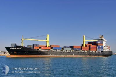
WARNOW WHALE
Container Ship
Current Trip
| Trip Time | 4 h, 46 mins |
|---|---|
| Trip Distance | 61.21 nm |
| AVG Speed | 14.6 Knots |
| MAX Speed | 15.7 Knots |
| Dybgang | 8.6 m |
| AVG Wind | 7.9 knots |
| MAX Wind | 12 knots |
| MIN Temp | 19.4°C / 66.92°F |
| MAX Temp | 27.4°C / 81.32°F |
| Position Modtaget | 9 h, 48 m siden |
Current Position
| Longitude | --- |
|---|---|
| Latitude | --- |
| Status | Under way using engine |
| Fart | 10 Knots |
| Kurs | 188.2° |
| Område | Caribbean Sea |
| Station | T-AIS |
| Position Modtaget | 9 h, 48 m siden |
Info
Information
The current position of WARNOW WHALE is in Caribbean Sea with coordinates 15.72716° / -88.61526° as reported on 2024-11-27 11:40 by AIS to our vessel tracker app. The vessel's current speed is 10 Knots and is currently inside the port of PUERTO SANTO TOMAS.
The vessel WARNOW WHALE (IMO: 9395032, MMSI: 209862000) is a Container Ship that was built in 2007 ( 17 år gamle ). It's sailing under the flag of [CY] Cyprus.
In this page you can find informations about the vessels current position, last detected port calls, and current voyage information. If the vessels is not in coverage by AIS you will find the latest position.
The current position of WARNOW WHALE is detected by our AIS receivers and we are not responsible for the reliability of the data. The last position was recorded while the vessel was in Coverage by the Ais receivers of our vessel tracking app.
The current draught of WARNOW WHALE as reported by AIS is 8.6 meters
Weather
| Temperature | 27.4°C / 81.32°F |
|---|---|
| Wind Speed | 4 knots |
| Direction | 28° NNE |
| Pressure | 1012 hPa |
| Humidity | 57.2 % |
| Cloud Coverage | --- |
Featured Company
Last Port Calls
| Port | Arrival | Departure | Time In Port |
|---|---|---|---|
| 2024-11-27 12:09 | |||
| 2024-11-25 23:37 | 2024-11-27 07:23 | 1 d | |
| 2024-11-22 16:35 | 2024-11-23 19:50 | 1 d | |
| 2024-11-19 12:10 | 2024-11-20 09:11 | 21 h | |
| 2024-11-17 21:42 | 2024-11-18 23:00 | 1 d | |
| 2024-11-13 20:36 | 2024-11-14 12:24 | 15 h | |
| 2024-11-10 13:06 | 2024-11-11 16:10 | 1 d | |
| 2024-11-09 19:15 | 2024-11-10 08:34 | 13 h | |
| 2024-11-06 23:53 | 2024-11-07 16:51 | 16 h | |
| 2024-11-04 08:09 | 2024-11-04 20:03 | 11 h |
Most Visited Ports (Last year)
| Port | Arrivals | |
|---|---|---|
| 39 | ||
| 38 | ||
| 37 | ||
| 4 | ||
| 3 | ||
| 2 |
Last Trips
| Origin | Departure | Destination | Arrival | Distance | |
|---|---|---|---|---|---|
| 2024-11-27 01:23 | 2024-11-27 06:09 | 61.21 nm | |||
| 2024-11-23 14:50 | 2024-11-25 17:37 | 784.41 nm | |||
| 2024-11-20 03:11 | 2024-11-22 11:35 | 835.47 nm | |||
| 2024-11-18 17:00 | 2024-11-19 06:10 | 64.02 nm | |||
| 2024-11-14 07:24 | 2024-11-17 15:42 | 950.29 nm | |||
| 2024-11-11 10:10 | 2024-11-13 15:36 | 834.95 nm | |||
| 2024-11-10 02:34 | 2024-11-10 07:06 | 60.23 nm | |||
| 2024-11-07 11:51 | 2024-11-09 13:15 | 785.83 nm | |||
| 2024-11-04 14:03 | 2024-11-06 18:53 | 833.42 nm | |||
| 2024-11-03 21:32 | 2024-11-04 02:09 | 64.02 nm |
Events
| Tid | Hændelsen | Detaljer | Position / Dest | Info |
|---|---|---|---|---|
| 2024-11-27 12:09 | STOP Sejllads |
15.69557 / -88.61873
[GT] PUERTO SANTO TOMAS
|
Fart: 0.2 kn Kurs: 60° |
|
| 2024-11-27 12:09 | Skibe i havn |
|
15.69557 / -88.61873
[GT] PUERTO SANTO TOMAS
|
Fart: 2.4 kn Kurs: 178° |
| 2024-11-27 11:41 | Status er ændret | Default Under way using engine |
15.72437 / -88.61568
GTSTC
|
Fart: 10 kn Kurs: 188.2° |
| 2024-11-27 11:40 | Udenfor Dækning |
15.72716 / -88.61526
Caribbean Sea
[GT] PUERTO SANTO TOMAS
|
Fart: 10 kn Kurs: 188.2° |
|
| 2024-11-27 10:15 | Status er ændret | Under way using engine Default |
15.99301 / -88.62450
GTSTC
|
Fart: 14.7 kn Kurs: 224° |
| 2024-11-27 10:13 | Status er ændret | Default Under way using engine |
15.99863 / -88.61946
GTSTC
|
Fart: 14.9 kn Kurs: 258.2° |
| 2024-11-27 10:09 | Status er ændret | Under way using engine Default |
16.00492 / -88.60251
GTSTC
|
Fart: 15 kn Kurs: 270° |
| 2024-11-27 10:02 | Status er ændret | Default Under way using engine |
16.00856 / -88.57172
GTSTC
|
Fart: 14.9 kn Kurs: 273.9° |
| 2024-11-27 09:22 | Status er ændret | Under way using engine Default |
15.95851 / -88.40823
GTSTC
|
Fart: 15.1 kn Kurs: 286° |
| 2024-11-27 09:17 | Status er ændret | Default Under way using engine |
15.95253 / -88.38515
GTSTC
|
Fart: 15 kn Kurs: 284.6° |