
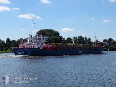
WANHEIM
General Cargo
Current Trip
NLRTM
| Time Travelled | 45 days |
|---|---|
| Remaining Time | --- |
| Distance Travelled | 117.88 nm |
| Remaining Distance | --- |
| AVG Speed | 8.8 Knots |
| MAX Speed | 11.9 Knots |
| AVG Wind | 8.4 knots |
| MAX Wind | 15.8 knots |
| MIN Temp | 6°C / 42.8°F |
| MAX Temp | 19.4°C / 66.92°F |
| Dybgang | 4.7 m |
| Position Modtaget | 3 m siden |
Current Position
| Longitude | 1.29692° |
|---|---|
| Latitude | 52.95672° |
| Status | At anchor |
| Fart | 0.1 Knots |
| Kurs | 274° |
| Område | North Sea |
| Station | T-AIS |
| Position Modtaget | 3 m siden |
Info
Information
The current position of WANHEIM is in North Sea with coordinates 52.95672° / 1.29692° as reported on 2024-07-07 21:18 by AIS to our vessel tracker app. The vessel's current speed is 0.1 Knots
The vessel WANHEIM (IMO: 8920268, MMSI: 636017466) is a General Cargo that was built in 1990 ( 34 år gamle ). It's sailing under the flag of [LR] Liberia.
In this page you can find informations about the vessels current position, last detected port calls, and current voyage information. If the vessels is not in coverage by AIS you will find the latest position.
The current position of WANHEIM is detected by our AIS receivers and we are not responsible for the reliability of the data. The last position was recorded while the vessel was in Coverage by the Ais receivers of our vessel tracking app.
The current draught of WANHEIM as reported by AIS is 4.7 meters
Weather
| Temperature | 13.9°C / 57.02°F |
|---|---|
| Wind Speed | 10 knots |
| Direction | 242° WSW |
| Pressure | 1010.4 hPa |
| Humidity | 80.9 % |
| Cloud Coverage | 4 % |
Featured Company
Events
| Tid | Hændelsen | Detaljer | Position / Dest | Info |
|---|---|---|---|---|
| 2024-07-07 18:24 | Status er ændret | At anchor Default |
52.95697 / 1.29594
NLRTM
|
Fart: Kurs: 299° |
| 2024-07-07 18:21 | Status er ændret | Default At anchor |
52.95699 / 1.29592
NLRTM
|
Fart: Kurs: 304° |
| 2024-07-07 15:18 | Status er ændret | At anchor Under way using engine |
52.95697 / 1.29324
NLRTM
|
Fart: 0.5 kn Kurs: 44° |
| 2024-07-07 15:13 | STOP Sejllads | 16.09 nm, East of WELLS-NEXT-THE-SEA |
52.95629 / 1.29432
NLRTM
|
Fart: 0.3 kn Kurs: 18° |
| 2024-07-07 13:17 | Status er ændret | Under way using engine Default |
53.10716 / .95580
NLRTM
|
Fart: 8 kn Kurs: 135° |
| 2024-07-07 13:02 | Indenfor Dækning |
53.10716 / .95580
North Sea
|
Fart: 8 kn Kurs: 134.1° |
|
| 2024-07-07 08:58 | Status er ændret | Default Under way using engine |
53.52249 / .24733
NLRTM
|
Fart: 10.5 kn Kurs: 103.9° |
| 2024-07-07 08:53 | Udenfor Dækning |
53.52595 / .22361
North Sea
|
Fart: 10.5 kn Kurs: 103.9° |
|
| 2024-07-07 08:51 | Status er ændret | Under way using engine Default |
53.52736 / .21409
NLRTM
|
Fart: 10.6 kn Kurs: 123° |
| 2024-07-07 08:38 | Status er ændret | Default Under way using engine |
53.54544 / .15828
NLRTM
|
Fart: 8.4 kn Kurs: 114.9° |