

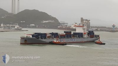
WAN HAI 287
Cargo

Current Trip
| Trip Time | 9 h, 53 mins |
|---|---|
| Trip Distance | 121.99 nm |
| AVG Speed | 12.8 Knots |
| MAX Speed | 17.3 Knots |
| Dybgang | 10.4 m |
| AVG Wind | 16.3 knots |
| MAX Wind | 23 knots |
| MIN Temp | 2.8°C / 37.04°F |
| MAX Temp | 11°C / 51.8°F |
| Position Modtaget | 19 h, 52 m siden |
Current Position
| Longitude | --- |
|---|---|
| Latitude | --- |
| Status | Moored |
| Fart | |
| Kurs | 64° |
| Område | Japan Sea |
| Station | T-AIS |
| Position Modtaget | 19 h, 52 m siden |
Information
The current position of WAN HAI 287 is in Japan Sea with coordinates 33.65575° / 130.40042° as reported on 2025-03-28 21:43 by AIS to our vessel tracker app. The vessel's current speed is 0 Knots and is currently inside the port of ONSAN.
The vessel WAN HAI 287 (IMO: 9871347, MMSI: 563132500) is a Cargo It's sailing under the flag of [SG] Singapore.
In this page you can find informations about the vessels current position, last detected port calls, and current voyage information. If the vessels is not in coverage by AIS you will find the latest position.
The current position of WAN HAI 287 is detected by our AIS receivers and we are not responsible for the reliability of the data. The last position was recorded while the vessel was in Coverage by the Ais receivers of our vessel tracking app.
The current draught of WAN HAI 287 as reported by AIS is 10.4 meters
Weather
| Temperature | 0.3°C / 32.54°F |
|---|---|
| Wind Speed | 6 knots |
| Direction | 316° NW |
| Pressure | 1026.3 hPa |
| Humidity | 34.3 % |
| Cloud Coverage | 99 % |


Featured Company
Last Port Calls
| Port | Arrival | Departure | Time In Port |
|---|---|---|---|
| 2025-03-29 21:06 | |||
| 2025-03-28 22:38 | 2025-03-29 11:13 | 12 h | |
| 2025-03-25 20:09 | 2025-03-26 06:34 | 10 h | |
| 2025-03-24 18:40 | 2025-03-25 07:02 | 12 h | |
| 2025-03-14 07:35 | 2025-03-15 06:06 | 22 h | |
| 2025-03-12 11:33 | 2025-03-13 01:02 | 13 h | |
| 2025-03-10 01:45 | 2025-03-10 15:13 | 13 h | |
| 2025-03-08 20:43 | 2025-03-09 06:43 | 10 h | |
| 2025-03-07 07:33 | 2025-03-07 15:33 | 7 h | |
| 2025-03-06 18:43 | 2025-03-07 06:20 | 11 h |
Last Trips
| Origin | Departure | Destination | Arrival | Distance | |
|---|---|---|---|---|---|
| 2025-03-29 11:13 | 2025-03-29 21:06 | 121.99 nm | |||
| 2025-03-26 06:34 | 2025-03-28 22:38 | 765.03 nm | |||
| 2025-03-25 07:02 | 2025-03-25 20:09 | 203.17 nm | |||
| 2025-03-15 06:06 | 2025-03-24 18:40 | 2472.62 nm | |||
| 2025-03-13 01:02 | 2025-03-14 07:35 | 263.43 nm | |||
| 2025-03-10 15:13 | 2025-03-12 11:33 | 719.00 nm | |||
| 2025-03-09 06:43 | 2025-03-10 01:45 | 57.29 nm | |||
| 2025-03-07 15:33 | 2025-03-08 20:43 | 453.66 nm | |||
| 2025-03-07 06:20 | 2025-03-07 07:33 | 9.14 nm | |||
| 2025-03-05 17:22 | 2025-03-06 18:43 | 380.78 nm |
Events
| Tid | Hændelsen | Detaljer | Position / Dest | Info |
|---|---|---|---|---|
| 2025-03-29 12:06 | STOP Sejllads |
35.44143 / 129.35585
[KR] ONSAN
|
Fart: Kurs: 245° |
|
| 2025-03-29 12:06 | Skibe i havn |
|
35.44143 / 129.35585
[KR] ONSAN
|
Fart: 1.7 kn Kurs: 261° |
| 2025-03-29 02:13 | Afsejlet fra sidste havn |
|
33.64775 / 130.30843
TW KEL
|
Fart: 11.2 kn Kurs: 292° |
| 2025-03-29 01:50 | START Sejllads |
33.64919 / 130.39131
[JP] HAKATA
|
Fart: 9.5 kn Kurs: 245° |
|
| 2025-03-28 21:58 | Status er ændret | Default Moored |
33.65572 / 130.40045
[JP] HAKATA
|
Fart: Kurs: 64° |
| 2025-03-28 21:43 | Udenfor Dækning |
33.65575 / 130.40042
Japan Sea
[JP] HAKATA
|
Fart: Kurs: 316.2° |
|
| 2025-03-28 21:04 | Fundet i havområde | Japanese part of the Japan Sea |
33.65579 / 130.40044
Japan Sea
|
Fart: Kurs: 176.4° |
| 2025-03-28 21:04 | Indenfor Dækning |
33.65579 / 130.40044
Japan Sea
[JP] HAKATA
|
Fart: Kurs: 176.4° |
|
| 2025-03-28 14:31 | STOP Sejllads |
33.65577 / 130.40042
[JP] HAKATA
|
Fart: Kurs: 64° |
|
| 2025-03-28 13:38 | Skibe i havn |
|
33.63918 / 130.33315
[JP] HAKATA
|
Fart: 10.7 kn Kurs: 112° |