
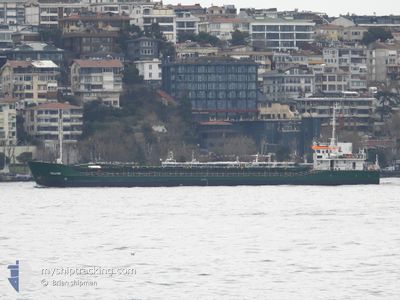
WALKER
General Cargo
Current Trip
| Trip Time | 6 days |
|---|---|
| Trip Distance | 887.68 nm |
| AVG Speed | 5.8 Knots |
| MAX Speed | 7.6 Knots |
| Dybgang | 2.9 m |
| AVG Wind | 12.6 knots |
| MAX Wind | 23 knots |
| MIN Temp | 3.3°C / 37.94°F |
| MAX Temp | 16.7°C / 62.06°F |
| Position Modtaget | 1 m siden |
Current Position
| Longitude | --- |
|---|---|
| Latitude | --- |
| Status | Moored |
| Fart | |
| Kurs | 305° |
| Område | Sea of Marmara |
| Station | T-AIS |
| Position Modtaget | 1 m siden |
Info
Information
The current position of WALKER is in Sea of Marmara with coordinates 40.41801° / 29.08841° as reported on 2026-02-24 18:19 by AIS to our vessel tracker app. The vessel's current speed is 0 Knots and is currently inside the port of GEMLIK.
The vessel WALKER (IMO: 9103972, MMSI: 341092001) is a General Cargo that was built in 1994 ( 32 år gamle ). It's sailing under the flag of [KN] St Kitts Nevis.
In this page you can find informations about the vessels current position, last detected port calls, and current voyage information. If the vessels is not in coverage by AIS you will find the latest position.
The current position of WALKER is detected by our AIS receivers and we are not responsible for the reliability of the data. The last position was recorded while the vessel was in Coverage by the Ais receivers of our vessel tracking app.
The current draught of WALKER as reported by AIS is 2.9 meters
Weather
| Temperature | 9.8°C / 49.64°F |
|---|---|
| Wind Speed | 5 knots |
| Direction | 272° W |
| Pressure | 1013 hPa |
| Humidity | 67.2 % |
| Cloud Coverage | 100 % |
Featured Company
Last Port Calls
| Port | Arrival | Departure | Time In Port |
|---|---|---|---|
| 2026-02-24 17:06 | |||
| 2026-02-12 11:31 | 2026-02-18 12:29 | 6 d | |
| 2026-01-31 07:39 | 2026-02-04 12:30 | 4 d | |
| 2026-01-19 08:34 | 2026-01-21 11:01 | 2 d | |
| 2026-01-12 14:41 | 2026-01-16 03:46 | 3 d | |
| 2025-12-24 01:23 | 2025-12-27 08:53 | 3 d | |
| 2025-12-19 07:39 | 2025-12-20 13:24 | 1 d | |
| 2025-12-15 07:35 | 2025-12-15 17:33 | 9 h | |
| 2025-12-11 22:29 | 2025-12-12 19:13 | 20 h | |
| 2025-12-04 07:32 | 2025-12-04 15:24 | 7 h |
Last Trips
| Origin | Departure | Destination | Arrival | Distance | |
|---|---|---|---|---|---|
| 2026-02-18 12:29 | 2026-02-24 17:06 | 887.68 nm | |||
| 2026-02-04 12:30 | 2026-02-12 11:31 | 839.19 nm | |||
| 2026-01-21 11:01 | 2026-01-31 07:39 | 435.34 nm | |||
| 2026-01-16 03:46 | 2026-01-19 08:34 | 408.82 nm | |||
| 2025-12-27 08:53 | 2026-01-12 14:41 | 809.96 nm | |||
| 2025-12-20 13:24 | 2025-12-24 01:23 | 493.14 nm | |||
| 2025-12-15 17:33 | 2025-12-19 07:39 | 484.89 nm | |||
| 2025-12-12 19:13 | 2025-12-15 07:35 | 132.58 nm | |||
| 2025-12-04 15:24 | 2025-12-11 22:29 | 970.04 nm | |||
| 2025-12-01 18:22 | 2025-12-04 07:32 | 296.49 nm |
Events
| Tid | Hændelsen | Detaljer | Position / Dest | Info |
|---|---|---|---|---|
| 2026-02-24 15:37 | Status er ændret | Moored Default |
40.41800 / 29.08839
[TR] GEMLIK
|
Fart: Kurs: -1° |
| 2026-02-24 15:30 | Status er ændret | Default Moored |
40.41806 / 29.08833
[TR] GEMLIK
|
Fart: Kurs: 305° |
| 2026-02-24 14:43 | Status er ændret | Moored Under way using engine |
40.41801 / 29.08841
[TR] GEMLIK
|
Fart: 0.3 kn Kurs: 302° |
| 2026-02-24 14:19 | STOP Sejllads |
40.41834 / 29.08856
[TR] GEMLIK
|
Fart: 0.3 kn Kurs: 279° |
|
| 2026-02-24 14:06 | Skibe i havn |
|
40.42259 / 29.08781
[TR] GEMLIK
|
Fart: 3.8 kn Kurs: 134° |
| 2026-02-24 12:56 | ETA er ændret | 2026/02/24 16:30 2026/02/24 20:00 |
40.43571 / 29.05005
TRGEM
|
Fart: 4.2 kn Kurs: 108° |
| 2026-02-24 12:50 | START Sejllads | --- |
40.43750 / 29.03720
TRGEM
|
Fart: 5 kn Kurs: 100.1° |
| 2026-02-24 12:46 | STOP Sejllads | --- |
40.43788 / 29.03416
TRGEM
|
Fart: 0.3 kn Kurs: 101° |
| 2026-02-24 12:06 | START Sejllads | --- |
40.43426 / 29.00422
TRGEM
|
Fart: 5.4 kn Kurs: 87.9° |
| 2026-02-24 11:58 | STOP Sejllads | --- |
40.43384 / 29.00071
TRGEM
|
Fart: 0.3 kn Kurs: 65° |