
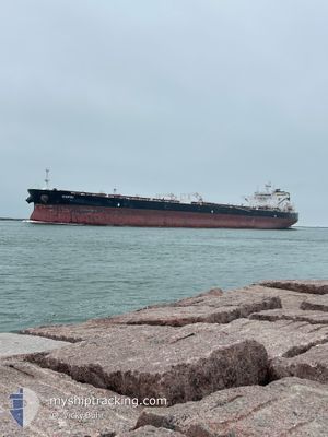
WAIKIKI
Tanker
Current Trip
| Time Travelled | 23 days |
|---|---|
| Remaining Time | 2 h, 40 mins |
| Distance Travelled | 5448.33 nm |
| Remaining Distance | 11.02 nm |
| AVG Speed | 10.7 Knots |
| MAX Speed | 16 Knots |
| AVG Wind | 16.9 knots |
| MAX Wind | 33.9 knots |
| MIN Temp | 12.9°C / 55.22°F |
| MAX Temp | 26°C / 78.8°F |
| Dybgang | 13.6 m |
| Position Modtaget | 1 m siden |
Current Position
| Longitude | --- |
|---|---|
| Latitude | --- |
| Status | Under way using engine |
| Fart | 1.1 Knots |
| Kurs | 80° |
| Område | Balearic Sea |
| Station | T-AIS |
| Position Modtaget | 1 m siden |
Info
Information
The current position of WAIKIKI is in Balearic Sea with coordinates 40.90238° / 1.21086° as reported on 2025-03-05 13:23 by AIS to our vessel tracker app. The vessel's current speed is 1.1 Knots and is heading at the port of TARRAGONA. The estimated time of arrival as calculated by MyShipTracking vessel tracking app is 2025-03-05 17:05 LT
The vessel WAIKIKI (IMO: 9776755, MMSI: 249857000) is a Tanker It's sailing under the flag of [MT] Malta.
In this page you can find informations about the vessels current position, last detected port calls, and current voyage information. If the vessels is not in coverage by AIS you will find the latest position.
The current position of WAIKIKI is detected by our AIS receivers and we are not responsible for the reliability of the data. The last position was recorded while the vessel was in Coverage by the Ais receivers of our vessel tracking app.
The current draught of WAIKIKI as reported by AIS is 13.6 meters
Weather
| Temperature | 13.5°C / 56.3°F |
|---|---|
| Wind Speed | 21 knots |
| Direction | 78° ENE |
| Pressure | 1021.1 hPa |
| Humidity | 76.5 % |
| Cloud Coverage | 18 % |
Featured Company
Last Port Calls
| Port | Arrival | Departure | Time In Port |
|---|---|---|---|
| 2025-02-09 15:20 | 2025-02-09 15:53 | 33 m | |
| 2025-01-26 14:20 | 2025-01-29 14:15 | 2 d |
Most Visited Ports (Last year)
| Port | Arrivals | |
|---|---|---|
| 2 | ||
| 1 | ||
| 1 | ||
| 1 | ||
| 1 |
Last Trips
| Origin | Departure | Destination | Arrival | Distance | |
|---|---|---|---|---|---|
| 2025-01-29 14:15 | 2025-02-09 15:20 | 233.02 nm | |||
| 2024-12-10 16:00 | 2025-01-26 14:20 | 12970.72 nm |
Events
| Tid | Hændelsen | Detaljer | Position / Dest | Info |
|---|---|---|---|---|
| 2025-03-05 12:31 | START Sejllads | 10.78 nm, South of SALOU |
40.89532 / 1.16171
ESTAR
|
Fart: 3.1 kn Kurs: 80° |
| 2025-03-04 21:24 | STOP Sejllads | 11.92 nm, South East of TORREDEMBARRA |
40.96734 / 1.54479
ESTAR
|
Fart: 0.3 kn Kurs: 86° |
| 2025-03-04 15:43 | START Sejllads | 7.38 nm, South East of TARRAGONA |
40.98578 / 1.31247
ESTAR
|
Fart: 3.1 kn Kurs: 95° |
| 2025-03-04 09:52 | Status er ændret | Under way using engine Default |
40.97492 / 1.47802
ESTAR
|
Fart: 1.3 kn Kurs: 169° |
| 2025-03-04 09:46 | Status er ændret | Default Under way using engine |
40.97459 / 1.48098
ESTAR
|
Fart: 1.3 kn Kurs: 168° |
| 2025-03-04 09:20 | Status er ændret | Under way using engine Default |
40.97348 / 1.49374
ESTAR
|
Fart: 1.3 kn Kurs: 166° |
| 2025-03-04 09:15 | Status er ændret | Default Under way using engine |
40.97338 / 1.49609
ESTAR
|
Fart: 1.3 kn Kurs: 166° |
| 2025-03-03 16:29 | STOP Sejllads | 8.45 nm, South East of TARRAGONA |
40.97190 / 1.32728
ESTAR
|
Fart: 0.3 kn Kurs: 61° |
| 2025-03-03 16:05 | START Sejllads | 8.22 nm, South East of TARRAGONA |
40.97187 / 1.31886
ESTAR
|
Fart: 3.1 kn Kurs: 37° |
| 2025-03-03 14:20 | STOP Sejllads | 7.89 nm, South East of TARRAGONA |
40.96771 / 1.29675
ESTAR
|
Fart: 0.3 kn Kurs: 54° |