

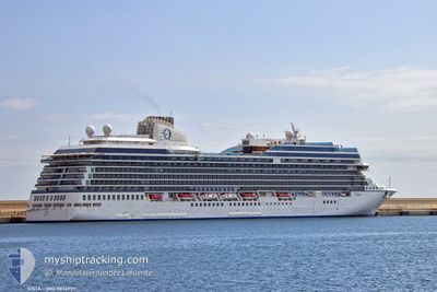
VISTA
Passenger

Current Trip
| Time Travelled | 14 h, 38 mins |
|---|---|
| Remaining Time | 1 day |
| Distance Travelled | 293.08 nm |
| Remaining Distance | 890.20 nm |
| AVG Speed | 20.5 Knots |
| MAX Speed | 21.2 Knots |
| AVG Wind | 13.5 knots |
| MAX Wind | 17 knots |
| MIN Temp | 25.4°C / 77.72°F |
| MAX Temp | 26.5°C / 79.7°F |
| Dybgang | 7.9 m |
| Position Modtaget | 9 h, 22 m siden |
Current Position
| Longitude | --- |
|---|---|
| Latitude | --- |
| Status | Under way using engine |
| Fart | 20.9 Knots |
| Kurs | 315.2° |
| Område | Caribbean Sea |
| Station | T-AIS |
| Position Modtaget | 9 h, 22 m siden |
Information
The current position of VISTA is in Caribbean Sea with coordinates 18.15863° / -63.38449° as reported on 2025-02-28 00:09 by AIS to our vessel tracker app. The vessel's current speed is 20.9 Knots and is heading at the port of MIAMI. The estimated time of arrival as calculated by MyShipTracking vessel tracking app is 2025-03-01 23:03 LT
The vessel VISTA (IMO: 9876957, MMSI: 538009952) is a Passenger It's sailing under the flag of [MH] Marshall Is.
In this page you can find informations about the vessels current position, last detected port calls, and current voyage information. If the vessels is not in coverage by AIS you will find the latest position.
The current position of VISTA is detected by our AIS receivers and we are not responsible for the reliability of the data. The last position was recorded while the vessel was in Coverage by the Ais receivers of our vessel tracking app.
The current draught of VISTA as reported by AIS is 7.9 meters
Weather
| Temperature | 25.5°C / 77.9°F |
|---|---|
| Wind Speed | 12 knots |
| Direction | 105° ESE |
| Pressure | 1014.6 hPa |
| Humidity | 76.1 % |
| Cloud Coverage | 7 % |


Featured Company
Last Port Calls
| Port | Arrival | Departure | Time In Port |
|---|---|---|---|
| 2025-02-27 06:03 | 2025-02-27 14:54 | 8 h | |
| 2025-02-26 07:04 | 2025-02-26 17:03 | 9 h | |
| 2025-02-25 06:38 | 2025-02-25 17:55 | 11 h | |
| 2025-02-24 07:15 | 2025-02-24 17:35 | 10 h | |
| 2025-02-23 09:10 | 2025-02-23 18:31 | 9 h | |
| 2025-02-19 05:11 | 2025-02-19 18:41 | 13 h | |
| 2025-02-16 06:23 | 2025-02-16 15:04 | 8 h | |
| 2025-02-15 06:15 | 2025-02-15 17:01 | 10 h | |
| 2025-02-14 07:59 | 2025-02-14 18:17 | 10 h | |
| 2025-02-14 07:10 | 2025-02-14 07:31 | 20 m |
Last Trips
| Origin | Departure | Destination | Arrival | Distance | |
|---|---|---|---|---|---|
| 2025-02-26 17:03 | 2025-02-27 06:03 | 159.50 nm | |||
| 2025-02-25 17:55 | 2025-02-26 07:04 | 174.58 nm | |||
| 2025-02-24 17:35 | 2025-02-25 06:38 | 149.74 nm | |||
| 2025-02-23 18:31 | 2025-02-24 07:15 | 144.39 nm | |||
| 2025-02-19 18:41 | 2025-02-23 09:10 | 1368.62 nm | |||
| 2025-02-16 15:04 | 2025-02-19 05:11 | 1170.18 nm | |||
| 2025-02-15 17:01 | 2025-02-16 06:23 | 212.74 nm | |||
| 2025-02-14 18:17 | 2025-02-15 06:15 | 148.33 nm | |||
| 2025-02-14 07:31 | 2025-02-14 07:59 | 3.54 nm | |||
| 2025-02-13 19:06 | 2025-02-14 07:10 | 141.71 nm |
Events
| Tid | Hændelsen | Detaljer | Position / Dest | Info |
|---|---|---|---|---|
| 2025-02-28 00:14 | Status er ændret | Default Under way using engine |
18.18129 / -63.40808
AGSJO>USMIA
|
Fart: 20.9 kn Kurs: 315.2° |
| 2025-02-28 00:09 | Udenfor Dækning |
18.15863 / -63.38449
Caribbean Sea
AGSJO>USMIA
|
Fart: 20.9 kn Kurs: 315.2° |
|
| 2025-02-27 23:50 | Ændre havområde | Anguilla part of the Caribbean Sea Saint-Martin part of the Caribbean Sea |
18.07884 / -63.30154
Caribbean Sea
AGSJO>USMIA
|
Fart: 21 kn Kurs: 315.5° |
| 2025-02-27 23:28 | Ændre havområde | Saint-Martin part of the Caribbean Sea Sint-Maarten part of the Caribbean Sea |
17.99113 / -63.20532
Caribbean Sea
AGSJO>USMIA
|
Fart: 20.9 kn Kurs: 313.4° |
| 2025-02-27 23:02 | Ændre havområde | Sint-Maarten part of the Caribbean Sea Saint-Martin part of the Caribbean Sea |
17.89602 / -63.07690
Caribbean Sea
AGSJO>USMIA
|
Fart: 21.1 kn Kurs: 307.2° |
| 2025-02-27 22:29 | Destination er ændret | AGSJO>USMIA BBBGI>DMRSU |
17.78307 / -62.90761
AGSJO>USMIA
|
Fart: 20.9 kn Kurs: 304.5° |
| 2025-02-27 22:29 | ETA er ændret | 2025/03/02 09:30 2025/02/26 11:00 |
17.78307 / -62.90761
AGSJO>USMIA
|
Fart: 20.9 kn Kurs: 304.5° |
| 2025-02-27 21:46 | Ændre havområde | Saint-Martin part of the Caribbean Sea Saint Kitts and Nevis part of the Caribbean Sea |
17.64946 / -62.69896
Caribbean Sea
|
Fart: 20.9 kn Kurs: 303.9° |
| 2025-02-27 20:08 | Ændre havområde | Saint Kitts and Nevis part of the Caribbean Sea Antigua and Barbuda part of the Caribbean Sea |
17.32802 / -62.21490
Caribbean Sea
|
Fart: 20.7 kn Kurs: 304° |
| 2025-02-27 18:54 | Afsejlet fra sidste havn |
|
17.12793 / -61.86870
BBBGI>DMRSU
|
Fart: 10.6 kn Kurs: 292° |