
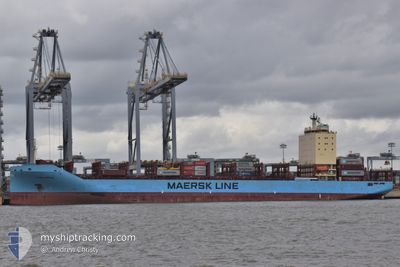
VILNIA MAERSK
Cargo A
Current Trip
GBFLX > FNKTK
| Time Travelled | 2 days |
|---|---|
| Remaining Time | --- |
| Distance Travelled | 933.66 nm |
| Remaining Distance | --- |
| AVG Speed | 17.1 Knots |
| MAX Speed | 21.5 Knots |
| AVG Wind | 13.2 knots |
| MAX Wind | 22.6 knots |
| MIN Temp | 7.8°C / 46.04°F |
| MAX Temp | 12°C / 53.6°F |
| Dybgang | 8.7 m |
| Position Modtaget | 1 m siden |
Current Position
| Longitude | 15.79092° |
|---|---|
| Latitude | 55.74135° |
| Status | Under way using engine |
| Fart | 19.8 Knots |
| Kurs | 61° |
| Område | Baltic Sea |
| Station | T-AIS |
| Position Modtaget | 1 m siden |
Info
Information
The current position of VILNIA MAERSK is in Baltic Sea with coordinates 55.74135° / 15.79092° as reported on 2024-04-29 13:20 by AIS to our vessel tracker app. The vessel's current speed is 19.8 Knots
The vessel VILNIA MAERSK (IMO: 9778533, MMSI: 219136000) is a Cargo A It's sailing under the flag of [DK] Denmark.
In this page you can find informations about the vessels current position, last detected port calls, and current voyage information. If the vessels is not in coverage by AIS you will find the latest position.
The current position of VILNIA MAERSK is detected by our AIS receivers and we are not responsible for the reliability of the data. The last position was recorded while the vessel was in Coverage by the Ais receivers of our vessel tracking app.
The current draught of VILNIA MAERSK as reported by AIS is 8.7 meters
Weather
| Temperature | 7.8°C / 46.04°F |
|---|---|
| Wind Speed | 9 knots |
| Direction | 231° SW |
| Pressure | 1024.7 hPa |
| Humidity | 83.8 % |
| Cloud Coverage | 100 % |
Featured Company
Last Port Calls
| Port | Arrival | Departure | Time In Port |
|---|---|---|---|
| 2024-04-25 06:31 | 2024-04-27 11:27 | 2 d | |
| 2024-04-22 19:45 | 2024-04-23 10:39 | 14 h | |
| 2024-04-20 20:49 | 2024-04-22 07:13 | 1 d | |
| 2024-04-17 13:28 | 2024-04-18 10:37 | 21 h | |
| 2024-04-15 10:04 | 2024-04-17 04:24 | 1 d | |
| 2024-04-11 19:39 | 2024-04-12 04:13 | 8 h | |
| 2024-04-09 02:09 | 2024-04-10 19:24 | 1 d | |
| 2024-04-04 06:52 | 2024-04-05 20:31 | 1 d | |
| 2024-04-02 02:04 | 2024-04-02 17:52 | 15 h | |
| 2024-03-27 09:26 | 2024-03-30 06:59 | 2 d |
Most Visited Ports (Last year)
| Port | Arrivals | |
|---|---|---|
| 19 | ||
| 17 | ||
| 12 | ||
| 12 | ||
| 9 | ||
| 4 |
Last Trips
| Origin | Departure | Destination | Arrival | Distance | |
|---|---|---|---|---|---|
| 2024-04-23 12:39 | 2024-04-25 07:31 | 431.39 nm | |||
| 2024-04-22 09:13 | 2024-04-22 21:45 | 125.58 nm | |||
| 2024-04-18 12:37 | 2024-04-20 22:49 | 905.61 nm | |||
| 2024-04-17 07:24 | 2024-04-17 15:28 | 157.11 nm | |||
| 2024-04-12 06:13 | 2024-04-15 13:04 | 1099.73 nm | |||
| 2024-04-10 21:24 | 2024-04-11 21:39 | 119.09 nm | |||
| 2024-04-05 22:31 | 2024-04-09 04:09 | 392.85 nm | |||
| 2024-04-02 19:52 | 2024-04-04 08:52 | 372.84 nm | |||
| 2024-03-30 06:59 | 2024-04-02 04:04 | 357.44 nm | |||
| 2024-03-25 10:56 | 2024-03-27 09:26 | 363.96 nm |
Events
| Tid | Hændelsen | Detaljer | Position / Dest | Info |
|---|---|---|---|---|
| 2024-04-29 12:32 | Ændre havområde | Swedish part of the Baltic Sea Danish part of the Kattegat |
55.61615 / 15.38142
Baltic Sea
GBFLX > FNKTK
|
Fart: 19.8 kn Kurs: 63.2° |
| 2024-04-29 09:29 | Ændre havområde | Danish part of the Kattegat Swedish part of the Baltic Sea |
55.00560 / 14.05343
Kattegat
GBFLX > FNKTK
|
Fart: 19.9 kn Kurs: 69.6° |
| 2024-04-29 09:17 | Ændre havområde | Swedish part of the Baltic Sea German part of the Baltic Sea |
54.98382 / 13.94447
Baltic Sea
GBFLX > FNKTK
|
Fart: 19.8 kn Kurs: 71.7° |
| 2024-04-29 06:08 | Ændre havområde | German part of the Baltic Sea Danish part of the Baltic Sea |
54.59937 / 12.34550
Baltic Sea
GBFLX > FNKTK
|
Fart: 18.6 kn Kurs: 56.6° |
| 2024-04-29 05:59 | Ændre havområde | Danish part of the Baltic Sea German part of the Baltic Sea |
54.56573 / 12.29228
Baltic Sea
GBFLX > FNKTK
|
Fart: 19 kn Kurs: 18.9° |
| 2024-04-29 05:20 | Ændre havområde | German part of the Baltic Sea Danish part of the Baltic Sea |
54.40512 / 12.10360
Baltic Sea
GBFLX > FNKTK
|
Fart: 19.1 kn Kurs: 85.9° |
| 2024-04-29 04:05 | Ændre havområde | Danish part of the Baltic Sea German part of the Baltic Sea |
54.49340 / 11.45605
Baltic Sea
GBFLX > FNKTK
|
Fart: 19.3 kn Kurs: 115.7° |
| 2024-04-29 03:08 | Ændre havområde | German part of the Baltic Sea Danish part of the Baltic Sea |
54.63615 / 11.03037
Baltic Sea
GBFLX > FNKTK
|
Fart: 17.1 kn Kurs: 121° |
| 2024-04-29 02:35 | Ændre havområde | Danish part of the Baltic Sea Danish part of the Kattegat |
54.73187 / 10.85080
Baltic Sea
GBFLX > FNKTK
|
Fart: 15 kn Kurs: 181.8° |
| 2024-04-28 14:16 | Ændre havområde | Danish part of the Kattegat Danish part of the Skaggerak |
57.77837 / 10.87555
Kattegat
GBFLX > FNKTK
|
Fart: 18.6 kn Kurs: 137° |