

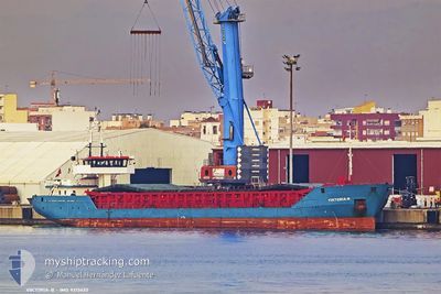
VIKTORIA B
General Cargo

Current Trip
| Time Travelled | 16 h, 59 mins |
|---|---|
| Remaining Time | 22 h, 51 mins |
| Distance Travelled | 150.95 nm |
| Remaining Distance | 205.96 nm |
| AVG Speed | 8.8 Knots |
| MAX Speed | 9.2 Knots |
| AVG Wind | 9.7 knots |
| MAX Wind | 14.2 knots |
| MIN Temp | 5.2°C / 41.36°F |
| MAX Temp | 9.4°C / 48.92°F |
| Dybgang | 4.5 m |
| Position Modtaget | 1 m siden |
Current Position
| Longitude | --- |
|---|---|
| Latitude | --- |
| Status | Under way using engine |
| Fart | 8.8 Knots |
| Kurs | 261.1° |
| Område | Baltic Sea |
| Station | T-AIS |
| Position Modtaget | 1 m siden |
Information
The current position of VIKTORIA B is in Baltic Sea with coordinates 54.72615° / 15.50594° as reported on 2025-03-29 04:53 by AIS to our vessel tracker app. The vessel's current speed is 8.8 Knots and is heading at the port of KIEL. The estimated time of arrival as calculated by MyShipTracking vessel tracking app is 2025-03-30 05:46 LT
The vessel VIKTORIA B (IMO: 9313632, MMSI: 304738000) is a General Cargo that was built in 2005 ( 20 år gamle ). It's sailing under the flag of [AG] Antigua Barbuda.
In this page you can find informations about the vessels current position, last detected port calls, and current voyage information. If the vessels is not in coverage by AIS you will find the latest position.
The current position of VIKTORIA B is detected by our AIS receivers and we are not responsible for the reliability of the data. The last position was recorded while the vessel was in Coverage by the Ais receivers of our vessel tracking app.
The current draught of VIKTORIA B as reported by AIS is 4.5 meters
Weather
| Temperature | 5.3°C / 41.54°F |
|---|---|
| Wind Speed | 8 knots |
| Direction | 158° SSE |
| Pressure | 1011 hPa |
| Humidity | 84.6 % |
| Cloud Coverage | 34 % |


Featured Company
Last Port Calls
| Port | Arrival | Departure | Time In Port |
|---|---|---|---|
| 2025-03-26 11:14 | 2025-03-28 12:56 | 2 d | |
| 2025-03-01 03:05 | |||
| 2025-02-10 00:37 | 2025-02-10 15:48 | 15 h | |
| 2025-02-07 21:20 | |||
| 2025-02-07 20:45 | |||
| 2025-02-07 20:45 | |||
| 2025-02-07 20:09 | |||
| 2025-02-06 18:02 | 2025-02-06 18:40 | 37 m | |
| 2025-02-06 17:05 | 2025-02-06 17:39 | 34 m | |
| 2025-02-05 07:41 |
Most Visited Ports (Last year)
| Port | Arrivals | |
|---|---|---|
| 15 | ||
| 3 | ||
| 3 | ||
| 2 | ||
| 2 | ||
| 2 |
Last Trips
| Origin | Departure | Destination | Arrival | Distance | |
|---|---|---|---|---|---|
| 2025-02-10 15:48 | 2025-03-26 11:14 | 3013.74 nm | |||
| 2025-02-10 15:48 | 2025-03-01 03:05 | 2766.27 nm | |||
| 2025-02-07 21:20 | 2025-02-10 00:37 | 253.07 nm | |||
| 2025-02-06 18:40 | 2025-02-07 20:45 | 47.36 nm | |||
| 2025-02-06 18:40 | 2025-02-07 20:09 | 45.68 nm | |||
| 2025-02-06 17:39 | 2025-02-06 18:02 | 0.17 nm | |||
| 2025-02-05 07:41 | 2025-02-06 17:05 | 276.48 nm | |||
| 2025-01-29 09:48 | 2025-02-01 10:25 | 45.63 nm | |||
| 2025-01-15 19:21 | 2025-01-29 08:49 | 1936.22 nm | |||
| 2025-01-15 19:21 | 2025-01-27 13:55 | 1930.61 nm |
Events
| Tid | Hændelsen | Detaljer | Position / Dest | Info |
|---|---|---|---|---|
| 2025-03-29 02:26 | Status er ændret | Under way using engine Default |
54.77797 / 16.12205
KIEL CANAL
|
Fart: 8.9 kn Kurs: 262° |
| 2025-03-29 02:26 | Indenfor Dækning |
54.77708 / 16.11371
Baltic Sea
KIEL CANAL
|
Fart: 8.8 kn Kurs: 259.3° |
|
| 2025-03-29 00:17 | Status er ændret | Default Under way using engine |
54.82953 / 16.67555
KIEL CANAL
|
Fart: 8.9 kn Kurs: 260.1° |
| 2025-03-29 00:05 | Status er ændret | Under way using engine Default |
54.83443 / 16.72587
KIEL CANAL
|
Fart: 8.9 kn Kurs: 256° |
| 2025-03-29 00:05 | Indenfor Dækning |
54.83443 / 16.72587
Baltic Sea
KIEL CANAL
|
Fart: 8.9 kn Kurs: 260.1° |
|
| 2025-03-29 00:05 | Udenfor Dækning |
54.83443 / 16.72587
Baltic Sea
KIEL CANAL
|
Fart: 8.9 kn Kurs: 260.1° |
|
| 2025-03-28 22:14 | Status er ændret | Default Under way using engine |
54.90281 / 17.19367
KIEL CANAL
|
Fart: 9.1 kn Kurs: 266.8° |
| 2025-03-28 21:59 | Udenfor Dækning |
54.90747 / 17.25765
Baltic Sea
KIEL CANAL
|
Fart: 9.1 kn Kurs: 266.8° |
|
| 2025-03-28 21:59 | Status er ændret | Under way using engine Default |
54.90749 / 17.25830
KIEL CANAL
|
Fart: 8.9 kn Kurs: 266° |
| 2025-03-28 21:59 | Indenfor Dækning |
54.90747 / 17.25765
Baltic Sea
KIEL CANAL
|
Fart: 9.1 kn Kurs: 266.8° |