

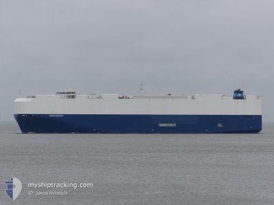
VIKING DESTINY
Cargo

Current Trip
| Time Travelled | 2 days |
|---|---|
| Remaining Time | 1 day |
| Distance Travelled | 1001.25 nm |
| Remaining Distance | 493.96 nm |
| AVG Speed | 16.5 Knots |
| MAX Speed | 19.6 Knots |
| AVG Wind | 10.6 knots |
| MAX Wind | 23.9 knots |
| MIN Temp | 4.5°C / 40.1°F |
| MAX Temp | 16.6°C / 61.88°F |
| Dybgang | 8.8 m |
| Position Modtaget | 1 m siden |
Current Position
| Longitude | --- |
|---|---|
| Latitude | --- |
| Status | Under way using engine |
| Fart | 12.9 Knots |
| Kurs | 293.9° |
| Område | Mediterranean Sea - Western Basin |
| Station | T-AIS |
| Position Modtaget | 1 m siden |
Information
The current position of VIKING DESTINY is in Mediterranean Sea - Western Basin with coordinates 37.80333° / 11.55253° as reported on 2025-03-09 10:23 by AIS to our vessel tracker app. The vessel's current speed is 12.9 Knots and is heading at the port of BARCELONA. The estimated time of arrival as calculated by MyShipTracking vessel tracking app is 2025-03-10 15:21 LT
The vessel VIKING DESTINY (IMO: 9728863, MMSI: 538007385) is a Cargo It's sailing under the flag of [MH] Marshall Is.
In this page you can find informations about the vessels current position, last detected port calls, and current voyage information. If the vessels is not in coverage by AIS you will find the latest position.
The current position of VIKING DESTINY is detected by our AIS receivers and we are not responsible for the reliability of the data. The last position was recorded while the vessel was in Coverage by the Ais receivers of our vessel tracking app.
The current draught of VIKING DESTINY as reported by AIS is 8.8 meters
Weather
| Temperature | 15.9°C / 60.62°F |
|---|---|
| Wind Speed | 22 knots |
| Direction | 152° SSE |
| Pressure | 1011.6 hPa |
| Humidity | 88 % |
| Cloud Coverage | 78 % |


Featured Company
Last Port Calls
| Port | Arrival | Departure | Time In Port |
|---|---|---|---|
| 2025-03-06 03:21 | 2025-03-06 18:29 | 15 h | |
| 2025-03-04 18:27 | 2025-03-05 20:54 | 1 d | |
| 2025-03-03 18:23 | 2025-03-04 17:22 | 22 h | |
| 2025-02-20 23:15 | 2025-02-22 23:04 | 1 d | |
| 2025-02-18 18:30 | 2025-02-19 23:37 | 1 d | |
| 2025-02-16 13:18 | 2025-02-17 15:38 | 1 d | |
| 2025-02-14 01:38 | 2025-02-15 17:12 | 1 d | |
| 2025-02-11 23:44 | 2025-02-13 15:19 | 1 d | |
| 2025-02-11 06:03 | 2025-02-11 16:56 | 10 h | |
| 2025-02-08 20:02 | 2025-02-09 13:36 | 17 h |
Most Visited Ports (Last year)
| Port | Arrivals | |
|---|---|---|
| 14 | ||
| 14 | ||
| 10 | ||
| 7 | ||
| 7 | ||
| 6 |
Last Trips
| Origin | Departure | Destination | Arrival | Distance | |
|---|---|---|---|---|---|
| 2025-03-05 23:54 | 2025-03-06 06:21 | 71.46 nm | |||
| 2025-03-04 20:22 | 2025-03-04 21:27 | 4.12 nm | |||
| 2025-02-23 00:04 | 2025-03-03 21:23 | 3157.47 nm | |||
| 2025-02-20 00:37 | 2025-02-21 00:15 | 284.15 nm | |||
| 2025-02-17 16:38 | 2025-02-18 19:30 | 351.27 nm | |||
| 2025-02-15 18:12 | 2025-02-16 14:18 | 312.84 nm | |||
| 2025-02-13 15:19 | 2025-02-14 02:38 | 141.52 nm | |||
| 2025-02-11 17:56 | 2025-02-11 23:44 | 80.68 nm | |||
| 2025-02-09 14:36 | 2025-02-11 07:03 | 658.90 nm | |||
| 2025-02-01 22:38 | 2025-02-08 21:02 | 2731.40 nm |
Events
| Tid | Hændelsen | Detaljer | Position / Dest | Info |
|---|---|---|---|---|
| 2025-03-09 08:38 | Ændre havområde | Italian part of the Mediterranean Sea - Western Basin Italian part of the Mediterranean Sea - Eastern Basin |
37.61917 / 12.05899
Mediterranean Sea - Western Basin
ESBCN
|
Fart: 15.7 kn Kurs: 295.2° |
| 2025-03-09 06:58 | Status er ændret | Under way using engine Default |
37.46811 / 12.47621
ESBCN
|
Fart: 13.1 kn Kurs: 294° |
| 2025-03-09 06:53 | Status er ændret | Default Under way using engine |
37.46182 / 12.49362
ESBCN
|
Fart: 13.2 kn Kurs: 294.4° |
| 2025-03-09 06:34 | Status er ændret | Under way using engine Default |
37.43152 / 12.57650
ESBCN
|
Fart: 13.4 kn Kurs: 297° |
| 2025-03-09 06:34 | Indenfor Dækning |
37.43226 / 12.57447
Mediterranean Sea - Eastern Basin
ESBCN
|
Fart: 13.2 kn Kurs: 294.5° |
|
| 2025-03-09 01:42 | Status er ændret | Default Under way using engine |
36.92301 / 13.76694
ESBCN
|
Fart: 13.3 kn Kurs: 297.9° |
| 2025-03-09 01:36 | Udenfor Dækning |
36.91258 / 13.79152
Mediterranean Sea - Eastern Basin
ESBCN
|
Fart: 13.3 kn Kurs: 297.9° |
|
| 2025-03-08 22:01 | Status er ændret | Under way using engine Default |
36.61345 / 14.69385
ESBCN
|
Fart: 13.1 kn Kurs: 286° |
| 2025-03-08 21:53 | Indenfor Dækning |
36.61345 / 14.69385
Mediterranean Sea - Eastern Basin
ESBCN
|
Fart: 13 kn Kurs: 288.5° |
|
| 2025-03-08 20:43 | Udenfor Dækning |
36.54803 / 15.03286
Mediterranean Sea - Eastern Basin
ESBCN
|
Fart: 12.9 kn Kurs: 279.6° |