
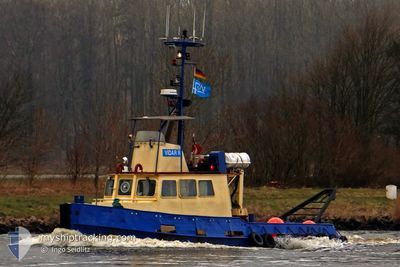
VIDAR-R
Tug
Current Trip
| Time Travelled | 15 h, 50 mins |
|---|---|
| Remaining Time | 3 h, 36 mins |
| Distance Travelled | 124.18 nm |
| Remaining Distance | 31.36 nm |
| AVG Speed | 7.6 Knots |
| MAX Speed | 9 Knots |
| AVG Wind | 8.2 knots |
| MAX Wind | 13 knots |
| MIN Temp | 8.2°C / 46.76°F |
| MAX Temp | 10.9°C / 51.62°F |
| Dybgang | 2.5 m |
| Position Modtaget | Nu |
Current Position
| Longitude | 12.58875° |
|---|---|
| Latitude | 55.08137° |
| Status | Under way using engine |
| Fart | 8 Knots |
| Kurs | 185.3° |
| Område | Baltic Sea |
| Station | T-AIS |
| Position Modtaget | Nu |
Info
Information
The current position of VIDAR-R is in Baltic Sea with coordinates 55.08137° / 12.58875° as reported on 2024-04-30 03:58 by AIS to our vessel tracker app. The vessel's current speed is 8 Knots and is heading at the port of STUBBEKOBING. The estimated time of arrival as calculated by MyShipTracking vessel tracking app is 2024-04-30 07:35 LT
The vessel VIDAR-R (MMSI: 219003406) is a Tug It's sailing under the flag of [DK] Denmark.
In this page you can find informations about the vessels current position, last detected port calls, and current voyage information. If the vessels is not in coverage by AIS you will find the latest position.
The current position of VIDAR-R is detected by our AIS receivers and we are not responsible for the reliability of the data. The last position was recorded while the vessel was in Coverage by the Ais receivers of our vessel tracking app.
The current draught of VIDAR-R as reported by AIS is 2.5 meters
Weather
| Temperature | 8.6°C / 47.48°F |
|---|---|
| Wind Speed | 13 knots |
| Direction | 98° E |
| Pressure | 1024.1 hPa |
| Humidity | 79.8 % |
| Cloud Coverage | 100 % |
Featured Company
Last Port Calls
| Port | Arrival | Departure | Time In Port |
|---|---|---|---|
| 2024-04-27 12:11 | 2024-04-29 12:09 | 1 d | |
| 2024-04-23 00:46 | 2024-04-23 09:52 | 9 h | |
| 2024-04-20 05:42 | 2024-04-20 07:23 | 1 h | |
| 2024-04-18 18:25 | 2024-04-18 18:50 | 25 m | |
| 2024-04-17 17:56 | 2024-04-17 18:15 | 18 m | |
| 2024-04-16 21:48 | 2024-04-17 12:12 | 14 h | |
| 2024-04-15 12:57 | 2024-04-16 02:56 | 13 h | |
| 2024-04-15 06:43 | 2024-04-15 12:51 | 6 h | |
| 2024-04-13 18:37 | 2024-04-15 06:31 | 1 d | |
| 2024-04-08 09:09 | 2024-04-13 04:41 | 4 d |
Most Visited Ports (Last year)
| Port | Arrivals | |
|---|---|---|
| 51 | ||
| 27 | ||
| 11 | ||
| 5 | ||
| 5 | ||
| 4 |
Last Trips
| Origin | Departure | Destination | Arrival | Distance | |
|---|---|---|---|---|---|
| 2024-04-23 11:52 | 2024-04-27 14:11 | 549.10 nm | |||
| 2024-04-20 09:23 | 2024-04-23 02:46 | 247.01 nm | |||
| 2024-04-18 20:50 | 2024-04-20 07:42 | 186.44 nm | |||
| 2024-04-17 20:15 | 2024-04-18 20:25 | 130.12 nm | |||
| 2024-04-17 14:12 | 2024-04-17 19:56 | 48.15 nm | |||
| 2024-04-16 04:56 | 2024-04-16 23:48 | 45.68 nm | |||
| 2024-04-15 14:51 | 2024-04-15 14:57 | 0.67 nm | |||
| 2024-04-15 08:31 | 2024-04-15 08:43 | 1.39 nm | |||
| 2024-04-13 06:41 | 2024-04-13 20:37 | 118.89 nm | |||
| 2024-04-08 07:04 | 2024-04-08 11:09 | 10.55 nm |
Events
| Tid | Hændelsen | Detaljer | Position / Dest | Info |
|---|---|---|---|---|
| 2024-04-30 02:11 | Ændre havområde | Danish part of the Baltic Sea Danish part of the Kattegat |
55.31730 / 12.61651
Baltic Sea
STUBBEKOBING
|
Fart: 7.8 kn Kurs: 171.9° |
| 2024-04-30 01:44 | Ændre havområde | Danish part of the Kattegat Swedish part of the Kattegat |
55.37518 / 12.62773
Kattegat
STUBBEKOBING
|
Fart: 7.7 kn Kurs: 191.5° |
| 2024-04-30 01:05 | Ændre havområde | Swedish part of the Kattegat Danish part of the Kattegat |
55.45704 / 12.65797
Kattegat
STUBBEKOBING
|
Fart: 7.7 kn Kurs: 196.5° |
| 2024-04-29 18:14 | Destination er ændret | STUBBEKOBING GEDSER BEACH |
56.17913 / 12.29260
STUBBEKOBING
|
Fart: 8.2 kn Kurs: 113.3° |
| 2024-04-29 17:15 | Status er ændret | Under way using engine Default |
56.19045 / 12.20127
GEDSER BEACH
|
Fart: 8.7 kn Kurs: 102° |
| 2024-04-29 16:28 | Status er ændret | Default Under way using engine |
56.21679 / 11.99944
GEDSER BEACH
|
Fart: 8.8 kn Kurs: 104.8° |
| 2024-04-29 14:29 | ETA er ændret | 2024/04/30 22:00 2024/04/30 15:00 |
56.30792 / 11.50591
GEDSER BEACH
|
Fart: 8.9 kn Kurs: 111.8° |
| 2024-04-29 14:22 | ETA er ændret | 2024/04/30 15:00 2024/04/27 15:00 |
56.31329 / 11.48017
GEDSER BEACH
|
Fart: 8.8 kn Kurs: 111.1° |
| 2024-04-29 12:09 | Afsejlet fra sidste havn |
|
56.41835 / 10.94081
GEDSER BEACH
|
Fart: 8.9 kn Kurs: 61.3° |
| 2024-04-29 12:06 | Destination er ændret | GEDSER BEACH GRENAA |
56.41524 / 10.92764
[DK] GRENAA
|
Fart: 6 kn Kurs: 87° |