
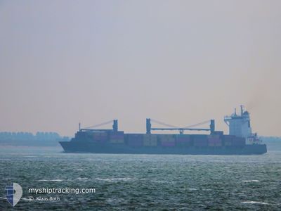
VALDIVIA
Container Ship
Current Trip
| Time Travelled | 2 days |
|---|---|
| Remaining Time | 1 day |
| Distance Travelled | 843.68 nm |
| Remaining Distance | 350.05 nm |
| AVG Speed | 14.2 Knots |
| MAX Speed | 19 Knots |
| AVG Wind | 9.2 knots |
| MAX Wind | 17 knots |
| MIN Temp | 10.1°C / 50.18°F |
| MAX Temp | 21.2°C / 70.16°F |
| Dybgang | 9.8 m |
| Position Modtaget | 1 m siden |
Current Position
| Longitude | 12.71729° |
|---|---|
| Latitude | 54.74706° |
| Status | Under way using engine |
| Fart | 14.8 Knots |
| Kurs | 58.4° |
| Område | Baltic Sea |
| Station | T-AIS |
| Position Modtaget | 1 m siden |
Info
Information
The current position of VALDIVIA is in Baltic Sea with coordinates 54.74706° / 12.71729° as reported on 2024-05-04 23:06 by AIS to our vessel tracker app. The vessel's current speed is 14.8 Knots and is heading at the port of NORRKOPING. The estimated time of arrival as calculated by MyShipTracking vessel tracking app is 2024-05-05 23:07 LT
The vessel VALDIVIA (IMO: 9333395, MMSI: 255806256) is a Container Ship that was built in 2006 ( 18 år gamle ). It's sailing under the flag of [PT] Portugal.
In this page you can find informations about the vessels current position, last detected port calls, and current voyage information. If the vessels is not in coverage by AIS you will find the latest position.
The current position of VALDIVIA is detected by our AIS receivers and we are not responsible for the reliability of the data. The last position was recorded while the vessel was in Coverage by the Ais receivers of our vessel tracking app.
The current draught of VALDIVIA as reported by AIS is 9.8 meters
Weather
| Temperature | 10°C / 50°F |
|---|---|
| Wind Speed | 3 knots |
| Direction | 89° E |
| Pressure | 1012.7 hPa |
| Humidity | 87.1 % |
| Cloud Coverage | 35 % |
Featured Company
Last Port Calls
| Port | Arrival | Departure | Time In Port |
|---|---|---|---|
| 2024-05-01 13:53 | 2024-05-02 12:48 | 22 h | |
| 2024-04-29 04:04 | 2024-04-30 03:55 | 23 h | |
| 2024-04-24 08:48 | 2024-04-25 17:06 | 1 d | |
| 2024-04-22 04:34 | 2024-04-22 14:28 | 9 h | |
| 2024-04-20 07:24 | 2024-04-20 15:25 | 8 h | |
| 2024-04-16 14:30 | 2024-04-17 11:59 | 21 h | |
| 2024-04-14 11:49 | 2024-04-14 21:18 | 9 h | |
| 2024-04-10 08:52 | 2024-04-11 09:19 | 1 d | |
| 2024-04-08 03:28 | 2024-04-08 21:56 | 18 h | |
| 2024-04-03 02:53 | 2024-04-04 00:54 | 22 h |
Most Visited Ports (Last year)
| Port | Arrivals | |
|---|---|---|
| 39 | ||
| 32 | ||
| 31 | ||
| 9 | ||
| 9 | ||
| 7 |
Last Trips
| Origin | Departure | Destination | Arrival | Distance | |
|---|---|---|---|---|---|
| 2024-04-30 05:55 | 2024-05-01 15:53 | 378.01 nm | |||
| 2024-04-25 19:06 | 2024-04-29 06:04 | 1166.07 nm | |||
| 2024-04-22 16:28 | 2024-04-24 10:48 | 309.99 nm | |||
| 2024-04-20 18:25 | 2024-04-22 06:34 | 275.30 nm | |||
| 2024-04-17 13:59 | 2024-04-20 10:24 | 1150.61 nm | |||
| 2024-04-14 23:18 | 2024-04-16 16:30 | 418.31 nm | |||
| 2024-04-11 11:19 | 2024-04-14 13:49 | 1166.11 nm | |||
| 2024-04-08 23:56 | 2024-04-10 10:52 | 298.00 nm | |||
| 2024-04-04 02:54 | 2024-04-08 05:28 | 1210.88 nm | |||
| 2024-04-02 05:23 | 2024-04-03 04:53 | 378.33 nm |
Events
| Tid | Hændelsen | Detaljer | Position / Dest | Info |
|---|---|---|---|---|
| 2024-05-04 22:04 | Ændre havområde | German part of the Baltic Sea Danish part of the Baltic Sea |
54.60669 / 12.35110
Baltic Sea
SENRK
|
Fart: 14.6 kn Kurs: 53° |
| 2024-05-04 21:46 | Ændre havområde | Danish part of the Baltic Sea German part of the Baltic Sea |
54.55079 / 12.27821
Baltic Sea
SENRK
|
Fart: 14.6 kn Kurs: 15.9° |
| 2024-05-04 21:01 | Ændre havområde | German part of the Baltic Sea Danish part of the Baltic Sea |
54.41087 / 12.11470
Baltic Sea
SENRK
|
Fart: 14.7 kn Kurs: 90.1° |
| 2024-05-04 19:16 | Fundet i havområde | Danish part of the Baltic Sea |
54.51056 / 11.42773
Baltic Sea
SENRK
|
Fart: 14.8 kn Kurs: 116° |
| 2024-05-04 17:52 | Ændre havområde | German part of the Baltic Sea Danish part of the Baltic Sea |
54.62908 / 10.89815
Baltic Sea
SENRK
|
Fart: 14.7 kn Kurs: 121.4° |
| 2024-05-04 17:20 | Ændre havområde | Danish part of the Baltic Sea Danish part of the Kattegat |
54.71675 / 10.76933
Baltic Sea
SENRK
|
Fart: 14.3 kn Kurs: 185.5° |
| 2024-05-04 04:56 | Ændre havområde | Danish part of the Kattegat Swedish part of the Kattegat |
57.22140 / 11.58049
Kattegat
SENRK
|
Fart: 14 kn Kurs: 159.9° |
| 2024-05-04 03:50 | Ændre havområde | Swedish part of the Kattegat Danish part of the Kattegat |
57.45752 / 11.39388
Kattegat
SENRK
|
Fart: 14.1 kn Kurs: 140.5° |
| 2024-05-04 02:02 | Ændre havområde | Danish part of the Kattegat Danish part of the Skaggerak |
57.78009 / 10.87288
Kattegat
SENRK
|
Fart: 13.9 kn Kurs: 136.6° |
| 2024-05-03 19:41 | Ændre havområde | Danish part of the Skaggerak Danish part of the North Sea |
57.26955 / 8.35925
Skaggerak
SENRK
|
Fart: 13.9 kn Kurs: 41.6° |