
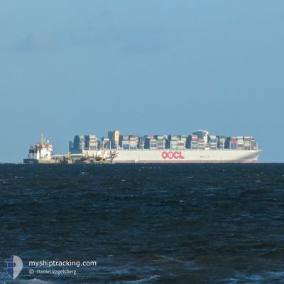
VAGA MAERSK
Cargo A
Current Trip
| Time Travelled | 7 days |
|---|---|
| Remaining Time | 5 days |
| Distance Travelled | 1369.75 nm |
| Remaining Distance | 2361.93 nm |
| AVG Speed | 12.8 Knots |
| MAX Speed | 16.5 Knots |
| AVG Wind | 12.7 knots |
| MAX Wind | 27.8 knots |
| MIN Temp | 16.1°C / 60.98°F |
| MAX Temp | 22.6°C / 72.68°F |
| Dybgang | 10.2 m |
| Position Modtaget | 1 d siden |
Current Position
| Longitude | --- |
|---|---|
| Latitude | --- |
| Status | Under way using engine |
| Fart | 13 Knots |
| Kurs | 290° |
| Område | Mediterranean Sea - Eastern Basin |
| Station | T-AIS |
| Position Modtaget | 1 d siden |
Info
Information
The current position of VAGA MAERSK is in Mediterranean Sea - Eastern Basin with coordinates 34.28460° / 21.91450° as reported on 2024-11-20 21:17 by AIS to our vessel tracker app. The vessel's current speed is 13 Knots and is heading at the port of MAASVLAKTE - ROTTERDAM. The estimated time of arrival as calculated by MyShipTracking vessel tracking app is 2024-11-28 12:20 LT
The vessel VAGA MAERSK (IMO: 9778545, MMSI: 219170000) is a Cargo A It's sailing under the flag of [DK] Denmark.
In this page you can find informations about the vessels current position, last detected port calls, and current voyage information. If the vessels is not in coverage by AIS you will find the latest position.
The current position of VAGA MAERSK is detected by our AIS receivers and we are not responsible for the reliability of the data. The last position was recorded while the vessel was in Coverage by the Ais receivers of our vessel tracking app.
The current draught of VAGA MAERSK as reported by AIS is 10.2 meters
Weather
| Temperature | 19.7°C / 67.46°F |
|---|---|
| Wind Speed | 27 knots |
| Direction | 283° WNW |
| Pressure | 1010.6 hPa |
| Humidity | 77.9 % |
| Cloud Coverage | 8 % |
Featured Company
Last Port Calls
| Port | Arrival | Departure | Time In Port |
|---|---|---|---|
| 2024-11-18 05:49 | 2024-11-19 02:56 | 21 h | |
| 2024-11-13 06:33 | 2024-11-15 04:01 | 1 d | |
| 2024-11-11 07:15 | 2024-11-12 08:01 | 1 d | |
| 2024-10-31 20:39 | 2024-11-02 05:25 | 1 d | |
| 2024-10-29 19:21 | 2024-10-30 08:16 | 12 h | |
| 2024-10-26 14:19 | 2024-10-27 13:38 | 1 d | |
| 2024-10-15 05:43 | 2024-10-16 06:33 | 1 d | |
| 2024-10-08 13:13 | 2024-10-09 14:13 | 1 d | |
| 2024-10-06 09:57 | 2024-10-07 13:49 | 1 d | |
| 2024-09-22 23:10 | 2024-09-24 00:00 | 1 d |
Most Visited Ports (Last year)
| Port | Arrivals | |
|---|---|---|
| 13 | ||
| 7 | ||
| 7 | ||
| 7 | ||
| 7 | ||
| 6 |
Last Trips
| Origin | Departure | Destination | Arrival | Distance | |
|---|---|---|---|---|---|
| 2024-11-15 04:01 | 2024-11-18 05:49 | 257.65 nm | |||
| 2024-11-12 08:01 | 2024-11-13 06:33 | 304.46 nm | |||
| 2024-11-02 05:25 | 2024-11-11 07:15 | 3485.25 nm | |||
| 2024-10-30 08:16 | 2024-10-31 20:39 | 388.00 nm | |||
| 2024-10-27 13:38 | 2024-10-29 19:21 | 232.88 nm | |||
| 2024-10-09 14:13 | 2024-10-26 14:19 | 3618.22 nm | |||
| 2024-10-09 14:13 | 2024-10-15 05:43 | 274.02 nm | |||
| 2024-10-07 13:49 | 2024-10-08 13:13 | 307.75 nm | |||
| 2024-09-24 00:00 | 2024-10-06 09:57 | 3859.81 nm | |||
| 2024-09-21 22:38 | 2024-09-22 23:10 | 371.34 nm |
Events
| Tid | Hændelsen | Detaljer | Position / Dest | Info |
|---|---|---|---|---|
| 2024-11-20 21:17 | Status er ændret | Default Under way using engine |
34.28563 / 21.91113
EGPSD>NLROT
|
Fart: 13 kn Kurs: 290° |
| 2024-11-20 21:17 | Status er ændret | Under way using engine Default |
34.28460 / 21.91450
EGPSD>NLROT
|
Fart: 13 kn Kurs: 290° |
| 2024-11-20 21:17 | Udenfor Dækning |
34.28460 / 21.91450
Mediterranean Sea - Eastern Basin
EGPSD>NLROT
|
Fart: 13 kn Kurs: 290° |
|
| 2024-11-20 21:04 | Indenfor Dækning |
34.28460 / 21.91450
Mediterranean Sea - Eastern Basin
EGPSD>NLROT
|
Fart: 13 kn Kurs: 290° |
|
| 2024-11-20 18:49 | Status er ændret | Default Under way using engine |
34.10726 / 22.51698
EGPSD>NLROT
|
Fart: 13.3 kn Kurs: 289.2° |
| 2024-11-20 18:34 | Udenfor Dækning |
34.08835 / 22.58223
Mediterranean Sea - Eastern Basin
EGPSD>NLROT
|
Fart: 13.3 kn Kurs: 289.2° |
|
| 2024-11-20 18:14 | Status er ændret | Under way using engine Default |
34.06973 / 22.66595
EGPSD>NLROT
|
Fart: 13.2 kn Kurs: 290° |
| 2024-11-20 17:57 | Status er ændret | Default Under way using engine |
34.05092 / 22.73850
EGPSD>NLROT
|
Fart: 13.3 kn Kurs: 289.6° |
| 2024-11-20 17:53 | Fundet i havområde | Libyan part of the Mediterranean Sea - Eastern Basin |
34.04607 / 22.75512
Mediterranean Sea - Eastern Basin
EGPSD>NLROT
|
Fart: 13.3 kn Kurs: 289.6° |
| 2024-11-20 17:53 | Status er ændret | Under way using engine Default |
34.04607 / 22.75512
EGPSD>NLROT
|
Fart: 13.1 kn Kurs: 289° |