
UNYECEM 1
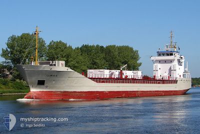
Cement Carrier
Current Trip
| Trip Time | 3 days |
|---|---|
| Trip Distance | 306.86 nm |
| AVG Speed | 7.6 Knots |
| MAX Speed | 9.6 Knots |
| Dybgang | 4.5 m |
| AVG Wind | 5.6 knots |
| MAX Wind | 13 knots |
| MIN Temp | 8.5°C / 47.3°F |
| MAX Temp | 17.9°C / 64.22°F |
| Position Modtaget | 20 d siden |
Current Position
| Longitude | --- |
|---|---|
| Latitude | --- |
| Status | Under way using engine |
| Fart | 9.3 Knots |
| Kurs | 109.4° |
| Område | Black Sea |
| Station | T-AIS |
| Position Modtaget | 20 d siden |
Info
Information
The current position of UNYECEM 1 is in Black Sea with coordinates 42.60371° / 31.51679° as reported on 2025-11-19 10:37 by AIS to our vessel tracker app. The vessel's current speed is 9.3 Knots and is currently inside the port of UNYE.
The vessel UNYECEM 1 (IMO: 9088275, MMSI: 271043513) is a Cement Carrier that was built in 1994 ( 31 år gamle ). It's sailing under the flag of [TR] Turkey.
In this page you can find informations about the vessels current position, last detected port calls, and current voyage information. If the vessels is not in coverage by AIS you will find the latest position.
The current position of UNYECEM 1 is detected by our AIS receivers and we are not responsible for the reliability of the data. The last position was recorded while the vessel was in Coverage by the Ais receivers of our vessel tracking app.
The current draught of UNYECEM 1 as reported by AIS is 4.5 meters
Weather
| Temperature | 8.5°C / 47.3°F |
|---|---|
| Wind Speed | 1 knots |
| Direction | 278° W |
| Pressure | 1020.8 hPa |
| Humidity | 92.8 % |
| Cloud Coverage | 100 % |
Featured Company
Last Port Calls
| Port | Arrival | Departure | Time In Port |
|---|---|---|---|
| 2025-12-10 07:01 | |||
| 2025-12-05 08:41 | 2025-12-06 12:21 | 1 d | |
| 2025-11-29 08:32 | 2025-11-30 13:00 | 1 d | |
| 2025-11-20 23:00 | 2025-11-22 12:48 | 1 d | |
| 2025-11-14 16:40 | 2025-11-18 18:04 | 4 d | |
| 2025-11-10 06:56 | 2025-11-12 03:28 | 1 d | |
| 2025-11-05 12:56 | 2025-11-06 18:24 | 1 d | |
| 2025-10-31 18:56 | 2025-11-02 20:36 | 2 d | |
| 2025-10-29 14:10 | |||
| 2025-10-22 08:33 | 2025-10-23 03:56 | 19 h |
Last Trips
| Origin | Departure | Destination | Arrival | Distance | |
|---|---|---|---|---|---|
| 2025-12-06 15:21 | 2025-12-10 10:01 | 306.86 nm | |||
| 2025-11-30 16:00 | 2025-12-05 11:41 | 307.40 nm | |||
| 2025-11-22 15:48 | 2025-11-29 11:32 | 310.12 nm | |||
| 2025-11-18 20:04 | 2025-11-21 02:00 | 434.03 nm | |||
| 2025-11-12 06:28 | 2025-11-14 18:40 | 436.17 nm | |||
| 2025-11-06 21:24 | 2025-11-10 09:56 | 307.42 nm | |||
| 2025-11-02 22:36 | 2025-11-05 15:56 | 459.50 nm | |||
| 2025-10-29 17:10 | 2025-10-31 20:56 | 434.27 nm | |||
| 2025-10-18 07:24 | 2025-10-22 11:33 | 437.30 nm | |||
| 2025-10-09 19:05 | 2025-10-14 18:48 | 444.81 nm |
Events
| Tid | Hændelsen | Detaljer | Position / Dest | Info |
|---|---|---|---|---|
| 2025-12-10 07:17 | STOP Sejllads |
41.11680 / 37.34164
[TR] UNYE
|
Fart: 0.1 kn Kurs: 94° |
|
| 2025-12-10 07:01 | Skibe i havn |
|
41.11553 / 37.34837
[TR] UNYE
|
Fart: 4.2 kn Kurs: 252° |
| 2025-12-06 12:21 | Afsejlet fra sidste havn |
|
41.11639 / 37.35202
TRUNY
|
Fart: 3.8 kn Kurs: 101° |
| 2025-12-06 12:17 | START Sejllads |
41.11540 / 37.34669
[TR] UNYE
|
Fart: 3.8 kn Kurs: 101° |
|
| 2025-12-05 08:57 | STOP Sejllads |
41.11686 / 37.34163
[TR] UNYE
|
Fart: 0.2 kn Kurs: 97° |
|
| 2025-12-05 08:41 | Skibe i havn |
|
41.11542 / 37.34683
[TR] UNYE
|
Fart: 3.7 kn Kurs: 239° |
| 2025-12-05 08:33 | START Sejllads | 0.6 nm, North East of UNYE |
41.11948 / 37.35545
TRUNY
|
Fart: 3.3 kn Kurs: 218° |
| 2025-12-05 08:08 | STOP Sejllads | 0.93 nm, East of UNYE |
41.12078 / 37.36277
TRUNY
|
Fart: 0.3 kn Kurs: 303° |
| 2025-12-05 07:45 | START Sejllads | 2.22 nm, East of UNYE |
41.12356 / 37.39131
TRUNY
|
Fart: 5.9 kn Kurs: 275° |
| 2025-12-04 17:40 | STOP Sejllads | 2.54 nm, East of UNYE |
41.11982 / 37.39927
TRUNY
|
Fart: 0.1 kn Kurs: 117° |