
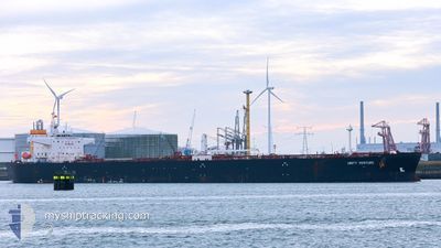
UNITY VENTURE
Tanker
Current Trip
| Time Travelled | 7 days |
|---|---|
| Remaining Time | --- |
| Distance Travelled | 1854.21 nm |
| Remaining Distance | 121.98 nm |
| AVG Speed | 11.1 Knots |
| MAX Speed | 13.5 Knots |
| AVG Wind | 12 knots |
| MAX Wind | 33.8 knots |
| MIN Temp | -3.1°C / 26.42°F |
| MAX Temp | 27°C / 80.6°F |
| Dybgang | 8.4 m |
| Position Modtaget | 3 d siden |
Current Position
| Longitude | --- |
|---|---|
| Latitude | --- |
| Status | Under way using engine |
| Fart | 11.7 Knots |
| Kurs | 169.3° |
| Område | North Atlantic Ocean |
| Station | T-AIS |
| Position Modtaget | 3 d siden |
Info
Information
The current position of UNITY VENTURE is in North Atlantic Ocean with coordinates 22.36066° / -68.74963° as reported on 2025-01-15 07:50 by AIS to our vessel tracker app. The vessel's current speed is 11.7 Knots and is heading at the port of BAJO GRANDE. The estimated time of arrival as calculated by MyShipTracking vessel tracking app is 2025-01-17 12:00 LT
The vessel UNITY VENTURE (IMO: 9773739, MMSI: 477023800) is a Tanker It's sailing under the flag of [HK] Hong Kong.
In this page you can find informations about the vessels current position, last detected port calls, and current voyage information. If the vessels is not in coverage by AIS you will find the latest position.
The current position of UNITY VENTURE is detected by our AIS receivers and we are not responsible for the reliability of the data. The last position was recorded while the vessel was in Coverage by the Ais receivers of our vessel tracking app.
The current draught of UNITY VENTURE as reported by AIS is 8.4 meters
Weather
| Temperature | 26.2°C / 79.16°F |
|---|---|
| Wind Speed | 19 knots |
| Direction | 88° E |
| Pressure | 1012 hPa |
| Humidity | 81.8 % |
| Cloud Coverage | 2 % |
Featured Company
Last Port Calls
| Port | Arrival | Departure | Time In Port |
|---|---|---|---|
| 2025-01-08 11:08 | 2025-01-10 17:54 | 2 d | |
| 2024-12-26 20:18 | 2024-12-28 11:31 | 1 d | |
| 2024-12-13 11:14 | 2024-12-19 17:19 | 6 d | |
| 2024-12-03 12:47 | 2024-12-05 17:09 | 2 d | |
| 2024-11-22 19:42 | 2024-11-24 18:16 | 1 d | |
| 2024-11-11 01:18 | 2024-11-12 12:49 | 1 d |
Most Visited Ports (Last year)
| Port | Arrivals | |
|---|---|---|
| 7 | ||
| 3 | ||
| 2 | ||
| 2 | ||
| 1 | ||
| 1 |
Last Trips
| Origin | Departure | Destination | Arrival | Distance | |
|---|---|---|---|---|---|
| 2024-12-28 07:31 | 2025-01-08 06:08 | 1943.07 nm | |||
| 2024-12-19 11:19 | 2024-12-26 16:18 | 1797.24 nm | |||
| 2024-12-05 13:09 | 2024-12-13 05:14 | 1797.84 nm | |||
| 2024-11-24 14:16 | 2024-12-03 08:47 | 443.57 nm | |||
| 2024-11-12 07:49 | 2024-11-22 15:42 | 1951.00 nm | |||
| 2024-10-18 00:14 | 2024-11-10 20:18 | 3808.43 nm |
Events
| Tid | Hændelsen | Detaljer | Position / Dest | Info |
|---|---|---|---|---|
| 2025-01-17 20:31 | START Sejllads |
12.36336 / -70.40076
BAJO GRANDE
|
Fart: 3.7 kn Kurs: 185° |
|
| 2025-01-17 13:27 | STOP Sejllads |
12.36311 / -70.39301
BAJO GRANDE
|
Fart: 0.3 kn Kurs: 79° |
|
| 2025-01-15 07:52 | Status er ændret | Default Under way using engine |
22.35477 / -68.74850
BAJO GRANDE
|
Fart: 11.7 kn Kurs: 169.3° |
| 2025-01-15 07:50 | Status er ændret | Under way using engine Default |
22.36066 / -68.74963
BAJO GRANDE
|
Fart: 11.7 kn Kurs: 171° |
| 2025-01-15 07:50 | Udenfor Dækning |
22.36066 / -68.74963
North Atlantic Ocean
BAJO GRANDE
|
Fart: 11.7 kn Kurs: 169.3° |
|
| 2025-01-15 07:32 | Status er ændret | Default Under way using engine |
22.41974 / -68.75995
BAJO GRANDE
|
Fart: 11.4 kn Kurs: 171.1° |
| 2025-01-15 07:01 | Status er ændret | Under way using engine Default |
22.51625 / -68.77748
BAJO GRANDE
|
Fart: 11.8 kn Kurs: 172° |
| 2025-01-15 06:41 | Indenfor Dækning |
22.51625 / -68.77748
North Atlantic Ocean
BAJO GRANDE
|
Fart: 11.7 kn Kurs: 171.4° |
|
| 2025-01-15 04:29 | Status er ændret | Default Under way using engine |
22.99778 / -68.88190
BAJO GRANDE
|
Fart: 11.8 kn Kurs: 170.5° |
| 2025-01-15 04:24 | Udenfor Dækning |
23.01528 / -68.88468
North Atlantic Ocean
BAJO GRANDE
|
Fart: 11.8 kn Kurs: 170.5° |