
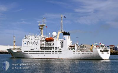
UMITAKA MARU
Fishing
Current Trip
JP TYO H
| Time Travelled | 5 days |
|---|---|
| Remaining Time | --- |
| Distance Travelled | 747.08 nm |
| Remaining Distance | --- |
| AVG Speed | 11.7 Knots |
| MAX Speed | 16 Knots |
| AVG Wind | 18 knots |
| MAX Wind | 33 knots |
| MIN Temp | 18.1°C / 64.58°F |
| MAX Temp | 24.7°C / 76.46°F |
| Dybgang | 5.9 m |
| Position Modtaget | 2 d siden |
Current Position
| Longitude | --- |
|---|---|
| Latitude | --- |
| Status | Under way using engine |
| Fart | 11.6 Knots |
| Kurs | 47.8° |
| Område | Tasman Sea |
| Station | T-AIS |
| Position Modtaget | 2 d siden |
Info
Information
The current position of UMITAKA MARU is in Tasman Sea with coordinates -32.48685° / 153.19248° as reported on 2025-02-14 21:40 by AIS to our vessel tracker app. The vessel's current speed is 11.6 Knots
The vessel UMITAKA MARU (IMO: 9231078, MMSI: 432187000) is a Fishing It's sailing under the flag of [JP] Japan.
In this page you can find informations about the vessels current position, last detected port calls, and current voyage information. If the vessels is not in coverage by AIS you will find the latest position.
The current position of UMITAKA MARU is detected by our AIS receivers and we are not responsible for the reliability of the data. The last position was recorded while the vessel was in Coverage by the Ais receivers of our vessel tracking app.
The current draught of UMITAKA MARU as reported by AIS is 5.9 meters
Weather
| Temperature | 24.4°C / 75.92°F |
|---|---|
| Wind Speed | 15 knots |
| Direction | 288° WNW |
| Pressure | 1002.1 hPa |
| Humidity | 84.5 % |
| Cloud Coverage | 100 % |
Featured Company
Events
| Tid | Hændelsen | Detaljer | Position / Dest | Info |
|---|---|---|---|---|
| 2025-02-14 21:40 | Udenfor Dækning |
-32.48685 / 153.19248
Tasman Sea
JP TYO H
|
Fart: 11.6 kn Kurs: 47.8° |
|
| 2025-02-14 05:40 | Indenfor Dækning |
-34.89981 / 151.13761
Tasman Sea
JP TYO H
|
Fart: 11.2 kn Kurs: 21.7° |
|
| 2025-02-13 00:33 | Udenfor Dækning |
-38.90777 / 149.64613
Tasman Sea
JP TYO H
|
Fart: 8.7 kn Kurs: 16.8° |
|
| 2025-02-12 09:15 | Indenfor Dækning |
-41.56511 / 148.65768
Tasman Sea
JP TYO H
|
Fart: 13.1 kn Kurs: 5.7° |
|
| 2025-02-12 06:58 | Udenfor Dækning |
-42.04898 / 148.53527
Tasman Sea
JP TYO H
|
Fart: 13.1 kn Kurs: 11.1° |
|
| 2025-02-12 06:58 | Indenfor Dækning |
-42.04898 / 148.53527
Tasman Sea
JP TYO H
|
Fart: 13.1 kn Kurs: 11.1° |
|
| 2025-02-12 03:23 | Udenfor Dækning |
-42.76010 / 148.24068
Tasman Sea
JP TYO H
|
Fart: 12.7 kn Kurs: 18.8° |
|
| 2025-02-11 21:50 | Afsejlet fra sidste havn |
|
-42.88214 / 147.34456
JP TYO H
|
Fart: 3.5 kn Kurs: 142° |
| 2025-02-11 21:50 | START Sejllads |
-42.88186 / 147.34427
[AU] HOBART
|
Fart: 3.3 kn Kurs: 142° |
|
| 2025-02-11 21:40 | Status er ændret | Under way using engine Moored |
-42.88108 / 147.34146
[AU] HOBART
|
Fart: 0.1 kn Kurs: 353° |