

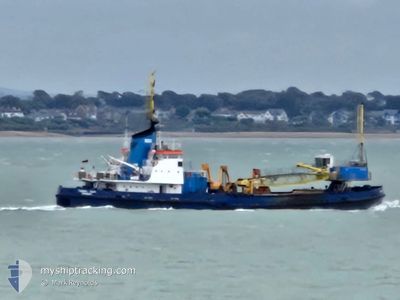
UKD CHERRY SAND
Grab Hopper Dredger

Current Trip
| Trip Time | 3 h, 47 mins |
|---|---|
| Trip Distance | 3.82 nm |
| AVG Speed | 4.6 Knots |
| MAX Speed | 7.2 Knots |
| Dybgang | 3.6 m |
| AVG Wind | 5.1 knots |
| MAX Wind | 7 knots |
| MIN Temp | 2.9°C / 37.22°F |
| MAX Temp | 6.4°C / 43.52°F |
| Position Modtaget | 5 m siden |
Current Position
| Longitude | --- |
|---|---|
| Latitude | --- |
| Status | Moored |
| Fart | |
| Kurs | 197° |
| Område | North Sea |
| Station | T-AIS |
| Position Modtaget | 5 m siden |
Information
The current position of UKD CHERRY SAND is in North Sea with coordinates 53.74162° / -0.26498° as reported on 2025-03-15 20:53 by AIS to our vessel tracker app. The vessel's current speed is 0 Knots and is currently inside the port of HULL.
The vessel UKD CHERRY SAND (IMO: 6811059, MMSI: 232003994) is a Grab Hopper Dredger that was built in 1968 ( 57 år gamle ). It's sailing under the flag of [GB] United Kingdom.
In this page you can find informations about the vessels current position, last detected port calls, and current voyage information. If the vessels is not in coverage by AIS you will find the latest position.
The current position of UKD CHERRY SAND is detected by our AIS receivers and we are not responsible for the reliability of the data. The last position was recorded while the vessel was in Coverage by the Ais receivers of our vessel tracking app.
The current draught of UKD CHERRY SAND as reported by AIS is 3.6 meters
Weather
| Temperature | 2.9°C / 37.22°F |
|---|---|
| Wind Speed | 4 knots |
| Direction | 34° NE |
| Pressure | 1025.9 hPa |
| Humidity | 81.3 % |
| Cloud Coverage | 5 % |


Featured Company
Last Port Calls
| Port | Arrival | Departure | Time In Port |
|---|---|---|---|
| 2025-03-15 19:57 | |||
| 2025-03-15 07:16 | 2025-03-15 16:10 | 8 h | |
| 2025-03-14 19:26 | 2025-03-15 06:52 | 11 h | |
| 2025-03-14 17:45 | 2025-03-14 19:09 | 1 h | |
| 2025-03-12 17:33 | 2025-03-14 17:26 | 1 d | |
| 2025-03-12 04:40 | 2025-03-12 13:48 | 9 h | |
| 2025-03-11 13:48 | 2025-03-12 02:15 | 12 h | |
| 2025-03-10 13:00 | 2025-03-11 12:44 | 23 h | |
| 2025-03-10 00:55 | 2025-03-10 11:43 | 10 h | |
| 2025-03-09 13:33 | 2025-03-09 23:46 | 10 h |
Last Trips
| Origin | Departure | Destination | Arrival | Distance | |
|---|---|---|---|---|---|
| 2025-03-15 16:10 | 2025-03-15 19:57 | 3.82 nm | |||
| 2025-03-15 06:52 | 2025-03-15 07:16 | 1.31 nm | |||
| 2025-03-14 19:09 | 2025-03-14 19:26 | 1.01 nm | |||
| 2025-03-14 17:26 | 2025-03-14 17:45 | 1.16 nm | |||
| 2025-03-12 13:48 | 2025-03-12 17:33 | 17.22 nm | |||
| 2025-03-12 02:15 | 2025-03-12 04:40 | 7.67 nm | |||
| 2025-03-11 12:44 | 2025-03-11 13:48 | 5.16 nm | |||
| 2025-03-10 11:43 | 2025-03-10 13:00 | 5.41 nm | |||
| 2025-03-09 23:46 | 2025-03-10 00:55 | 6.26 nm | |||
| 2025-03-09 11:29 | 2025-03-09 13:33 | 0.19 nm |
Events
| Tid | Hændelsen | Detaljer | Position / Dest | Info |
|---|---|---|---|---|
| 2025-03-15 20:38 | Status er ændret | Moored Default |
53.74162 / -.26500
[GB] HULL
|
Fart: Kurs: 197° |
| 2025-03-15 20:35 | Status er ændret | Default Moored |
53.74162 / -.26500
[GB] HULL
|
Fart: Kurs: 196° |
| 2025-03-15 20:30 | Status er ændret | Moored Restricted manoeuverability |
53.74162 / -.26502
[GB] HULL
|
Fart: Kurs: 197° |
| 2025-03-15 20:05 | STOP Sejllads |
53.74102 / -.27245
[GB] HULL
|
Fart: 0.3 kn Kurs: 59° |
|
| 2025-03-15 19:57 | Skibe i havn |
|
53.73952 / -.27657
[GB] HULL
|
Fart: 3.2 kn Kurs: 47° |
| 2025-03-15 19:53 | START Sejllads | 0.64 nm, South West of HULL |
53.73540 / -.28278
GB HUL
|
Fart: 5.1 kn Kurs: 52.1° |
| 2025-03-15 19:44 | STOP Sejllads | 0.75 nm, South West of HULL |
53.73460 / -.28558
GB HUL
|
Fart: 0.2 kn Kurs: 103° |
| 2025-03-15 19:37 | START Sejllads | 0.97 nm, West of HULL |
53.73950 / -.29515
GB HUL
|
Fart: 6.3 kn Kurs: 156.4° |
| 2025-03-15 18:15 | STOP Sejllads | 1.02 nm, West of HULL |
53.74095 / -.29702
GB HUL
|
Fart: 0.3 kn Kurs: 49° |
| 2025-03-15 18:07 | START Sejllads | 0.87 nm, South West of HULL |
53.73522 / -.29002
GB HUL
|
Fart: 6.1 kn Kurs: 297.9° |