
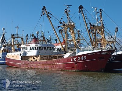
UK246 CONCORDIA
Trawler
Current Trip
FISHING GROUNDS
| Time Travelled | 1 day |
|---|---|
| Remaining Time | --- |
| Distance Travelled | 20.07 nm |
| Remaining Distance | --- |
| AVG Speed | 11.8 Knots |
| MAX Speed | 13.4 Knots |
| AVG Wind | 16.5 knots |
| MAX Wind | 19.7 knots |
| MIN Temp | 5.2°C / 41.36°F |
| MAX Temp | 5.7°C / 42.26°F |
| Dybgang | 5 m |
| Position Modtaget | 1 d siden |
Current Position
| Longitude | --- |
|---|---|
| Latitude | --- |
| Status | Engaged in Fishing |
| Fart | 10.6 Knots |
| Kurs | 322.1° |
| Område | North Sea |
| Station | T-AIS |
| Position Modtaget | 1 d siden |
Info
Information
The current position of UK246 CONCORDIA is in North Sea with coordinates 53.32288° / 5.01033° as reported on 2025-03-17 02:26 by AIS to our vessel tracker app. The vessel's current speed is 10.6 Knots
The vessel UK246 CONCORDIA (IMO: 9055034, MMSI: 246068000) is a Trawler that was built in 1993 ( 32 år gamle ). It's sailing under the flag of [NL] Netherlands.
In this page you can find informations about the vessels current position, last detected port calls, and current voyage information. If the vessels is not in coverage by AIS you will find the latest position.
The current position of UK246 CONCORDIA is detected by our AIS receivers and we are not responsible for the reliability of the data. The last position was recorded while the vessel was in Coverage by the Ais receivers of our vessel tracking app.
The current draught of UK246 CONCORDIA as reported by AIS is 5 meters
Weather
| Temperature | 5.5°C / 41.9°F |
|---|---|
| Wind Speed | 19 knots |
| Direction | 70° ENE |
| Pressure | 1026.6 hPa |
| Humidity | 85.5 % |
| Cloud Coverage | 6 % |
Featured Company
Last Port Calls
| Port | Arrival | Departure | Time In Port |
|---|---|---|---|
| 2025-03-14 14:51 | 2025-03-17 01:36 | 2 d | |
| 2025-03-07 15:03 | 2025-03-10 01:56 | 2 d | |
| 2025-02-28 04:47 | 2025-03-03 01:56 | 2 d | |
| 2025-02-21 02:23 | 2025-02-24 01:37 | 2 d | |
| 2025-02-07 22:26 | 2025-02-17 01:49 | 9 d | |
| 2025-01-31 06:12 | 2025-02-03 01:42 | 2 d | |
| 2025-01-24 03:55 | 2025-01-27 01:46 | 2 d | |
| 2025-01-17 03:41 | 2025-01-20 01:42 | 2 d | |
| 2025-01-11 05:56 | 2025-01-13 01:36 | 1 d | |
| 2025-01-07 08:08 |
Most Visited Ports (Last year)
| Port | Arrivals | |
|---|---|---|
| 33 | ||
| 9 | ||
| 2 |
Last Trips
| Origin | Departure | Destination | Arrival | Distance | |
|---|---|---|---|---|---|
| 2025-03-10 01:56 | 2025-03-14 14:51 | 172.35 nm | |||
| 2025-03-03 01:56 | 2025-03-07 15:03 | 307.15 nm | |||
| 2025-02-24 01:37 | 2025-02-28 04:47 | 58.98 nm | |||
| 2025-02-17 01:49 | 2025-02-21 02:23 | 54.37 nm | |||
| 2025-02-03 01:42 | 2025-02-07 22:26 | 53.17 nm | |||
| 2025-01-27 01:46 | 2025-01-31 06:12 | 58.84 nm | |||
| 2025-01-20 01:42 | 2025-01-24 03:55 | 41.85 nm | |||
| 2025-01-13 01:36 | 2025-01-17 03:41 | 53.59 nm | |||
| 2025-01-07 08:08 | 2025-01-11 05:56 | 53.73 nm |
Events
| Tid | Hændelsen | Detaljer | Position / Dest | Info |
|---|---|---|---|---|
| 2025-03-17 02:26 | Udenfor Dækning |
53.32288 / 5.01033
North Sea
FISHING GROUNDS
|
Fart: 10.6 kn Kurs: 322.1° |
|
| 2025-03-17 00:36 | Afsejlet fra sidste havn |
|
53.17687 / 5.40035
FISHING GROUNDS
|
Fart: 7.3 kn Kurs: 288° |
| 2025-03-17 00:30 | START Sejllads |
53.17777 / 5.41300
[NL] HARLINGEN
|
Fart: 4.5 kn Kurs: 219° |
|
| 2025-03-14 13:53 | STOP Sejllads |
53.17924 / 5.41473
[NL] HARLINGEN
|
Fart: 0.3 kn Kurs: 213° |
|
| 2025-03-14 13:51 | Skibe i havn |
|
53.17868 / 5.41377
[NL] HARLINGEN
|
Fart: 0.8 kn Kurs: 304° |
| 2025-03-14 11:03 | Indenfor Dækning |
53.34684 / 4.94919
North Sea
FISHING GROUNDS
|
Fart: 11.3 kn Kurs: 171.4° |
|
| 2025-03-11 00:39 | Udenfor Dækning |
52.62024 / 3.77397
North Sea
FISHING GROUNDS
|
Fart: 6.3 kn Kurs: 290.3° |
|
| 2025-03-11 00:38 | Indenfor Dækning |
52.62024 / 3.77397
North Sea
FISHING GROUNDS
|
Fart: 6.3 kn Kurs: 290.3° |
|
| 2025-03-10 21:45 | Udenfor Dækning |
52.85722 / 3.96363
North Sea
FISHING GROUNDS
|
Fart: 6.8 kn Kurs: 208.5° |
|
| 2025-03-10 21:26 | Indenfor Dækning |
52.88932 / 3.98768
North Sea
FISHING GROUNDS
|
Fart: 6.7 kn Kurs: 199.2° |