
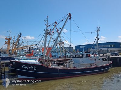
UK168 KEES KORF
Fishing
Current Trip
| Trip Time | 5 h, 32 mins |
|---|---|
| Trip Distance | 39.03 nm |
| AVG Speed | 7.7 Knots |
| MAX Speed | 9.2 Knots |
| Dybgang | 0 m |
| AVG Wind | 9.8 knots |
| MAX Wind | 11.4 knots |
| MIN Temp | 7.7°C / 45.86°F |
| MAX Temp | 9.9°C / 49.82°F |
| Position Modtaget | 1 m siden |
Current Position
| Longitude | 5.59867° |
|---|---|
| Latitude | 52.66113° |
| Status | Engaged in Fishing |
| Fart | |
| Kurs | 350° |
| Område | North Sea |
| Station | T-AIS |
| Position Modtaget | 1 m siden |
Info
Information
The current position of UK168 KEES KORF is in North Sea with coordinates 52.66113° / 5.59867° as reported on 2024-05-03 10:24 by AIS to our vessel tracker app. The vessel's current speed is 0 Knots and is currently inside the port of URK.
The vessel UK168 KEES KORF (IMO: 8432182, MMSI: 245572000) is a Fishing It's sailing under the flag of [NL] Netherlands.
In this page you can find informations about the vessels current position, last detected port calls, and current voyage information. If the vessels is not in coverage by AIS you will find the latest position.
The current position of UK168 KEES KORF is detected by our AIS receivers and we are not responsible for the reliability of the data. The last position was recorded while the vessel was in Coverage by the Ais receivers of our vessel tracking app.
Weather
| Temperature | 11.7°C / 53.06°F |
|---|---|
| Wind Speed | 14 knots |
| Direction | 220° SW |
| Pressure | 1005.4 hPa |
| Humidity | 93.1 % |
| Cloud Coverage | 100 % |
Featured Company
Last Port Calls
| Port | Arrival | Departure | Time In Port |
|---|---|---|---|
| 2024-04-26 16:43 | |||
| 2024-04-26 10:26 | 2024-04-26 11:11 | 44 m | |
| 2024-04-19 02:56 | 2024-04-22 01:40 | 2 d | |
| 2024-04-13 04:39 | 2024-04-16 09:58 | 3 d | |
| 2024-04-05 10:11 | 2024-04-08 12:33 | 3 d | |
| 2024-03-28 12:16 | 2024-04-02 09:30 | 4 d | |
| 2024-03-22 09:10 | 2024-03-25 02:55 | 2 d | |
| 2024-03-15 11:19 | 2024-03-18 09:37 | 2 d | |
| 2024-03-07 13:41 | 2024-03-11 13:39 | 3 d | |
| 2024-03-07 08:04 | 2024-03-07 08:08 | 4 m |
Most Visited Ports (Last year)
| Port | Arrivals | |
|---|---|---|
| 29 | ||
| 10 | ||
| 6 | ||
| 5 | ||
| 2 | ||
| 2 |
Last Trips
| Origin | Departure | Destination | Arrival | Distance | |
|---|---|---|---|---|---|
| 2024-04-26 13:11 | 2024-04-26 18:43 | 39.03 nm | |||
| 2024-04-22 03:40 | 2024-04-26 12:26 | 407.73 nm | |||
| 2024-04-16 11:58 | 2024-04-19 04:56 | 237.67 nm | |||
| 2024-04-08 14:33 | 2024-04-13 06:39 | 377.38 nm | |||
| 2024-04-02 11:30 | 2024-04-05 12:11 | 208.16 nm | |||
| 2024-03-25 03:55 | 2024-03-28 13:16 | 274.00 nm | |||
| 2024-03-18 10:37 | 2024-03-22 10:10 | 338.69 nm | |||
| 2024-03-11 14:39 | 2024-03-15 12:19 | 244.17 nm | |||
| 2024-03-07 09:08 | 2024-03-07 14:41 | 32.77 nm | |||
| 2024-03-04 20:44 | 2024-03-07 09:04 | 54.13 nm |
Events
| Tid | Hændelsen | Detaljer | Position / Dest | Info |
|---|---|---|---|---|
| 2024-04-26 16:46 | STOP Sejllads |
52.65937 / 5.59633
[NL] URK
|
Fart: 0.1 kn Kurs: 10° |
|
| 2024-04-26 16:43 | Skibe i havn |
|
52.65678 / 5.59846
[NL] URK
|
Fart: 7.7 kn Kurs: 343° |
| 2024-04-26 12:40 | START Sejllads | 2.38 nm, North West of MAKKUM |
53.06763 / 5.33733
FISHING GROUNDS
|
Fart: 5.2 kn Kurs: 179° |
| 2024-04-26 12:27 | STOP Sejllads | 2.44 nm, North West of MAKKUM |
53.06951 / 5.33693
FISHING GROUNDS
|
Fart: 0.1 kn Kurs: 166° |
| 2024-04-26 12:22 | START Sejllads | 2.61 nm, North West of MAKKUM |
53.07332 / 5.33508
FISHING GROUNDS
|
Fart: 3.9 kn Kurs: 167° |
| 2024-04-26 12:01 | STOP Sejllads | 2.78 nm, North West of MAKKUM |
53.07677 / 5.33284
FISHING GROUNDS
|
Fart: Kurs: 160° |
| 2024-04-26 11:11 | Afsejlet fra sidste havn |
|
53.17492 / 5.40008
FISHING GROUNDS
|
Fart: 8.1 kn Kurs: 211° |
| 2024-04-26 11:04 | START Sejllads |
53.17773 / 5.41260
[NL] HARLINGEN
|
Fart: 4.4 kn Kurs: 215° |
|
| 2024-04-26 10:27 | STOP Sejllads |
53.17938 / 5.41460
[NL] HARLINGEN
|
Fart: 0.2 kn Kurs: 175° |
|
| 2024-04-26 10:26 | Skibe i havn |
|
53.17923 / 5.41450
[NL] HARLINGEN
|
Fart: 0.7 kn Kurs: 157° |