
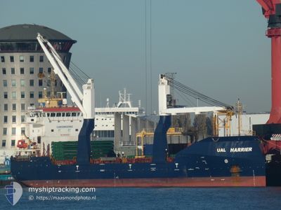
UAL HARRIER
General Cargo
Current Trip
CI ABJ
| Time Travelled | 3 days |
|---|---|
| Remaining Time | --- |
| Distance Travelled | 708.76 nm |
| Remaining Distance | --- |
| AVG Speed | 10.8 Knots |
| MAX Speed | 12 Knots |
| AVG Wind | 8.1 knots |
| MAX Wind | 11.9 knots |
| MIN Temp | 26.8°C / 80.24°F |
| MAX Temp | 29°C / 84.2°F |
| Dybgang | 7.4 m |
| Position Modtaget | 2024-04-05 17:32 |
Current Position
| Longitude | -17.04387° |
|---|---|
| Latitude | 24.11623° |
| Status | Under way using engine |
| Fart | 11.3 Knots |
| Kurs | 203.1° |
| Område | North Atlantic Ocean |
| Station | T-AIS |
| Position Modtaget | 2024-04-05 17:32 |
Info
Information
The current position of UAL HARRIER is in North Atlantic Ocean with coordinates 24.11623° / -17.04387° as reported on 2024-04-05 17:32 by AIS to our vessel tracker app. The vessel's current speed is 11.3 Knots
The vessel UAL HARRIER (IMO: 9594303, MMSI: 235089913) is a General Cargo that was built in 2012 ( 12 år gamle ). It's sailing under the flag of [GB] United Kingdom.
In this page you can find informations about the vessels current position, last detected port calls, and current voyage information. If the vessels is not in coverage by AIS you will find the latest position.
The current position of UAL HARRIER is detected by our AIS receivers and we are not responsible for the reliability of the data. The last position was recorded while the vessel was in Coverage by the Ais receivers of our vessel tracking app.
The current draught of UAL HARRIER as reported by AIS is 7.4 meters
Weather
| Temperature | 28.9°C / 84.02°F |
|---|---|
| Wind Speed | 14 knots |
| Direction | 274° W |
| Pressure | 1008.5 hPa |
| Humidity | 79.4 % |
| Cloud Coverage | 92 % |
Featured Company
Last Port Calls
| Port | Arrival | Departure | Time In Port |
|---|---|---|---|
| 2024-05-10 06:55 | 2024-05-10 16:19 | 9 h | |
| 2024-05-08 15:39 | 2024-05-10 06:19 | 1 d | |
| 2024-05-03 12:54 | 2024-05-05 08:03 | 1 d | |
| 2024-04-24 06:19 | 2024-05-02 08:30 | 8 d | |
| 2024-04-15 15:25 | 2024-04-18 12:38 | 2 d | |
| 2024-04-04 07:30 | 2024-04-04 18:17 | 10 h | |
| 2024-03-21 17:09 | 2024-03-26 16:46 | 4 d | |
| 2024-03-15 00:42 | 2024-03-20 00:46 | 5 d | |
| 2024-03-13 07:32 | 2024-03-14 23:53 | 1 d | |
| 2024-03-03 18:15 | 2024-03-03 23:11 | 4 h |
Last Trips
| Origin | Departure | Destination | Arrival | Distance | |
|---|---|---|---|---|---|
| 2024-05-10 07:19 | 2024-05-10 07:55 | 1.05 nm | |||
| 2024-05-05 09:03 | 2024-05-08 16:39 | 176.46 nm | |||
| 2024-05-02 09:30 | 2024-05-03 13:54 | 219.04 nm | |||
| 2024-04-18 12:38 | 2024-04-24 07:19 | 1383.85 nm | |||
| 2024-04-04 19:17 | 2024-04-15 15:25 | 2108.78 nm | |||
| 2024-03-26 17:46 | 2024-04-04 08:30 | 1779.44 nm | |||
| 2024-03-20 00:46 | 2024-03-21 18:09 | 439.69 nm | |||
| 2024-03-03 23:11 | 2024-03-15 00:42 | 2093.23 nm | |||
| 2024-03-03 23:11 | 2024-03-13 07:32 | 2080.47 nm | |||
| 2024-02-23 10:57 | 2024-03-03 18:15 | 2034.37 nm |
Events
| Tid | Hændelsen | Detaljer | Position / Dest | Info |
|---|---|---|---|---|
| 2024-05-11 15:39 | START Sejllads |
-5.81333 / 9.80833
CI ABJ
|
Fart: 5 kn Kurs: 57° |
|
| 2024-05-11 10:45 | STOP Sejllads |
-5.72833 / 9.88667
CI ABJ
|
Fart: Kurs: -1° |
|
| 2024-05-11 09:15 | START Sejllads |
-5.69167 / 9.97667
CI ABJ
|
Fart: 7 kn Kurs: 264° |
|
| 2024-05-11 06:27 | STOP Sejllads |
-5.72500 / 9.99333
CI ABJ
|
Fart: Kurs: -1° |
|
| 2024-05-10 16:19 | START Sejllads | 0.64 nm, North East of POINTE NOIRE |
-4.77440 / 11.84464
CI ABJ
|
Fart: 3.8 kn Kurs: 282° |
| 2024-05-10 16:19 | Afsejlet fra sidste havn |
|
-4.77440 / 11.84464
CI ABJ
|
Fart: 3.7 kn Kurs: 315° |
| 2024-05-10 06:55 | Skibe i havn |
|
-4.77897 / 11.84900
[CG] POINTE NOIRE
|
Fart: 0.1 kn Kurs: 138° |
| 2024-05-10 06:47 | STOP Sejllads | 0.84 nm, East of POINTE NOIRE |
-4.77807 / 11.84913
CI ABJ
|
Fart: 0.1 kn Kurs: 138° |
| 2024-05-10 06:19 | Afsejlet fra sidste havn |
|
-4.77210 / 11.83378
CI ABJ
|
Fart: 2.8 kn Kurs: 1° |
| 2024-05-10 06:07 | START Sejllads |
-4.78271 / 11.83440
[CG] POINTE NOIRE
|
Fart: 3.7 kn Kurs: 351° |