
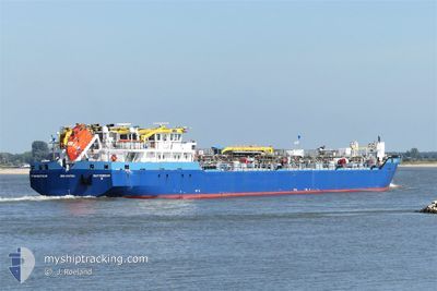
TWISTER
Lpg Tanker
Current Trip
| Trip Time | 2 days |
|---|---|
| Trip Distance | 210.56 nm |
| AVG Speed | 10.3 Knots |
| MAX Speed | 13.3 Knots |
| Dybgang | 2.9 m |
| AVG Wind | 11.3 knots |
| MAX Wind | 19 knots |
| MIN Temp | 1.2°C / 34.16°F |
| MAX Temp | 7°C / 44.6°F |
| Position Modtaget | 5 h, 44 m siden |
Current Position
| Longitude | --- |
|---|---|
| Latitude | --- |
| Status | Moored |
| Fart | |
| Kurs | 324° |
| Område | North Sea |
| Station | T-AIS |
| Position Modtaget | 5 h, 44 m siden |
Info
Information
The current position of TWISTER is in North Sea with coordinates 53.64823° / -0.20842° as reported on 2025-01-23 13:25 by AIS to our vessel tracker app. The vessel's current speed is 0 Knots and is currently inside the port of IMMINGHAM.
The vessel TWISTER (IMO: 9507594, MMSI: 245881000) is a Lpg Tanker that was built in 2010 ( 15 år gamle ). It's sailing under the flag of [NL] Netherlands.
In this page you can find informations about the vessels current position, last detected port calls, and current voyage information. If the vessels is not in coverage by AIS you will find the latest position.
The current position of TWISTER is detected by our AIS receivers and we are not responsible for the reliability of the data. The last position was recorded while the vessel was in Coverage by the Ais receivers of our vessel tracking app.
The current draught of TWISTER as reported by AIS is 2.9 meters
Weather
| Temperature | 6.4°C / 43.52°F |
|---|---|
| Wind Speed | 12 knots |
| Direction | 254° WSW |
| Pressure | 995.5 hPa |
| Humidity | 80.2 % |
| Cloud Coverage | 100 % |
Featured Company
Last Port Calls
| Port | Arrival | Departure | Time In Port |
|---|---|---|---|
| 2025-01-23 12:57 | |||
| 2025-01-19 16:54 | 2025-01-20 18:10 | 1 d | |
| 2025-01-17 07:37 | 2025-01-18 15:16 | 1 d | |
| 2025-01-14 08:48 | 2025-01-14 16:44 | 7 h | |
| 2025-01-10 19:15 | 2025-01-11 15:17 | 20 h | |
| 2025-01-09 13:28 | 2025-01-10 01:08 | 11 h | |
| 2025-01-05 12:09 | 2025-01-06 00:22 | 12 h | |
| 2024-12-31 14:01 | |||
| 2024-12-23 12:13 | 2024-12-30 09:34 | 6 d | |
| 2024-12-19 05:17 | 2024-12-19 18:26 | 13 h |
Last Trips
| Origin | Departure | Destination | Arrival | Distance | |
|---|---|---|---|---|---|
| 2025-01-20 19:10 | 2025-01-23 12:57 | 210.56 nm | |||
| 2025-01-18 16:16 | 2025-01-19 17:54 | 260.58 nm | |||
| 2025-01-14 17:44 | 2025-01-17 08:37 | 602.87 nm | |||
| 2025-01-11 16:17 | 2025-01-14 09:48 | 593.84 nm | |||
| 2025-01-10 02:08 | 2025-01-10 20:15 | 137.62 nm | |||
| 2025-01-06 01:22 | 2025-01-09 14:28 | 560.84 nm | |||
| 2024-12-30 10:34 | 2025-01-05 13:09 | 593.90 nm | |||
| 2024-12-30 10:34 | 2024-12-31 15:01 | 97.96 nm | |||
| 2024-12-19 19:26 | 2024-12-23 13:13 | 618.43 nm | |||
| 2024-12-16 17:01 | 2024-12-19 06:17 | 582.68 nm |
Events
| Tid | Hændelsen | Detaljer | Position / Dest | Info |
|---|---|---|---|---|
| 2025-01-23 13:28 | Status er ændret | Default Moored |
53.64823 / -.20842
[GB] IMMINGHAM
|
Fart: Kurs: 324° |
| 2025-01-23 13:25 | Udenfor Dækning |
53.64823 / -.20843
North Sea
[GB] IMMINGHAM
|
Fart: Kurs: 200.1° |
|
| 2025-01-23 13:22 | Status er ændret | Moored Under way using engine |
53.64823 / -.20842
[GB] IMMINGHAM
|
Fart: Kurs: 324° |
| 2025-01-23 13:05 | STOP Sejllads |
53.64816 / -.20829
[GB] IMMINGHAM
|
Fart: 0.3 kn Kurs: 322° |
|
| 2025-01-23 12:57 | Skibe i havn |
|
53.64577 / -.20264
[GB] IMMINGHAM
|
Fart: 4.2 kn Kurs: 305° |
| 2025-01-23 11:09 | Status er ændret | Under way using engine Default |
53.54982 / .21029
IMMINGHAM
|
Fart: 7.5 kn Kurs: 265° |
| 2025-01-23 11:05 | Status er ændret | Default Under way using engine |
53.55035 / .22899
IMMINGHAM
|
Fart: 6.3 kn Kurs: 249.6° |
| 2025-01-23 10:46 | Status er ændret | Under way using engine Default |
53.53408 / .28786
IMMINGHAM
|
Fart: 9.4 kn Kurs: 314° |
| 2025-01-23 10:33 | Indenfor Dækning |
53.53408 / .28786
North Sea
|
Fart: 9.5 kn Kurs: 312.3° |
|
| 2025-01-23 09:07 | Udenfor Dækning |
53.44344 / .32048
North Sea
|
Fart: Kurs: 160° |