
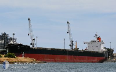
TWINKLE ISLAND
Bulk Carrier
Current Trip
FOR ORDER
| Time Travelled | 23 days |
|---|---|
| Remaining Time | --- |
| Distance Travelled | 6891.73 nm |
| Remaining Distance | --- |
| AVG Speed | 11.8 Knots |
| MAX Speed | 16.2 Knots |
| AVG Wind | 10.6 knots |
| MAX Wind | 25 knots |
| MIN Temp | 15.8°C / 60.44°F |
| MAX Temp | 30.5°C / 86.9°F |
| Dybgang | 7.6 m |
| Position Modtaget | 1 d siden |
Current Position
| Longitude | 18.36621° |
|---|---|
| Latitude | -34.98010° |
| Status | Under way using engine |
| Fart | 13.6 Knots |
| Kurs | 278.2° |
| Område | South Atlantic Ocean |
| Station | T-AIS |
| Position Modtaget | 1 d siden |
Info
Information
The current position of TWINKLE ISLAND is in South Atlantic Ocean with coordinates -34.98010° / 18.36621° as reported on 2024-05-26 14:20 by AIS to our vessel tracker app. The vessel's current speed is 13.6 Knots
The vessel TWINKLE ISLAND (IMO: 9512367, MMSI: 538004652) is a Bulk Carrier that was built in 2012 ( 12 år gamle ). It's sailing under the flag of [MH] Marshall Is.
In this page you can find informations about the vessels current position, last detected port calls, and current voyage information. If the vessels is not in coverage by AIS you will find the latest position.
The current position of TWINKLE ISLAND is detected by our AIS receivers and we are not responsible for the reliability of the data. The last position was recorded while the vessel was in Coverage by the Ais receivers of our vessel tracking app.
The current draught of TWINKLE ISLAND as reported by AIS is 7.6 meters
Weather
| Temperature | 16.9°C / 62.42°F |
|---|---|
| Wind Speed | 14 knots |
| Direction | 326° NW |
| Pressure | 1017.3 hPa |
| Humidity | 71.6 % |
| Cloud Coverage | 100 % |
Featured Company
Last Port Calls
| Port | Arrival | Departure | Time In Port |
|---|---|---|---|
| 2024-04-30 17:01 | 2024-05-05 06:32 | 4 d | |
| 2024-03-19 12:53 |
Last Trips
| Origin | Departure | Destination | Arrival | Distance | |
|---|---|---|---|---|---|
| 2024-03-19 12:53 | 2024-04-30 17:01 | 10347.02 nm |
Events
| Tid | Hændelsen | Detaljer | Position / Dest | Info |
|---|---|---|---|---|
| 2024-05-26 14:27 | Status er ændret | Default Under way using engine |
-34.97528 / 18.33475
FOR ORDER
|
Fart: 13.6 kn Kurs: 278.2° |
| 2024-05-26 14:20 | Udenfor Dækning |
-34.98010 / 18.36621
South Atlantic Ocean
|
Fart: 13.6 kn Kurs: 278.2° |
|
| 2024-05-26 14:15 | Ændre havområde | South African part of the South Atlantic Ocean Malaysian part of the Singapore Strait |
-34.98330 / 18.38815
South Atlantic Ocean
|
Fart: 13.6 kn Kurs: 276° |
| 2024-05-26 14:15 | Status er ændret | Under way using engine Default |
-34.98330 / 18.38815
FOR ORDER
|
Fart: 13.7 kn Kurs: 282° |
| 2024-05-26 13:56 | Indenfor Dækning |
-34.98330 / 18.38815
South Atlantic Ocean
|
Fart: 13.6 kn Kurs: 276° |