
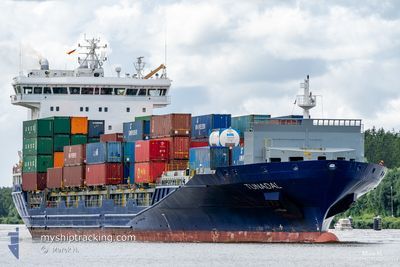
TUNADAL
Container Ship
Current Trip
| Time Travelled | 10 h, 44 mins |
|---|---|
| Remaining Time | 4 h, 56 mins |
| Distance Travelled | 89.87 nm |
| Remaining Distance | 31.77 nm |
| AVG Speed | 12.4 Knots |
| MAX Speed | 17.2 Knots |
| AVG Wind | 18.9 knots |
| MAX Wind | 30.8 knots |
| MIN Temp | 2.7°C / 36.86°F |
| MAX Temp | 10.1°C / 50.18°F |
| Dybgang | 6.9 m |
| Position Modtaget | 8 m siden |
Current Position
| Longitude | --- |
|---|---|
| Latitude | --- |
| Status | At anchor |
| Fart | 0.8 Knots |
| Kurs | 249° |
| Område | North Sea |
| Station | T-AIS |
| Position Modtaget | 8 m siden |
Info
Information
The current position of TUNADAL is in North Sea with coordinates 53.89574° / 7.82752° as reported on 2024-11-24 02:44 by AIS to our vessel tracker app. The vessel's current speed is 0.8 Knots and is heading at the port of BREMERHAVEN. The estimated time of arrival as calculated by MyShipTracking vessel tracking app is 2024-11-24 07:48 LT
The vessel TUNADAL (IMO: 9429235, MMSI: 636020533) is a Container Ship that was built in 2012 ( 12 år gamle ). It's sailing under the flag of [LR] Liberia.
In this page you can find informations about the vessels current position, last detected port calls, and current voyage information. If the vessels is not in coverage by AIS you will find the latest position.
The current position of TUNADAL is detected by our AIS receivers and we are not responsible for the reliability of the data. The last position was recorded while the vessel was in Coverage by the Ais receivers of our vessel tracking app.
The current draught of TUNADAL as reported by AIS is 6.9 meters
Weather
| Temperature | 10°C / 50°F |
|---|---|
| Wind Speed | 31 knots |
| Direction | 224° SW |
| Pressure | 999.9 hPa |
| Humidity | 88.8 % |
| Cloud Coverage | 100 % |
Featured Company
Last Port Calls
| Port | Arrival | Departure | Time In Port |
|---|---|---|---|
| 2024-11-22 04:54 | 2024-11-23 16:08 | 1 d | |
| 2024-11-14 10:17 | 2024-11-14 17:12 | 6 h | |
| 2024-11-14 01:52 | 2024-11-14 10:13 | 8 h | |
| 2024-11-13 15:14 | 2024-11-14 01:47 | 10 h | |
| 2024-11-10 17:03 | 2024-11-12 17:50 | 2 d | |
| 2024-10-31 20:43 | 2024-11-02 23:32 | 2 d | |
| 2024-10-30 19:12 | 2024-10-30 23:01 | 3 h | |
| 2024-10-30 04:15 | 2024-10-30 17:13 | 12 h | |
| 2024-10-28 04:20 | 2024-10-29 03:33 | 23 h | |
| 2024-10-22 14:52 | 2024-10-23 19:18 | 1 d |
Most Visited Ports (Last year)
| Port | Arrivals | |
|---|---|---|
| 44 | ||
| 22 | ||
| 18 | ||
| 12 | ||
| 11 | ||
| 10 |
Last Trips
| Origin | Departure | Destination | Arrival | Distance | |
|---|---|---|---|---|---|
| 2024-11-14 18:12 | 2024-11-22 05:54 | 1540.26 nm | |||
| 2024-11-14 11:13 | 2024-11-14 11:17 | 0.36 nm | |||
| 2024-11-14 02:47 | 2024-11-14 02:52 | 0.24 nm | |||
| 2024-11-12 18:50 | 2024-11-13 16:14 | 309.79 nm | |||
| 2024-11-03 00:32 | 2024-11-10 18:03 | 1448.55 nm | |||
| 2024-10-31 00:01 | 2024-10-31 21:43 | 310.83 nm | |||
| 2024-10-30 18:13 | 2024-10-30 20:12 | 16.38 nm | |||
| 2024-10-29 04:33 | 2024-10-30 05:15 | 258.34 nm | |||
| 2024-10-23 22:18 | 2024-10-28 05:20 | 919.72 nm | |||
| 2024-10-19 08:39 | 2024-10-22 17:52 | 759.13 nm |
Events
| Tid | Hændelsen | Detaljer | Position / Dest | Info |
|---|---|---|---|---|
| 2024-11-24 02:44 | Status er ændret | At anchor Default |
53.89574 / 7.82752
DEBRV
|
Fart: 0.6 kn Kurs: 263° |
| 2024-11-24 02:32 | Status er ændret | Default At anchor |
53.89540 / 7.82772
DEBRV
|
Fart: 2.1 kn Kurs: 245° |
| 2024-11-24 02:29 | Status er ændret | At anchor Default |
53.89557 / 7.82764
DEBRV
|
Fart: 0.4 kn Kurs: 265° |
| 2024-11-24 02:16 | Status er ændret | Default At anchor |
53.89599 / 7.82726
DEBRV
|
Fart: 0.6 kn Kurs: 253° |
| 2024-11-24 02:00 | Status er ændret | At anchor Default |
53.89580 / 7.82744
DEBRV
|
Fart: 1.7 kn Kurs: 255° |
| 2024-11-24 01:45 | Status er ændret | Default At anchor |
53.89581 / 7.82742
DEBRV
|
Fart: 0.7 kn Kurs: 246° |
| 2024-11-24 01:13 | Status er ændret | At anchor Default |
53.89602 / 7.82721
DEBRV
|
Fart: 0.5 kn Kurs: 254° |
| 2024-11-24 00:55 | Status er ændret | Default At anchor |
53.89569 / 7.82752
DEBRV
|
Fart: 0.6 kn Kurs: 256° |
| 2024-11-24 00:47 | Status er ændret | At anchor Default |
53.89600 / 7.82703
DEBRV
|
Fart: 1.2 kn Kurs: 239° |
| 2024-11-24 00:12 | STOP Sejllads | 7.52 nm, North of WANGEROOGE |
53.89654 / 7.82622
DEBRV
|
Fart: 0.3 kn Kurs: 233° |