
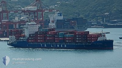
TS MAWEI
Cargo A
Current Trip
| Time Travelled | 5 days |
|---|---|
| Remaining Time | --- |
| Distance Travelled | 837.44 nm |
| Remaining Distance | 264.62 nm |
| AVG Speed | 12.1 Knots |
| MAX Speed | 17.7 Knots |
| AVG Wind | 10.8 knots |
| MAX Wind | 21 knots |
| MIN Temp | 16.3°C / 61.34°F |
| MAX Temp | 22.3°C / 72.14°F |
| Dybgang | 7.7 m |
| Position Modtaget | 13 h, 56 m siden |
Current Position
| Longitude | --- |
|---|---|
| Latitude | --- |
| Status | Under way using engine |
| Fart | 14.3 Knots |
| Kurs | 128.4° |
| Område | South China Sea |
| Station | T-AIS |
| Position Modtaget | 13 h, 56 m siden |
Info
Information
The current position of TS MAWEI is in South China Sea with coordinates 20.59523° / 106.92427° as reported on 2026-01-02 16:03 by AIS to our vessel tracker app. The vessel's current speed is 14.3 Knots and is heading at the port of NANSHA. The estimated time of arrival as calculated by MyShipTracking vessel tracking app is 2026-01-04 08:00 LT
The vessel TS MAWEI (IMO: 9947653, MMSI: 538010433) is a Cargo A It's sailing under the flag of [MH] Marshall Is.
In this page you can find informations about the vessels current position, last detected port calls, and current voyage information. If the vessels is not in coverage by AIS you will find the latest position.
The current position of TS MAWEI is detected by our AIS receivers and we are not responsible for the reliability of the data. The last position was recorded while the vessel was in Coverage by the Ais receivers of our vessel tracking app.
The current draught of TS MAWEI as reported by AIS is 7.7 meters
Weather
| Temperature | 18.4°C / 65.12°F |
|---|---|
| Wind Speed | 14 knots |
| Direction | 85° E |
| Pressure | 1022.4 hPa |
| Humidity | 64.6 % |
| Cloud Coverage | 36 % |
Featured Company
Last Port Calls
| Port | Arrival | Departure | Time In Port |
|---|---|---|---|
| 2025-12-29 00:52 | 2025-12-29 13:06 | 12 h | |
| 2025-12-27 18:59 | 2025-12-28 07:48 | 12 h | |
| 2025-12-26 02:01 | 2025-12-26 20:12 | 18 h | |
| 2025-12-25 07:38 | 2025-12-25 17:10 | 9 h | |
| 2025-12-24 05:22 | 2025-12-25 00:14 | 18 h | |
| 2025-12-20 21:22 | 2025-12-21 07:38 | 10 h | |
| 2025-12-19 07:32 | 2025-12-19 18:06 | 10 h | |
| 2025-12-18 18:51 | 2025-12-19 05:25 | 10 h | |
| 2025-12-13 01:29 | 2025-12-13 12:31 | 11 h | |
| 2025-12-12 09:01 | 2025-12-12 17:44 | 8 h |
Last Trips
| Origin | Departure | Destination | Arrival | Distance | |
|---|---|---|---|---|---|
| 2025-12-28 07:48 | 2025-12-29 00:52 | 69.15 nm | |||
| 2025-12-26 20:12 | 2025-12-27 18:59 | 352.39 nm | |||
| 2025-12-25 17:10 | 2025-12-26 02:01 | 134.93 nm | |||
| 2025-12-25 00:14 | 2025-12-25 07:38 | 111.55 nm | |||
| 2025-12-21 07:38 | 2025-12-24 05:22 | 1025.90 nm | |||
| 2025-12-19 18:06 | 2025-12-20 21:22 | 201.74 nm | |||
| 2025-12-19 05:25 | 2025-12-19 07:32 | 14.63 nm | |||
| 2025-12-13 12:31 | 2025-12-18 18:51 | 1659.05 nm | |||
| 2025-12-12 17:44 | 2025-12-13 01:29 | 70.86 nm | |||
| 2025-12-05 14:44 | 2025-12-12 09:01 | 1106.38 nm |
Events
| Tid | Hændelsen | Detaljer | Position / Dest | Info |
|---|---|---|---|---|
| 2026-01-02 16:06 | Status er ændret | Default Under way using engine |
20.58894 / 106.93444
CN 0NW
|
Fart: 14.3 kn Kurs: 128.4° |
| 2026-01-02 16:03 | Udenfor Dækning |
20.59523 / 106.92427
South China Sea
CN 0NW
|
Fart: 14.3 kn Kurs: 128.4° |
|
| 2026-01-02 13:21 | START Sejllads | 3.36 nm, South East of HAI PHONG |
20.83075 / 106.78924
CN 0NW
|
Fart: 3.6 kn Kurs: 90° |
| 2026-01-02 13:12 | Status er ændret | Under way using engine Moored |
20.83053 / 106.78709
CN 0NW
|
Fart: Kurs: 125° |
| 2026-01-02 12:00 | Dybgangen er ændret | 7.7 8.8 |
20.83052 / 106.78698
CN 0NW
|
Fart: Kurs: 124° |
| 2026-01-02 12:00 | Destination er ændret | CN 0NW VN HPH |
20.83052 / 106.78698
CN 0NW
|
Fart: Kurs: 124° |
| 2026-01-02 12:00 | ETA er ændret | 2026/01/04 00:00 2026/01/01 12:00 |
20.83052 / 106.78698
CN 0NW
|
Fart: Kurs: 124° |
| 2026-01-02 01:15 | Dybgangen er ændret | 8.8 8.6 |
20.83058 / 106.78701
VN HPH
|
Fart: Kurs: 123° |
| 2026-01-02 01:14 | Status er ændret | Moored Default |
20.83058 / 106.78701
VN HPH
|
Fart: Kurs: 124° |
| 2026-01-02 01:14 | Fundet i havområde | Vietnamese part of the South China Sea |
20.83058 / 106.78701
South China Sea
|
Fart: Kurs: 35.5° |