
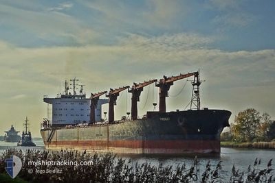
TROGIR
Bulk Carrier
Current Trip
| Trip Time | 8 days |
|---|---|
| Trip Distance | 1514.99 nm |
| AVG Speed | 9.3 Knots |
| MAX Speed | 12.3 Knots |
| Dybgang | 6.2 m |
| AVG Wind | 11.3 knots |
| MAX Wind | 20.4 knots |
| MIN Temp | 12.1°C / 53.78°F |
| MAX Temp | 24.2°C / 75.56°F |
| Position Modtaget | 1 h, 15 m siden |
Current Position
| Longitude | 31.00993° |
|---|---|
| Latitude | 46.58263° |
| Status | Under way using engine |
| Fart | 10.7 Knots |
| Kurs | 11.2° |
| Område | Black Sea |
| Station | T-AIS |
| Position Modtaget | 1 h, 15 m siden |
Info
Information
The current position of TROGIR is in Black Sea with coordinates 46.58263° / 31.00993° as reported on 2024-05-13 16:57 by AIS to our vessel tracker app. The vessel's current speed is 10.7 Knots and is currently inside the port of YUZHNY.
The vessel TROGIR (IMO: 9222572, MMSI: 238179000) is a Bulk Carrier that was built in 2001 ( 23 år gamle ). It's sailing under the flag of [HR] Croatia.
In this page you can find informations about the vessels current position, last detected port calls, and current voyage information. If the vessels is not in coverage by AIS you will find the latest position.
The current position of TROGIR is detected by our AIS receivers and we are not responsible for the reliability of the data. The last position was recorded while the vessel was in Coverage by the Ais receivers of our vessel tracking app.
The current draught of TROGIR as reported by AIS is 6.2 meters
Weather
| Temperature | 10.8°C / 51.44°F |
|---|---|
| Wind Speed | 7 knots |
| Direction | 33° NNE |
| Pressure | 1017.6 hPa |
| Humidity | 51.1 % |
| Cloud Coverage | 77 % |
Featured Company
Last Port Calls
Most Visited Ports (Last year)
| Port | Arrivals | |
|---|---|---|
| 3 | ||
| 2 | ||
| 2 | ||
| 2 | ||
| 2 | ||
| 2 |
Last Trips
| Origin | Departure | Destination | Arrival | Distance | |
|---|---|---|---|---|---|
| 2024-05-05 06:56 | 2024-05-13 20:04 | 1514.99 nm | |||
| 2024-04-18 15:20 | 2024-04-28 06:04 | 1551.35 nm | |||
| 2024-04-04 14:04 | 2024-04-16 11:19 | 663.00 nm | |||
| 2024-03-18 22:22 | 2024-04-02 14:08 | 2097.19 nm | |||
| 2024-03-08 01:53 | 2024-03-13 00:15 | 93.50 nm | |||
| 2024-02-24 07:55 | 2024-03-06 06:32 | 523.87 nm |
Events
| Tid | Hændelsen | Detaljer | Position / Dest | Info |
|---|---|---|---|---|
| 2024-05-13 17:05 | Status er ændret | Default Under way using engine |
46.60196 / 31.01624
[UA] YUZHNY
|
Fart: 10.7 kn Kurs: 11.2° |
| 2024-05-13 17:04 | Skibe i havn |
|
46.60196 / 31.01624
[UA] YUZHNY
|
Fart: 10.7 kn Kurs: 11.2° |
| 2024-05-13 16:57 | Udenfor Dækning |
46.58263 / 31.00993
Black Sea
[UA] YUZHNY
|
Fart: 10.7 kn Kurs: 11.2° |
|
| 2024-05-13 16:03 | Indenfor Dækning |
46.51294 / 30.88949
Black Sea
PIVDENNYI
|
Fart: 3.8 kn Kurs: 290.6° |
|
| 2024-05-13 14:23 | Udenfor Dækning |
46.46269 / 30.87091
Black Sea
PIVDENNYI
|
Fart: 0.6 kn Kurs: 191.7° |
|
| 2024-05-13 14:17 | STOP Sejllads | 4.43 nm, East of MALYI FONTAN |
46.46332 / 30.87153
PIVDENNYI
|
Fart: 0.3 kn Kurs: 267° |
| 2024-05-13 14:10 | Status er ændret | Under way using engine Default |
46.46410 / 30.87285
PIVDENNYI
|
Fart: 6 kn Kurs: 57° |
| 2024-05-13 13:50 | START Sejllads | 4.56 nm, East of MALYI FONTAN |
46.46538 / 30.87472
PIVDENNYI
|
Fart: 6 kn Kurs: 57° |
| 2024-05-13 13:48 | Status er ændret | Default Under way using engine |
46.46506 / 30.87563
PIVDENNYI
|
Fart: 0.2 kn Kurs: 253° |
| 2024-05-13 12:15 | Fundet i havområde | Ukrainian part of the Black Sea |
46.46259 / 30.88260
Black Sea
PIVDENNYI
|
Fart: 0.5 kn Kurs: 307.7° |