
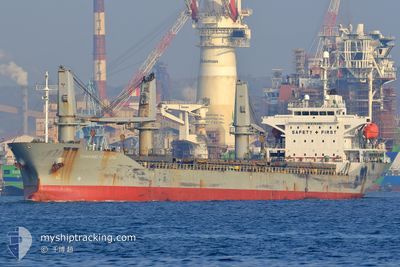
TRAWIND FORTUNE
Bulk Carrier
Current Trip
ZAP CN
| Time Travelled | 5 days |
|---|---|
| Remaining Time | --- |
| Distance Travelled | 727.42 nm |
| Remaining Distance | --- |
| AVG Speed | 10.9 Knots |
| MAX Speed | 16 Knots |
| AVG Wind | 8.5 knots |
| MAX Wind | 24.6 knots |
| MIN Temp | 19.2°C / 66.56°F |
| MAX Temp | 31.1°C / 87.98°F |
| Dybgang | 8.5 m |
| Position Modtaget | 5 d siden |
Current Position
| Longitude | 120.07382° |
|---|---|
| Latitude | 22.76750° |
| Status | Moored |
| Fart | 10.5 Knots |
| Kurs | 328° |
| Område | South China Sea |
| Station | T-AIS |
| Position Modtaget | 5 d siden |
Info
Information
The current position of TRAWIND FORTUNE is in South China Sea with coordinates 22.76750° / 120.07382° as reported on 2024-05-31 08:34 by AIS to our vessel tracker app. The vessel's current speed is 10.5 Knots
The vessel TRAWIND FORTUNE (IMO: 9391830, MMSI: 372254000) is a Bulk Carrier that was built in 2006 ( 18 år gamle ). It's sailing under the flag of [PA] Panama.
In this page you can find informations about the vessels current position, last detected port calls, and current voyage information. If the vessels is not in coverage by AIS you will find the latest position.
The current position of TRAWIND FORTUNE is detected by our AIS receivers and we are not responsible for the reliability of the data. The last position was recorded while the vessel was in Coverage by the Ais receivers of our vessel tracking app.
The current draught of TRAWIND FORTUNE as reported by AIS is 8.5 meters
Weather
| Temperature | 20.5°C / 68.9°F |
|---|---|
| Wind Speed | 8 knots |
| Direction | 153° SSE |
| Pressure | 1017.2 hPa |
| Humidity | 77.4 % |
| Cloud Coverage | 100 % |
Featured Company
Most Visited Ports (Last year)
| Port | Arrivals | |
|---|---|---|
| 4 | ||
| 3 | ||
| 3 | ||
| 2 | ||
| 2 | ||
| 2 |
Last Trips
| Origin | Departure | Destination | Arrival | Distance | |
|---|---|---|---|---|---|
| 2024-05-16 23:42 | 2024-05-31 00:51 | 3071.05 nm | |||
| 2024-04-30 15:36 | 2024-05-13 04:06 | 1905.26 nm | |||
| 2024-04-17 09:23 | 2024-04-26 23:48 | 2453.49 nm | |||
| 2024-04-13 16:16 | 2024-04-14 04:31 | 136.93 nm | |||
| 2024-03-09 08:09 | 2024-04-08 03:28 | 5935.49 nm |
Events
| Tid | Hændelsen | Detaljer | Position / Dest | Info |
|---|---|---|---|---|
| 2024-06-05 03:56 | START Sejllads | 3.4 nm, South West of ZHAPU |
30.55788 / 121.03181
ZAP CN
|
Fart: 5.7 kn Kurs: 69° |
| 2024-06-03 02:09 | STOP Sejllads | 3.66 nm, South West of ZHAPU |
30.55867 / 121.02547
ZAP CN
|
Fart: 0.2 kn Kurs: 231° |
| 2024-06-03 00:50 | START Sejllads | 4.43 nm, East of ZHAPU |
30.56973 / 121.17110
ZAP CN
|
Fart: 6.3 kn Kurs: 314° |
| 2024-06-02 14:14 | STOP Sejllads | 4.64 nm, East of ZHAPU |
30.56650 / 121.17440
ZAP CN
|
Fart: 0.1 kn Kurs: 221° |
| 2024-05-31 08:46 | Status er ændret | Default Moored |
22.79807 / 120.05295
ZAP CN
|
Fart: 10.5 kn Kurs: 328° |
| 2024-05-31 08:34 | Udenfor Dækning |
22.76750 / 120.07382
South China Sea
ZAP CN
|
Fart: 10.5 kn Kurs: 328° |
|
| 2024-05-31 07:17 | Afsejlet fra sidste havn |
|
22.62022 / 120.25310
ZAP CN
|
Fart: 8.8 kn Kurs: 291° |
| 2024-05-31 06:51 | START Sejllads |
22.60517 / 120.29413
[TW] KAOHSIUNG
|
Fart: 3.2 kn Kurs: 344° |
|
| 2024-05-31 06:09 | Destination er ændret | ZAP CN TW KHH |
22.60403 / 120.29568
[TW] KAOHSIUNG
|
Fart: Kurs: 162° |
| 2024-05-31 06:09 | ETA er ændret | 2024/06/02 17:00 2024/05/31 02:00 |
22.60403 / 120.29568
[TW] KAOHSIUNG
|
Fart: Kurs: 162° |