
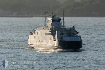
TRANOY
Ro-Ro/Passenger Ship
Current Trip
| Trip Time | 2 h, 56 mins |
|---|---|
| Trip Distance | 33.02 nm |
| AVG Speed | 11.9 Knots |
| MAX Speed | 13.7 Knots |
| Dybgang | 4.5 m |
| AVG Wind | 6.3 knots |
| MAX Wind | 10 knots |
| MIN Temp | 0.8°C / 33.44°F |
| MAX Temp | 3.5°C / 38.3°F |
| Position Modtaget | 2 m siden |
Current Position
| Longitude | 15.99595° |
|---|---|
| Latitude | 68.41742° |
| Status | Moored |
| Fart | |
| Kurs | 329° |
| Område | Norwegian Sea |
| Station | T-AIS |
| Position Modtaget | 2 m siden |
Info
Information
The current position of TRANOY is in Norwegian Sea with coordinates 68.41742° / 15.99595° as reported on 2024-05-12 23:50 by AIS to our vessel tracker app. The vessel's current speed is 0 Knots and is currently inside the port of LOEDINGEN.
The vessel TRANOY (IMO: 8917340, MMSI: 257310500) is a Ro-Ro/Passenger Ship that was built in 1990 ( 34 år gamle ). It's sailing under the flag of [NO] Norway.
In this page you can find informations about the vessels current position, last detected port calls, and current voyage information. If the vessels is not in coverage by AIS you will find the latest position.
The current position of TRANOY is detected by our AIS receivers and we are not responsible for the reliability of the data. The last position was recorded while the vessel was in Coverage by the Ais receivers of our vessel tracking app.
The current draught of TRANOY as reported by AIS is 4.5 meters
Weather
| Temperature | 4.5°C / 40.1°F |
|---|---|
| Wind Speed | 7 knots |
| Direction | 174° S |
| Pressure | 1018.8 hPa |
| Humidity | 99.7 % |
| Cloud Coverage | 100 % |
Featured Company
Events
| Tid | Hændelsen | Detaljer | Position / Dest | Info |
|---|---|---|---|---|
| 2024-05-12 03:50 | Status er ændret | Moored Default |
68.41718 / 15.99581
[NO] LOEDINGEN
|
Fart: Kurs: 329° |
| 2024-05-12 03:47 | Status er ændret | Default Moored |
68.41721 / 15.99575
[NO] LOEDINGEN
|
Fart: Kurs: 329° |
| 2024-05-12 03:29 | Status er ændret | Moored Default |
68.41726 / 15.99578
[NO] LOEDINGEN
|
Fart: Kurs: 329° |
| 2024-05-12 03:26 | Status er ændret | Default Moored |
68.41721 / 15.99582
[NO] LOEDINGEN
|
Fart: Kurs: 329° |
| 2024-05-09 16:45 | Status er ændret | Moored Under way using engine |
68.41716 / 15.99579
[NO] LOEDINGEN
|
Fart: Kurs: 329° |
| 2024-05-09 16:32 | STOP Sejllads |
68.41720 / 15.99587
[NO] LOEDINGEN
|
Fart: 0.3 kn Kurs: 329° |
|
| 2024-05-09 16:24 | START Sejllads |
68.41902 / 16.00400
[NO] LOEDINGEN
|
Fart: 6.5 kn Kurs: 162° |
|
| 2024-05-09 15:20 | STOP Sejllads |
68.42038 / 15.99544
[NO] LOEDINGEN
|
Fart: 0.3 kn Kurs: 244° |
|
| 2024-05-09 15:14 | Skibe i havn |
|
68.42207 / 16.00158
[NO] LOEDINGEN
|
Fart: 5.5 kn Kurs: 246.7° |
| 2024-05-09 12:50 | START Sejllads | 1.74 nm, South East of HARSTAD |
68.77199 / 16.59874
LODINGEN
|
Fart: 10.6 kn Kurs: 146.7° |