
TORTUGAS
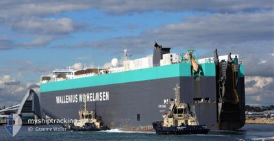
Vehicles Carrier
Current Trip
| Time Travelled | 24 days |
|---|---|
| Remaining Time | --- |
| Distance Travelled | 8476.19 nm |
| Remaining Distance | --- |
| AVG Speed | 14.7 Knots |
| MAX Speed | 17.8 Knots |
| AVG Wind | 12.4 knots |
| MAX Wind | 29.9 knots |
| MIN Temp | 6°C / 42.8°F |
| MAX Temp | 30°C / 86°F |
| Dybgang | 10.3 m |
| Position Modtaget | 18 h, 42 m siden |
Current Position
| Longitude | -79.59550° |
|---|---|
| Latitude | 9.00115° |
| Status | Under way using engine |
| Fart | 2 Knots |
| Kurs | 317° |
| Område | North Pacific Ocean |
| Station | T-AIS |
| Position Modtaget | 18 h, 42 m siden |
Info
Information
The current position of TORTUGAS is in North Pacific Ocean with coordinates 9.00115° / -79.59550° as reported on 2024-04-28 07:33 by AIS to our vessel tracker app. The vessel's current speed is 2 Knots and is heading at the port of BALBOA. The estimated time of arrival as calculated by MyShipTracking vessel tracking app is 2024-04-27 14:00 LT
The vessel TORTUGAS (IMO: 9319765, MMSI: 249757000) is a Vehicles Carrier that was built in 2006 ( 18 år gamle ). It's sailing under the flag of [MT] Malta.
In this page you can find informations about the vessels current position, last detected port calls, and current voyage information. If the vessels is not in coverage by AIS you will find the latest position.
The current position of TORTUGAS is detected by our AIS receivers and we are not responsible for the reliability of the data. The last position was recorded while the vessel was in Coverage by the Ais receivers of our vessel tracking app.
The current draught of TORTUGAS as reported by AIS is 10.3 meters
Weather
| Temperature | 27.7°C / 81.86°F |
|---|---|
| Wind Speed | 15 knots |
| Direction | 57° ENE |
| Pressure | 1010.5 hPa |
| Humidity | 84 % |
| Cloud Coverage | 5 % |
Featured Company
Last Port Calls
| Port | Arrival | Departure | Time In Port |
|---|---|---|---|
| 2024-04-01 05:41 | 2024-04-04 13:55 | 3 d | |
| 2024-03-05 19:42 | |||
| 2024-03-03 07:20 | 2024-03-03 23:01 | 15 h | |
| 2024-02-29 20:29 | 2024-03-01 03:17 | 6 h | |
| 2024-02-25 11:05 | 2024-02-25 20:48 | 9 h | |
| 2024-02-23 20:43 | 2024-02-24 05:54 | 9 h | |
| 2024-02-21 02:41 | 2024-02-22 01:41 | 23 h | |
| 2024-02-19 11:08 | 2024-02-20 04:51 | 17 h |
Most Visited Ports (Last year)
| Port | Arrivals | |
|---|---|---|
| 5 | ||
| 3 | ||
| 2 | ||
| 2 | ||
| 2 | ||
| 2 |
Last Trips
| Origin | Departure | Destination | Arrival | Distance | |
|---|---|---|---|---|---|
| 2024-03-05 14:42 | 2024-04-01 14:41 | 9599.48 nm | |||
| 2024-02-29 21:17 | 2024-03-03 02:20 | 740.20 nm | |||
| 2024-02-25 14:48 | 2024-02-29 14:29 | 179.94 nm | |||
| 2024-02-23 23:54 | 2024-02-25 05:05 | 222.77 nm | |||
| 2024-02-21 19:41 | 2024-02-23 14:43 | 734.60 nm | |||
| 2024-02-19 22:51 | 2024-02-20 20:41 | 181.99 nm | |||
| 2024-02-01 05:23 | 2024-02-19 05:08 | 7314.66 nm |
Events
| Tid | Hændelsen | Detaljer | Position / Dest | Info |
|---|---|---|---|---|
| 2024-04-28 12:50 | START Sejllads | 3.9 nm, South of CRISTOBAL |
9.28208 / -79.92133
PA BLB
|
Fart: 4.2 kn Kurs: 9° |
| 2024-04-28 11:42 | STOP Sejllads | 4.55 nm, South of CRISTOBAL |
9.27125 / -79.92292
PA BLB
|
Fart: Kurs: 9° |
| 2024-04-28 08:34 | START Sejllads | 4.85 nm, North West of RODMAN |
9.02278 / -79.61938
PA BLB
|
Fart: 5.4 kn Kurs: 296° |
| 2024-04-28 08:11 | STOP Sejllads | 4.36 nm, North West of RODMAN |
9.01743 / -79.61263
PA BLB
|
Fart: Kurs: 313° |
| 2024-04-28 07:39 | Status er ændret | Default Under way using engine |
9.00625 / -79.60072
PA BLB
|
Fart: 2 kn Kurs: 317° |
| 2024-04-28 07:39 | START Sejllads | 3.43 nm, North West of RODMAN |
9.00625 / -79.60072
PA BLB
|
Fart: 6.1 kn Kurs: 318° |
| 2024-04-28 07:33 | Status er ændret | Under way using engine Default |
9.00115 / -79.59550
PA BLB
|
Fart: 1.7 kn Kurs: 316° |
| 2024-04-28 07:33 | Udenfor Dækning |
9.00115 / -79.59550
North Pacific Ocean
|
Fart: 2 kn Kurs: 316° |
|
| 2024-04-28 06:50 | STOP Sejllads | 2.64 nm, North West of RODMAN |
8.99635 / -79.59085
PA BLB
|
Fart: Kurs: 316° |
| 2024-04-28 06:39 | Status er ændret | Default Under way using engine |
8.99458 / -79.58916
PA BLB
|
Fart: 1 kn Kurs: 316° |