
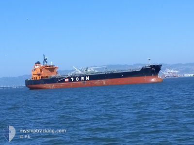
TORM SUPREME
Tanker
Current Trip
| Time Travelled | 13 days |
|---|---|
| Remaining Time | --- |
| Distance Travelled | 3462.42 nm |
| Remaining Distance | --- |
| AVG Speed | 12.8 Knots |
| MAX Speed | 14.7 Knots |
| AVG Wind | 9 knots |
| MAX Wind | 20 knots |
| MIN Temp | 14.5°C / 58.1°F |
| MAX Temp | 30°C / 86°F |
| Dybgang | 10.5 m |
| Position Modtaget | 20 h, 17 m siden |
Current Position
| Longitude | -79.50147° |
|---|---|
| Latitude | 8.84801° |
| Status | At anchor |
| Fart | |
| Kurs | 7° |
| Område | North Pacific Ocean |
| Station | T-AIS |
| Position Modtaget | 20 h, 17 m siden |
Info
Information
The current position of TORM SUPREME is in North Pacific Ocean with coordinates 8.84801° / -79.50147° as reported on 2024-09-16 00:32 by AIS to our vessel tracker app. The vessel's current speed is 0 Knots
The vessel TORM SUPREME (IMO: 9797735, MMSI: 563033900) is a Tanker It's sailing under the flag of [SG] Singapore.
In this page you can find informations about the vessels current position, last detected port calls, and current voyage information. If the vessels is not in coverage by AIS you will find the latest position.
The current position of TORM SUPREME is detected by our AIS receivers and we are not responsible for the reliability of the data. The last position was recorded while the vessel was in Coverage by the Ais receivers of our vessel tracking app.
The current draught of TORM SUPREME as reported by AIS is 10.5 meters
Weather
| Temperature | 29.7°C / 85.46°F |
|---|---|
| Wind Speed | 3 knots |
| Direction | 59° ENE |
| Pressure | 1006.5 hPa |
| Humidity | 72.2 % |
| Cloud Coverage | 100 % |
Featured Company
Last Port Calls
| Port | Arrival | Departure | Time In Port |
|---|---|---|---|
| 2024-09-01 02:44 | 2024-09-03 03:22 | 2 d | |
| 2024-08-18 14:12 | 2024-08-23 08:16 | 4 d | |
| 2024-07-26 01:29 | 2024-07-27 16:57 | 1 d | |
| 2024-07-21 04:09 | 2024-07-21 11:31 | 7 h | |
| 2024-07-18 12:27 | 2024-07-19 10:07 | 21 h |
Most Visited Ports (Last year)
| Port | Arrivals | |
|---|---|---|
| 3 | ||
| 2 | ||
| 2 | ||
| 1 | ||
| 1 | ||
| 1 |
Last Trips
| Origin | Departure | Destination | Arrival | Distance | |
|---|---|---|---|---|---|
| 2024-08-23 01:16 | 2024-08-31 19:44 | 909.34 nm | |||
| 2024-07-27 14:27 | 2024-08-18 07:12 | 5746.92 nm | |||
| 2024-07-21 07:31 | 2024-07-25 22:59 | 1051.14 nm | |||
| 2024-07-19 06:07 | 2024-07-21 00:09 | 38.49 nm | |||
| 2024-06-22 17:45 | 2024-07-18 08:27 | 5010.92 nm |
Events
| Tid | Hændelsen | Detaljer | Position / Dest | Info |
|---|---|---|---|---|
| 2024-09-16 14:51 | START Sejllads | 2.42 nm, South of CRISTOBAL |
9.30677 / -79.91853
PABLB
|
Fart: 8 kn Kurs: 1° |
| 2024-09-16 12:19 | STOP Sejllads | 4.96 nm, South of CRISTOBAL |
9.26453 / -79.92374
PABLB
|
Fart: Kurs: 358° |
| 2024-09-16 09:19 | START Sejllads | 5.07 nm, North West of RODMAN |
9.02462 / -79.62309
PABLB
|
Fart: 5.9 kn Kurs: 298° |
| 2024-09-16 08:39 | STOP Sejllads | 4.28 nm, North West of RODMAN |
9.01609 / -79.61216
PABLB
|
Fart: 0.3 kn Kurs: 310° |
| 2024-09-16 08:02 | START Sejllads | 3.24 nm, North West of RODMAN |
9.00357 / -79.59885
PABLB
|
Fart: 4.2 kn Kurs: 314° |
| 2024-09-16 07:11 | STOP Sejllads | 2.57 nm, North West of RODMAN |
8.99516 / -79.59062
PABLB
|
Fart: Kurs: 314° |
| 2024-09-16 05:35 | START Sejllads | 3.04 nm, North East of TABOGUILLA |
8.85396 / -79.49814
PABLB
|
Fart: 5.6 kn Kurs: 356° |
| 2024-09-16 00:38 | Status er ændret | Default At anchor |
8.84809 / -79.50150
PABLB
|
Fart: Kurs: 7° |
| 2024-09-16 00:32 | Status er ændret | At anchor Default |
8.84801 / -79.50147
PABLB
|
Fart: Kurs: 6° |
| 2024-09-16 00:32 | Udenfor Dækning |
8.84801 / -79.50147
North Pacific Ocean
|
Fart: Kurs: 147.9° |